

Latest Weather Blog
Wednesday PM Forecast: Dog days of summer continue, tropics heating up
We are in the dog days of summer, which means expect heat, humidity, and pop-up storms. Elsewhere, in the tropics, things are beginning to heat up as we head towards the peak of the hurricane season.
Tonight & Tomorrow: Skies will clear out in the overnight hours with lows settling into the mid 70s. It will be rinse and repeat in the weather department for Thursday. The heat and humidity are not going anywhere with highs near 93 degrees, and a heat index in the triple digits. Pop-up storms will be possible in the afternoon and evening, but coverage will remain low. Spotty showers and thunderstorms are expected, meaning most will stay dry.
Up Next: The dog days of summer will only continue! Highs will hold steady in the lower 90s for the foreseeable future with the humidity not going anywhere. The biggest changes day to day will be the amount of rain coverage we get.
Through Saturday, coverage will be spotty to isolated in nature because of below average available moisture in our atmosphere. This looks to change Sunday and into early next week as a tropical wave approaches the area. How close this wave gets to the coast will influence rain chances across the Capital Area. Right now, inland spots look to only see a few isolated showers or storms, while areas closer to the coast may see more activity. If the moisture shifts closer, greater rain chances will spread further inland. Regardless, widespread washouts do not look likely at this time.
Trending News
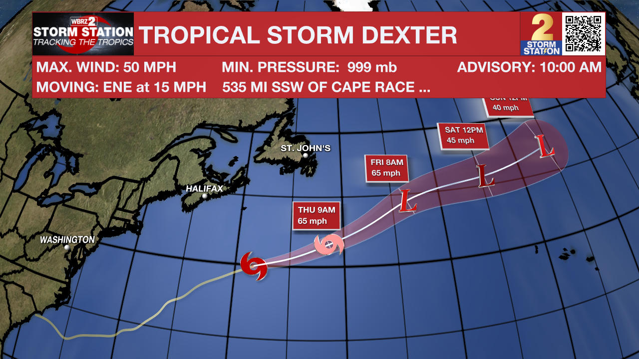
The Tropics: Tropical Storm Dexter continues to trek ENE at 15 mph across the northern Atlantic. It has max sustained winds of 50 mph. It may become slightly stronger as it transitions to a post-tropical storm over the next few days. There are no coastal watches or warnings in effect, and it poses no immediate hazards to land.
A weak area of low pressure located several hundred miles off the coast of the southeastern United States continues to produce only limited shower and thunderstorm activity. This system is forecast to drift northward over the next day or two before turning northeastward. Environmental conditions now only appear marginally favorable for tropical development into early next week as the system moves northeastward, remaining offshore of the eastern United States.
Shower and thunderstorm activity has become a bit more concentrated with a tropical wave in the eastern tropical Atlantic. Environmental conditions are forecast to be conducive for gradual development during the next few days, and a tropical depression could form late this week or over the weekend as the system moves generally west-northwestward to northwestward across the central tropical and subtropical Atlantic.
Get the latest 7-day forecast and real-time weather updates HERE.
Watch live news HERE.
– Balin
The Storm Station is here for you, on every platform. Your weather updates can be found on News 2, wbrz.com, and the WBRZ WX App on your Apple or Android device. Follow WBRZ Weather on Facebook and X for even more weather updates while you are on the go.
More News
