A line of showers and thunderstorms is expected to move through the Capital Region overnight into early Sunday. Most of the rain should be gone around or shortly after sunrise, with improving conditions through the day as drier air moves in.

Today and Tonight: Saturday will be hot with highs in the mid 90s. Fortunately, there are no advisories for excessive heat today. Thunderstorms develop overnight. While a few storms could become strong with gusty winds, most of the activity in the Capital Region is expected while many people are asleep.
Up Next: Sunday afternoon looks much more comfortable as humidity drops behind the front. Temperatures will still reach the 90s through the first half of next week, but lower dew points will make the heat feel less oppressive before Gulf moisture begins to return by mid-week.
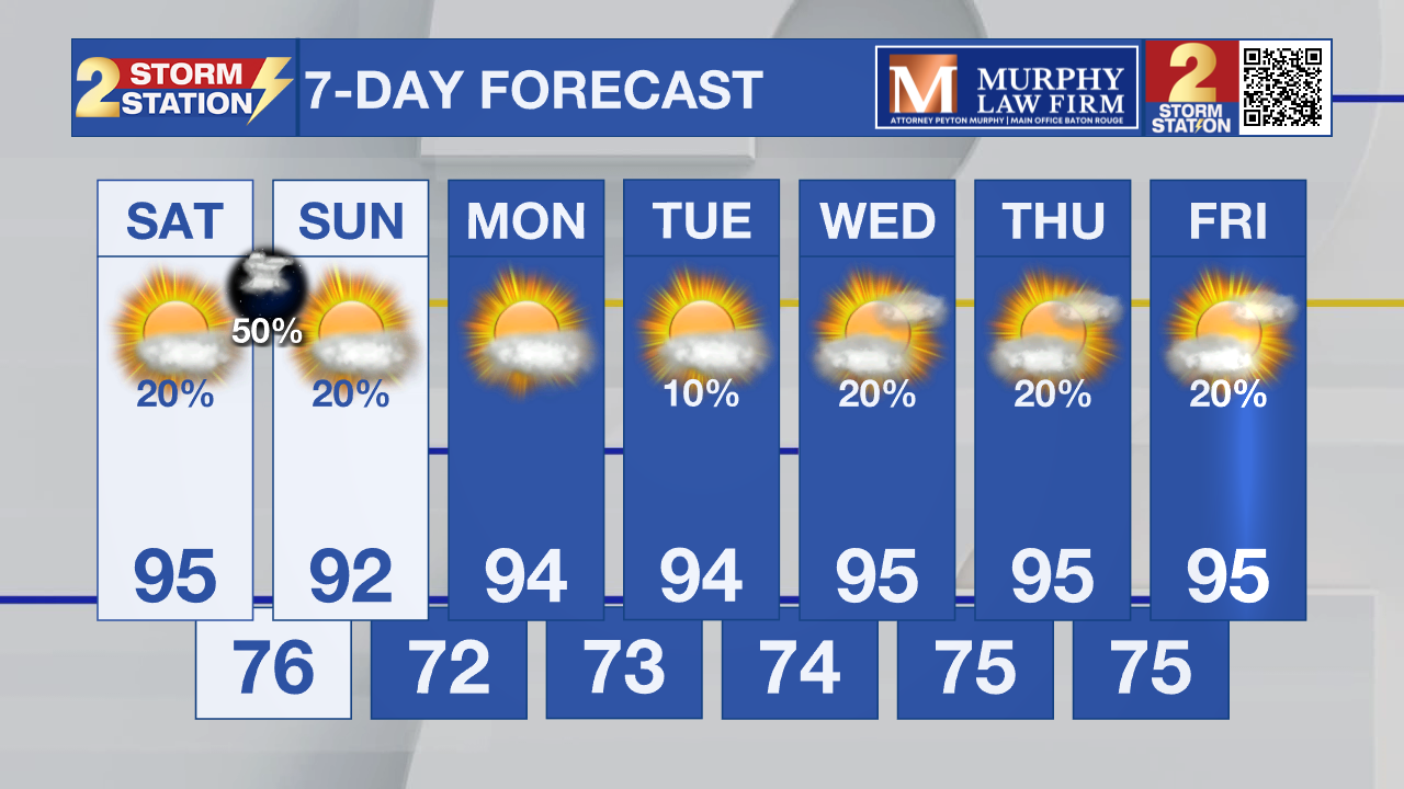
Tropics: The Atlantic Basin remains quiet. The National Hurricane Center is not expecting tropical cyclone development during the next seven days.
Get the latest 7-day forecast and real-time weather updates HERE.
Watch live news HERE.
– Dave
The Storm Station is here for you, on every platform. Your weather updates can be found on News 2, wbrz.com, and the WBRZ WX App on your Apple or Android device. Follow WBRZ Weather on Facebook and X for even more weather updates while you are on the go.