

Latest Weather Blog
Monday AM forecast: Early rain, peeks of sun this afternoon
Rain chances linger this morning, more spotty this afternoon, while drier air begins working in from the west. Breezy and humid today, then sunshine returns for much of the week ahead. The pattern turns quieter and warmer through midweek as the upper ridge builds back over the Gulf.
Today & Tonight
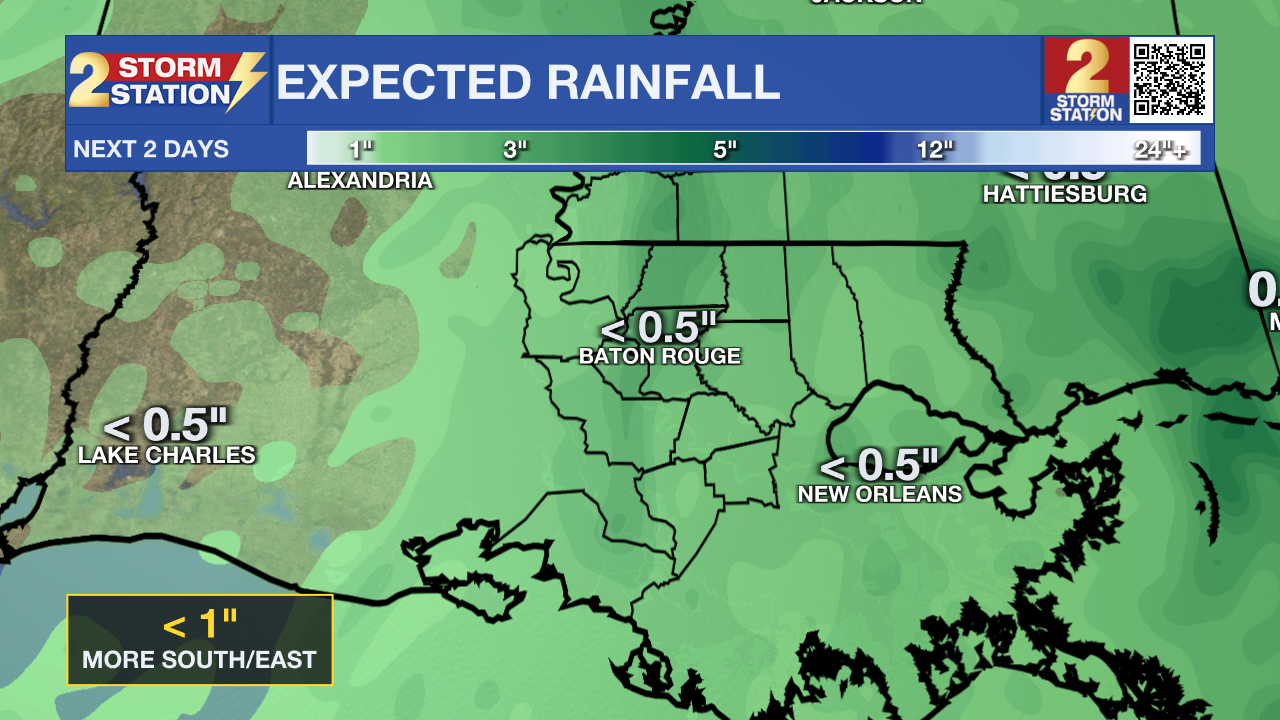
Showers and a few thunderstorms will continue to spread across the area as deep Gulf moisture pushes inland. The heaviest rain will stay over eastern areas this morning, where some morning totals exceeded five inches and some flooding is occurring. An additional inch or two is still possible before tapering begins late this afternoon. Winds will not be as strong as Sunday, but an easterly breeze will still gust 20 to 25 miles per hour at times, especially along the coast. Clouds will limit sunshine for most of the day, keeping highs in the mid to upper 80s. Overnight, skies begin to clear toward sunrise on Tuesday. Lows drop into the low 70s inland and the mid 70s along the coast.
Up Next
Drier and warmer conditions take over starting Tuesday as high pressure strengthens across the Gulf. Rain chances will shrink by Wednesday, with most inland areas turning dry and partly cloudy. By Thursday and Friday, a northerly flow will bring in even drier air. Temperatures will climb a few degrees above normal with highs in the upper 80s to near 90 and lows in the 60s. The weekend looks mainly dry and warm as a weak front approaches. Cooler temperatures at night are forecast.
Trending News
Tropics
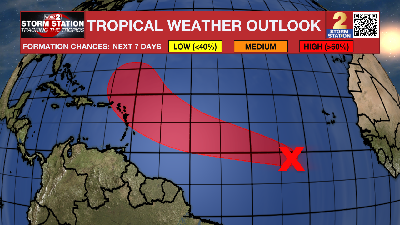
The National Hurricane Center is monitoring a broad area of low pressure (95L) located several hundred miles south-southwest of the Cabo Verde Islands. It’s showing signs of organization, and conditions appear favorable for gradual development. A tropical depression is likely to form this week as it moves across the central tropical Atlantic and approaches the Leeward Islands by the latter part of the week. The National Hurricane Center gives this system a 40 percent chance of formation within 48 hours and a 70 percent chance within seven days.
Get the latest 7-day forecast and real-time weather updates HERE.
Watch live news HERE.
– Dave
The Storm Station is here for you, on every platform. Your weather updates can be found on News 2, wbrz.com, and the WBRZ WX App on your Apple or Android device. Follow WBRZ Weather on Facebook and X for even more weather updates while you are on the go.
More News
