

Latest Weather Blog
Monday PM Forecast: Heat and steam flaring up, relief not far behind
As rain winds down, a touch of summer will briefly return to the Capital Region. But it won’t stick around for long; a cold front will quickly send the heat and steam on its way.
Tonight & Tomorrow: Unlike last night, rain will end in a hurry after sunset. Skies will clear out for a good chunk of the night before low clouds redevelop toward daybreak. With wet soils from recent rain, high humidity, and calm winds, ingredients appear to be in place for fog. Be on the lookout for patchy dense fog during the Tuesday morning drive, especially north of I-10. Consider adding a few minutes to the morning drive, and be sure to use low beams when driving through fog. Overnight lows will settle in the low to mid-70s.

Tuesday will be partly sunny and very warm. Humid conditions will accompany the high near 90°, creating a summer-like feel. Isolated pop-up storms will likely fire during the heat of the day.
Up Next: Although summer-like heat and steam will hang around on Wednesday, it will be close to checking out. A cold front is set to move through on Wednesday night and will change the narrative for the second half of the week. Only a minor dent in temperatures is expected with daytime highs reaching the mid to upper-80s — close to average. Morning lows will stand out a bit more, slipping through the 60s. A gradual drop in humidity will allow for this, and by the weekend, many will be waking up to temperatures in the low 60s. Sunshine will dominate after the frontal passage — setting up a perfect weather weekend.
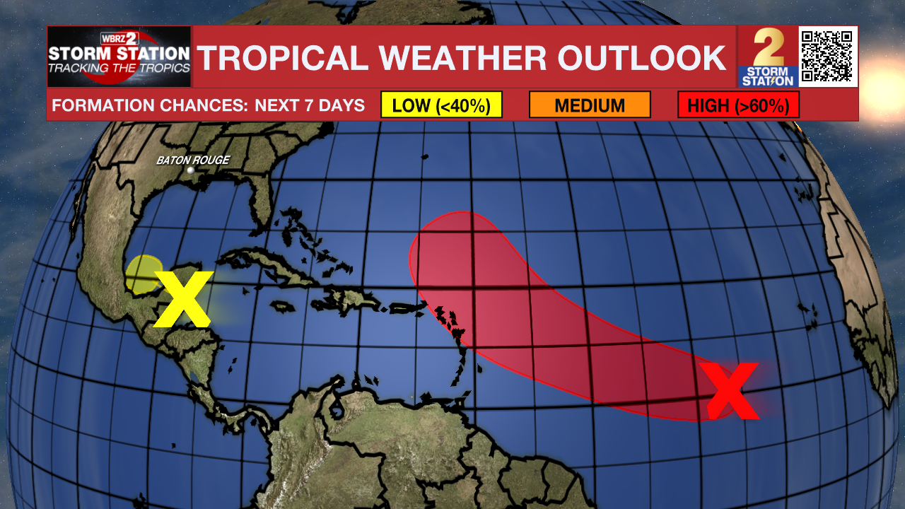
The Tropics: Satellite imagery indicates that an area of low pressure located over the central tropical Atlantic is becoming better organized. Conditions appear favorable for further development of this system, and a tropical depression is likely to form over the next couple of days. Thereafter, the system will likely strengthen and take the name Jerry. The system will be near or north of the Leeward Islands by late week, and does not pose any threat to the Gulf Coast.
A trough of low pressure in the northwest Caribbean Sea is producing a disorganized area of showers and thunderstorms. This system will move across the Yucatan Peninsula and emerge over the Bay of Campeche by late Tuesday. Slow development is possible once the system exits the Yucatan Peninsula around midweek. Development odds are low at this time, and steering currents will keep it away from Louisiana. Regardless of development, areas of heavy rain and gusty winds are likely across the Yucatan Peninsula, Belize, and southern Mexico in the coming days.
Trending News
Get the latest 7-day forecast and real-time weather updates HERE.
Watch live news HERE.
— Meteorologist Malcolm Byron
The Storm Station is here for you, on every platform. Your weather updates can be found on News 2, wbrz.com, and the WBRZ WX App on your Apple or Android device. Follow WBRZ Weather on Facebook and X for even more weather updates while you are on the go.
More News
