

Latest Weather Blog
Wednesday AM Forecast: Classic August weather continues as students head back to class
Hot and steamy August days continue—classic Louisiana style—with just enough pop-up afternoon storms to keep things interesting. Don’t forget the shades and umbrella!
Today & Tonight: Wednesday's forecast is that of a typical early August day; hot and steamy with highs in the lower-90s and feels-like temperatures a few degrees higher with plenty of sunshine and a few isolated storms likely developing Wednesday afternoon. Around 40% of the Capital Region will see rain today with the highest coverage south of I-10/12. Storms will fizzle overnight and skies will clear, allowing temperatures to fall into the low to mid-70s Thursday morning.
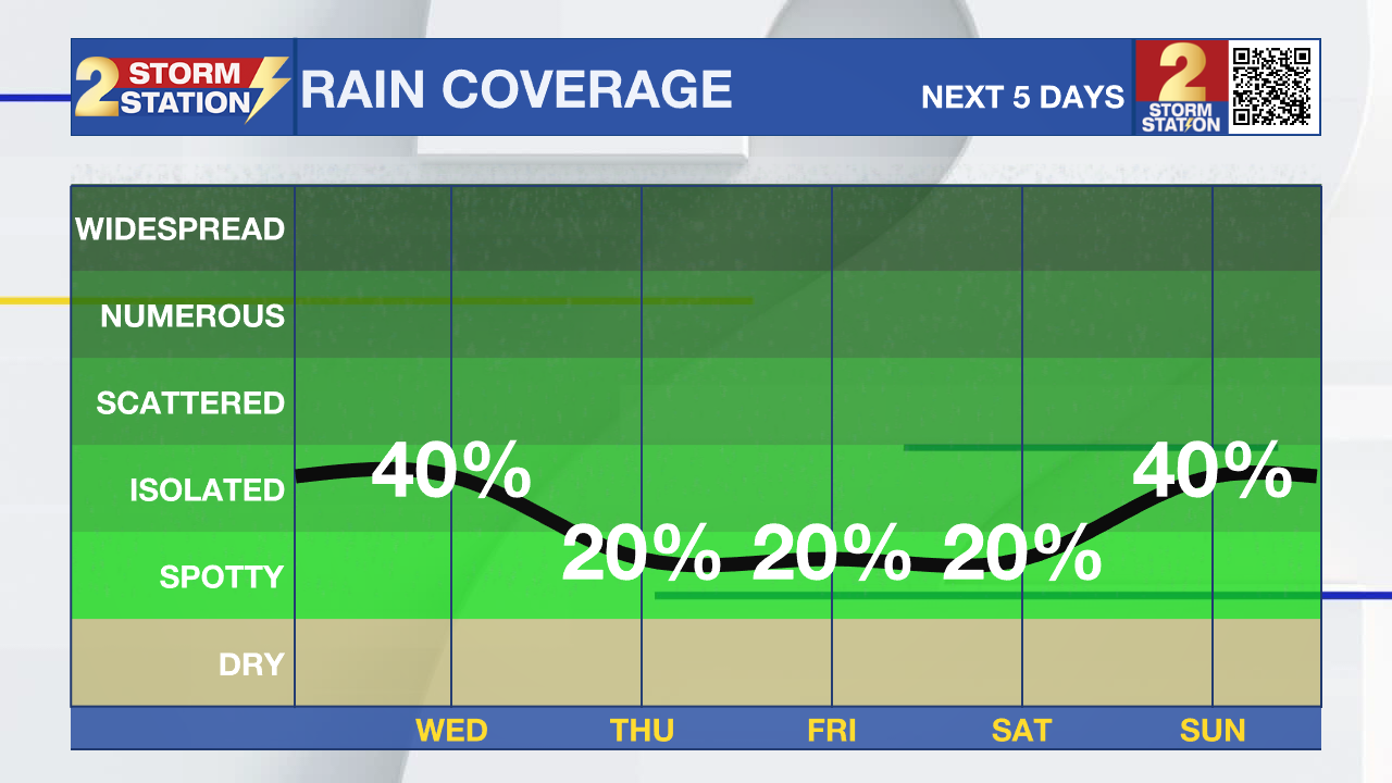
Up Next: It's a rinse-and-repeat forecast kind of week with even less rain coverage on Thursday and Friday. The days will be hot and humid with plenty of sunshine and only a few spotty showers and thunderstorms each afternoon. For the kiddos heading back to school, expect warm and muggy mornings by the bus stop and lots of heat for afterschool activities.
There’s still some uncertainty in the weekend forecast. A wave of tropical moisture from the eastern Gulf is expected to move near southern Louisiana, and how close it gets to the coast will influence rain chances across the Capital Area. Right now, inland spots look mostly dry with only a few isolated showers or storms, while areas closer to the coast may see more activity. If the moisture shifts closer, rain chances will increase by late weekend into early next week. Temperatures will hold steady through mid-August, with highs in the low 90s and lows in the mid-70s.
Trending News
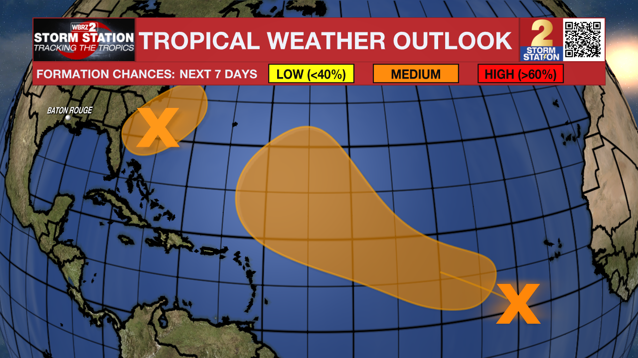
The Tropics: Tropical Storm Dexter continues to trek ENE at 12 mph across the northern Atlantic. It may become slightly stronger as it transitions to a post-tropical storm over the next few days. There are no coastal watches or warnings in effect, and it poses no immediate hazards to land.
A weak surface trough located several hundred miles off the coast of the southeastern United States is producing scattered showers and thunderstorms. An area of low pressure is expected to develop from this system over the next day or so, and environmental conditions appear generally favorable for additional development. A tropical depression could develop late this week or this weekend as the low drifts westward before gradually turning northward to northeastward by the weekend.
A tropical wave over the eastern tropical Atlantic is producing disorganized showers and thunderstorms. Environmental conditions are forecast to be conducive for gradual development during the next few days, and a tropical depression could form late this week or over the weekend as the system moves generally west-northwestward across the central tropical or subtropical Atlantic.
Get the latest 7-day forecast and real-time weather updates HERE.
Watch live news HERE.
– Emma Kate C.
The Storm Station is here for you, on every platform. Your weather updates can be found on News 2, wbrz.com, and the WBRZ WX App on your Apple or Android device. Follow WBRZ Weather on Facebook and X for even more weather updates while you are on the go.
More News
