

Latest Weather Blog
Thursday PM Forecast: heat and stray showers into holiday weekend
New to the Storm Station forecast, some cloud cover may alleviate long-duration heat on the Fourth of July, but several days with highs in the mid-90s remain in the forecast. There is an increasing likelihood of a new tropical system forming in the southwest Atlantic Ocean.
Tonight & Independence Day: Cloud cover will increase overnight as a weak passing disturbance moves through. It might even be enough to ring out a few showers. Overnight lows will be a little warmer in turn, in the mid to upper 70s. Cloud cover now appears to linger for the first half of Independence Day. This will help take the edge off the heat. Afternoon sun should push thermometers past 90° by the end of the day, but a delayed warmup could spare the area from extended high heat. A spotty shower or storm cannot be ruled out either. For WBRZ’s Fireworks on the Mississippi, any leftover rain will be wrapping up. Skies will clear and temperatures will ease into the mid-80s. A push of dry air will finally work into the region on Saturday, keeping rain chances to a minimum. With little rain and plenty of sun, highs should reach the mid-90s.

Up Next: It will be hard to find many spotty showers and thunderstorms on Saturday. A lot of sunshine is expected. Expect highs in the mid-90s. Enough humidity will be present to cause heat index values near 105 degrees at times. Stay hydrated and take breaks in the shade or air conditioning if enjoying time outside.
Moisture will seep back into the region Sunday through Tuesday. This will help to ignite isolated to scattered showers and thunderstorms. Thanks to a pocket of disturbed air aloft, the showers and thunderstorms may not necessarily be limited to afternoons, but will be enhanced by daytime heating. The latter part of next week looks to feature a continuation of the average summer weather with highs in the 90s along with pop-up afternoon showers and thunderstorms.
Trending News
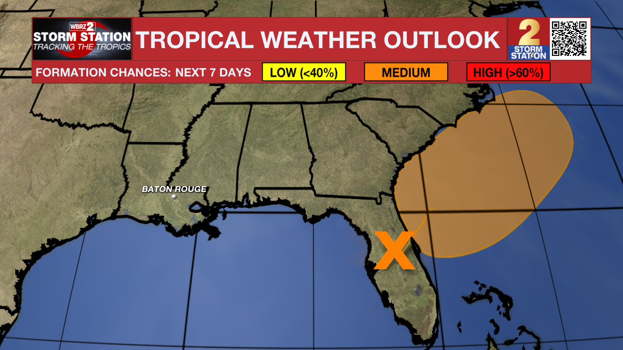
The Tropics: An area of low pressure is forecast to develop along a weakening frontal boundary near Florida or the Atlantic coast of the southeastern United States on Friday or Saturday. Environmental conditions appear only marginally conducive for some slow development, but a tropical or subtropical depression could form in this region over the weekend or early next week while the system drifts northward or northeastward. Regardless of development, heavy rainfall is possible across portions of the southeast U.S., particularly across the west-central Florida coast. An Air Force Reserve Hurricane Hunter aircraft is scheduled to investigate the system on Friday, if necessary.
Get the latest 7-day forecast and real-time weather updates HERE.
Watch live news HERE.
– Josh
The Storm Station is here for you, on every platform. Your weather updates can be found on News 2, wbrz.com, and the WBRZ WX App on your Apple or Android device. Follow WBRZ Weather on Facebook and X for even more weather updates while you are on the go.
More News
