

Latest Weather Blog
Wednesday PM Forecast: Rain is packing its bags, but the heat is here to stay
While isolated storms remain possible on Thursday, they'll become more sparse into the weekend. Rain won’t threaten many outdoor plans, but be prepared to break a sweat.
Tonight & Tomorrow: Any afternoon thunderstorms that managed to pop up will gradually fade away during the evening. Though a rogue overnight shower, mainly north and east of Baton Rouge, isn’t totally off the table, most will stay completely dry. Expect a partly cloudy start to the day with morning lows in the mid-70s. Extra sunshine on Thursday means afternoon temperatures will climb even higher. Baton Rouge will top out around 93°, but unrelenting humidity will make it feel about 10° hotter at peak warming. An isolated shower or thunderstorm cannot be ruled out in the heat of the day. Any storm could produce gusty winds and/or a quick downpour.

Up Next: Moving toward and into the weekend, a ridge of high pressure in the upper atmosphere will intensify over the central Gulf Coast. Comprised of warm, sinking air, ridges tend to fight against thunderstorm development while boosting air temperatures. Afternoon highs will soar into the mid-90s by the weekend, combining with summer humidity to create heat index values in the 105-110° range. Should the heat index top 108°, that would trigger a Heat Advisory. In any event, exercise common sense to beat the heat by hydrating more and taking breaks from time to time.
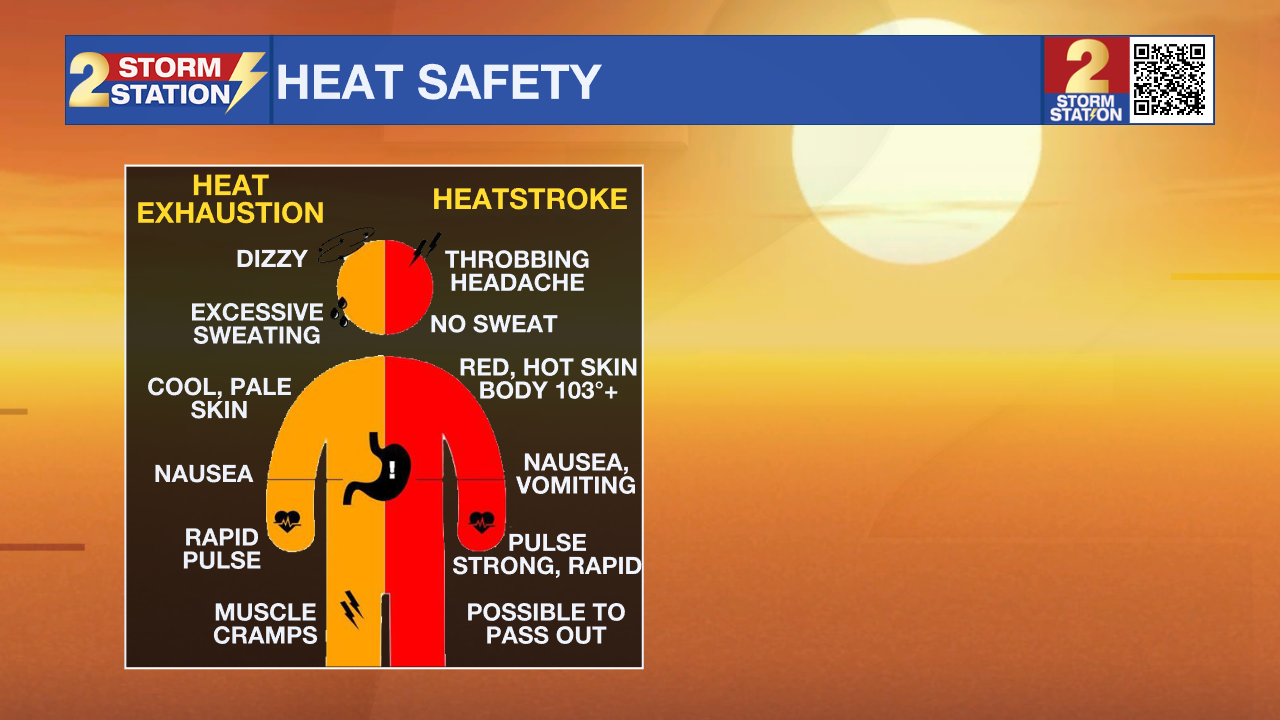
Know the signs of heat exhaustion and heatstroke as well. If you start noticing signs of heat exhaustion, move inside to an air-conditioned room immediately. Heatstroke, on the other hand, is a medical emergency that requires calling 911 right away.
By Tuesday or Wednesday of next week, that ridge will shift north, opening the door for an atmospheric disturbance to arrive out of the east. This will allow for the return of rain-cooling showers, which may help take the sting out of the afternoon heat.
Trending News

Get the latest 7-day forecast and real-time weather updates HERE.
Watch live news HERE.
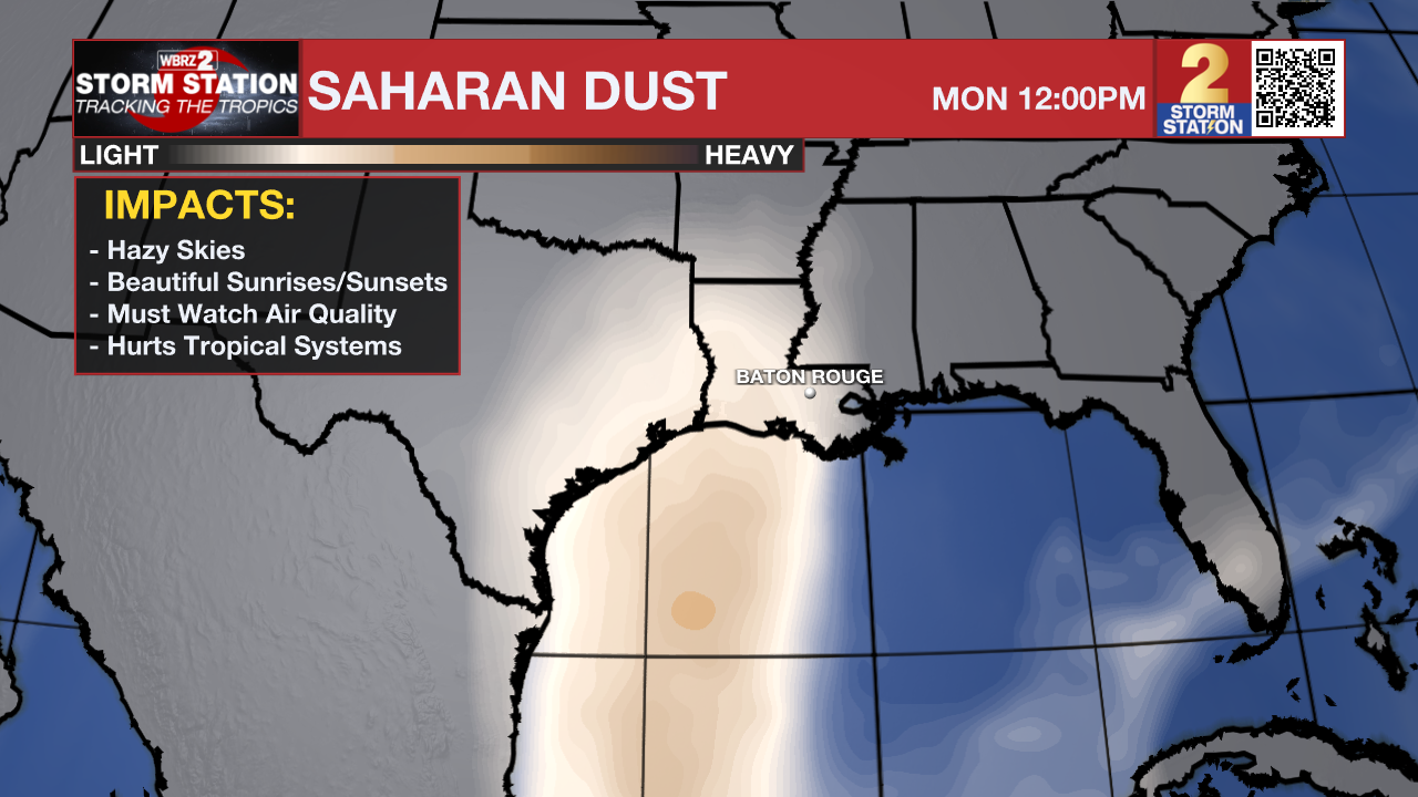
The Tropics: For the North Atlantic, Gulf, and Caribbean, all is quiet. No development is expected over the next seven days. In fact, the first major Saharan dust plume will track across the Atlantic over the next week, helping to limit the chances of tropical development. Some of that dust could reach the Capital Area early next week, creating hazy daytime skies before scattering the light rays to produce more vivid, fiery-orange sunrises and sunsets.
— Meteorologist Malcolm Byron
The Storm Station is here for you, on every platform. Your weather updates can be found on News 2, wbrz.com, and the WBRZ WX App on your Apple or Android device. Follow WBRZ Weather on Facebook and X for even more weather updates while you are on the go.
More News
