

Latest Weather Blog
Thursday AM Forecast: Heat alerts are back, continuing to watch the tropics
Heat alerts are back! After a break from seeing heat alerts, a heat advisory has been issued for Thursday, and more are likely through most of next week. In the tropics, there are still multiple disturbances that we are tracking.
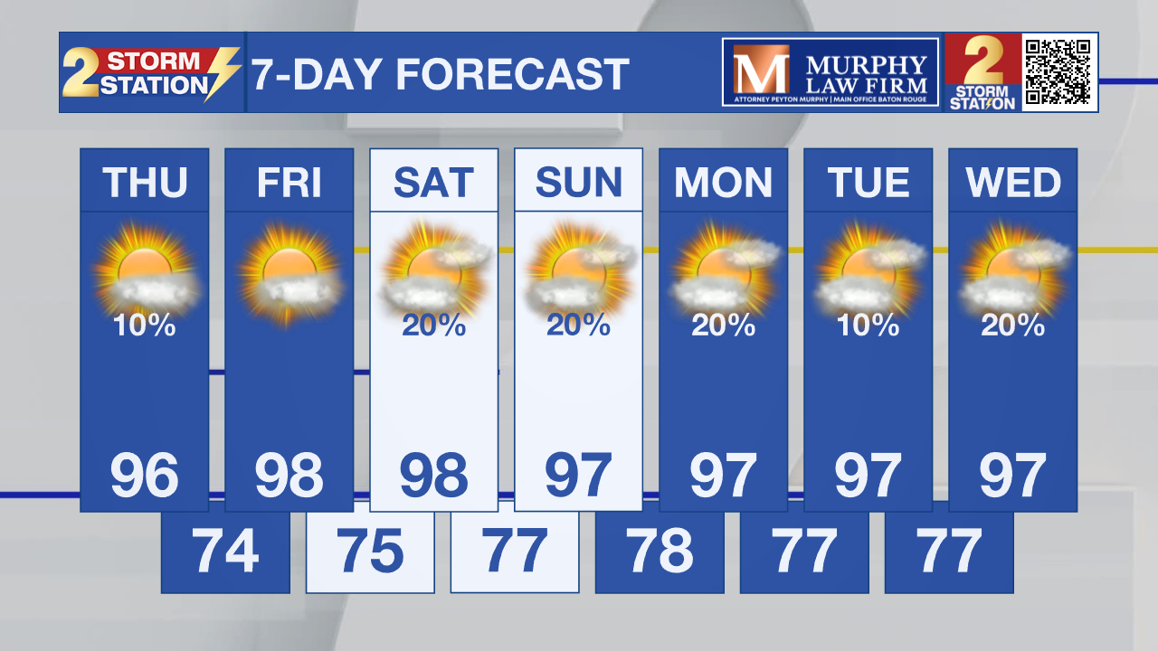
Today & Tonight: A Heat Advisory has been issued for Thursday between 11am - 8pm. Peak feels-like temperatures up to 110° are expected. Make sure to hydrate plenty, slow down if outside, and wear light, loose-fitting clothing. Highs will reach near 96° under mostly sunny skies. Rain will be almost non-existent so everyone will feel the heat all day long. Overnight, expect clear skies with lows near 74°.
Up Next: A dominant high-pressure ridge is set to anchor itself across the Gulf Coast through the weekend. This atmospheric setup will cap storm development and trap heat, driving afternoon highs into the upper 90s beginning Friday. Widespread rain is off the table, with only a spotty shower possible at best. Lower humidity levels will make Friday and Saturday feel slightly more tolerable before moisture rebounds Sunday. Once that high humidity returns, feel-like temperatures will peak above 108°, making additional heat alerts a near certainty.

If you’re working outside, make sure to hydrate constantly, rest in the shade, and keep an eye out for heat illness. That advice becomes critical heading into next week, as back-to-back days of extreme heat take a heavy toll on the body. On top of that, the mix of blistering temperatures and virtually no rain could cause dry conditions to turn into a quick-onset drought. We’ll be keeping a close eye on how this unfolds and updating you as things develop.
Trending News
The Tropics:
Tropical Depression Cristobal:
Tropical Storm Cristobal has weakened into a tropical depression with maximum winds dropping to around 35 mph, as satellite imagery shows a distinct lack of deep thunderstorm activity around its center. Facing increasingly harsh atmospheric conditions, the storm is not expected to regain strength and will likely collapse into a remnant low-pressure system within the next 12 hours before completely breaking apart shortly after. For now, it continues to move east-northeast at roughly 16 mph, with a slight shift toward the northeast expected over the next half-day, keeping its overall path largely unchanged.
Central Tropical Atlantic:
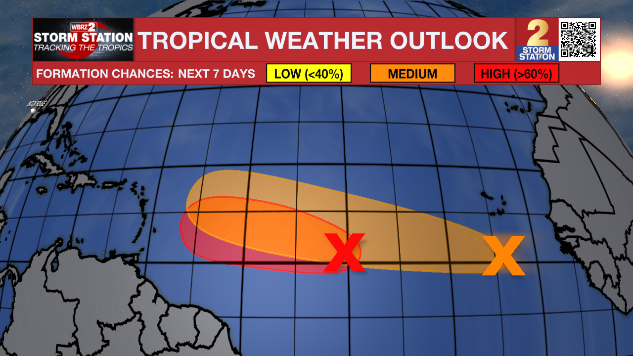
Showers and thunderstorms associated with a tropical wave located midway between the Lesser Antilles and the west coast of Africa have become a little better organized since yesterday.
Environmental conditions are forecast to be conducive for further development during the next day or so, and a tropical depression will likely form while the system moves westward to west-
northwestward across the central tropical Atlantic. Beginning on Friday, upper-level winds are likely to become too strong for development as the system approaches the Lesser Antilles.
Eastern Tropical Atlantic:
A tropical wave located a few hundred miles south of the Cabo Verde Islands is producing disorganized showers and thunderstorms. Environmental conditions are forecast to be generally conducive for some development, and a tropical depression could form late this week or this weekend while the wave moves westward or west-northwestward across the eastern and central tropical Atlantic.
Get the latest 7-day forecast and real-time weather updates HERE.
Watch live news HERE.
— Balin
The Storm Station is here for you, on every platform. Your weather updates can be found on News 2, wbrz.com, and the WBRZ WX App on your Apple or Android device. Follow WBRZ Weather on Facebook and X for even more weather updates while you are on the go.
More News

