

Latest Weather Blog
Tuesday AM Forecast: Intense heat continues today before midweek storms
The intense heat gripping the Baton Rouge area will persist through Tuesday, with afternoon heat index values climbing between 105-110°F. A shifting weather pattern by midweek promises some welcome relief in the form of cooling showers and thunderstorms, though these storms may linger into the Fourth of July weekend.

Today & Tonight: A ridge of high pressure will remain firmly in place over the region today. This creates sinking air that suppresses widespread storm development, leading to hot conditions. Expect afternoon temperatures to easily climb into the mid-to-upper 90s. When combined with the high Gulf humidity, it will feel more like 105 to 110 degrees outside. Because of these dangerous heat index values, a Heat Advisory is officially in effect for the area. There are some storms in the forecast during the PM hours, but these will stay spotty in nature, meaning most will stay dry. Overnight, we will not be completely dry as spotty showers and storms will be possible. Lows will reach into the upper 70s.
Trending News

Use the slider to advance through the next 24 hours of Futurecast
Up Next: A wave of tropical moisture is forecast to move through the Metro Area on Wednesday, bringing a round of heavy thunderstorms that will help knock down our afternoon temperatures. Because this system is moving at a steady pace, widespread or prolonged flooding is not a major concern, though brief street flooding and gusty winds remain possible in localized areas.
As this system tracks westward, we will transition back into a typical summertime pattern for Thursday and Friday. High humidity will trigger the typical isolated, pop-up afternoon showers and thunderstorms.
Looking ahead to the Fourth of July weekend, another weak atmospheric disturbance is expected to arrive. While it currently does not look like a complete washout, you will want to have a backup indoor option ready to avoid brief afternoon downpours and lightning.
Get the latest 7-day forecast and real-time weather updates HERE.
Watch live news HERE.
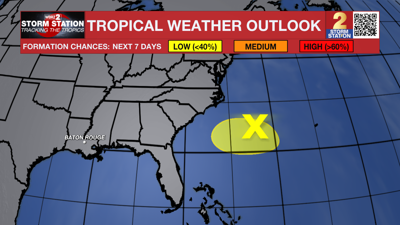
The Tropics: Shower and thunderstorm activity remains limited and disorganized in association with an area of low pressure along a frontal boundary located off the southeastern U.S. coast. Environmental conditions appear only marginally favorable for some tropical development over the next day or two as the system drifts southward and then westward before conditions become even less favorable later this week.
– Balin
The Storm Station is here for you, on every platform. Your weather updates can be found on News 2, wbrz.com, and the WBRZ WX App on your Apple or Android device. Follow WBRZ Weather on Facebook and X for even more weather updates while you are on the go.
More News
