

Latest Weather Blog
Thursday PM Forecast: Heat intensifying, signs of returning rain, tracking the tropics
Heat is going to be the name of the game straight through the weekend and into early next week. Following a hot stretch of weather, some relief may arrive toward midweek in the form of returning showers. Meanwhile, the Storm Station is monitoring a few areas in the tropics.
Tonight & Tomorrow: Expect a quiet night ahead with nothing more than a few passing clouds and lows in the mid-70s. Under a partly sunny sky, highs will soar into the mid-90s on Friday. High humidity will make it feel quite steamy, driving afternoon heat index values up to 105-106°. Brief downpours will be few and far between, if not non-existent altogether. The overwhelming majority will make it through the day dry.

Up Next: It’s pretty much a copy-paste forecast for the weekend. It will stay hot, with highs in the mid-90s (feeling ~10° warmer) and lows in the mid-70s. Dry air will limit most, if not all, afternoon storm development. The heat dials it up a notch next week, with afternoon highs creeping up toward the upper 90s. Then, the afternoon feels-like temperature may have an easier time surpassing 108°, possibly prompting Heat Advisories. Regardless of official alerts, remember to drink plenty of water and try to save high-exertion activities for the cooler early morning or evening hours. Please know the signs of heat exhaustion and heatstroke, listen to your body, and take immediate breaks to cool off if needed.
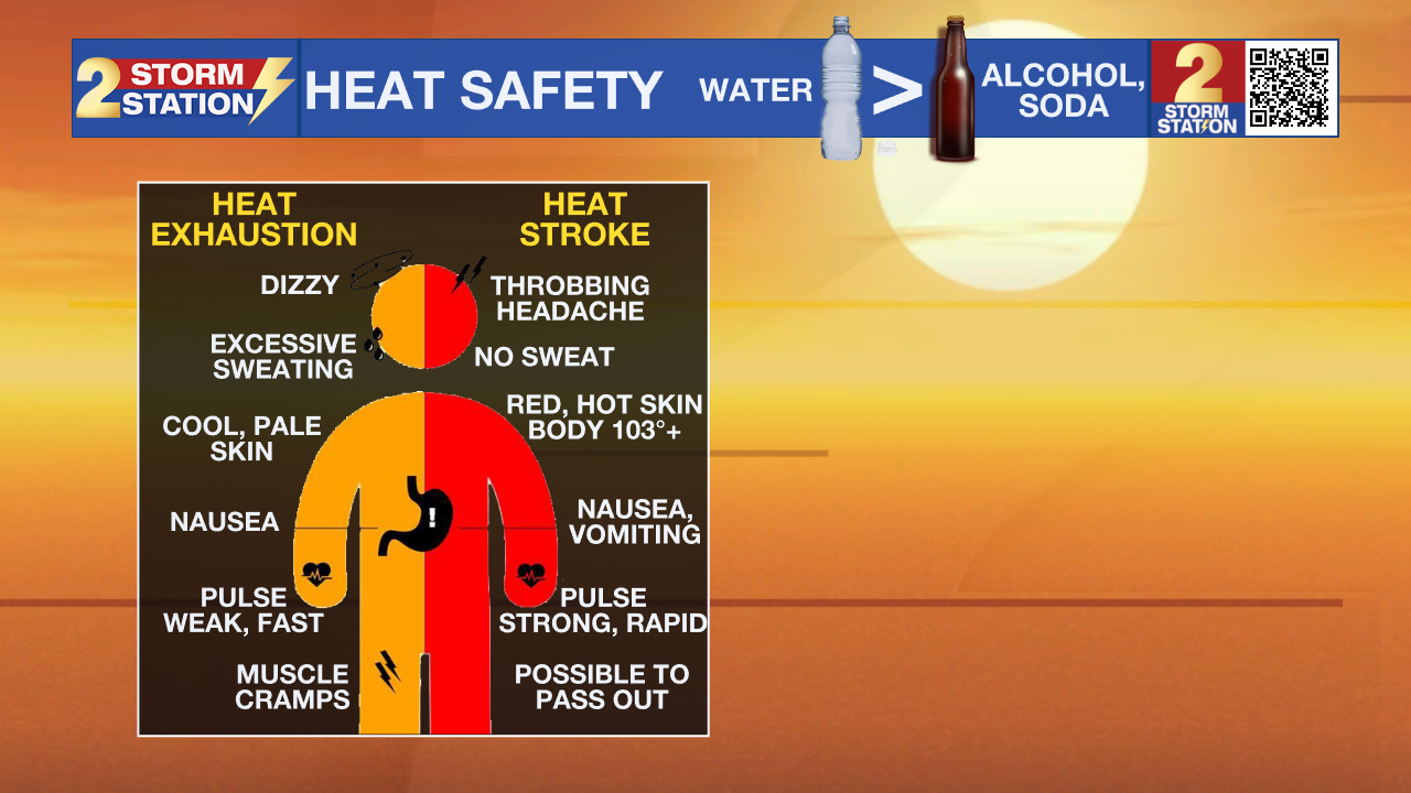
There are signs of some relief by midweek. Moisture will start creeping back into the Capital Area, dragging storm chances up and hopefully taking a bit of the edge off the heat.
The Tropics: The National Hurricane Center recently highlighted two areas to watch across the Atlantic Basin — one closer to home, and another way out to sea.
Trending News
Northeastern Gulf — An area of low pressure is expected to form during the weekend in the northeastern Gulf. Subsequent slow development of this system is possible early next week, provided it stays over open water long enough. As of now, there is a low, 20% chance of tropical development. New data suggests that if a system does develop, it could track westward across the northern Gulf. However, it’s important to remember that forecast models struggle to accurately track a system until it actually forms. The Storm Station is monitoring the situation closely, but there is nothing to worry about right now. The next name on the Atlantic storm list is Bertha.
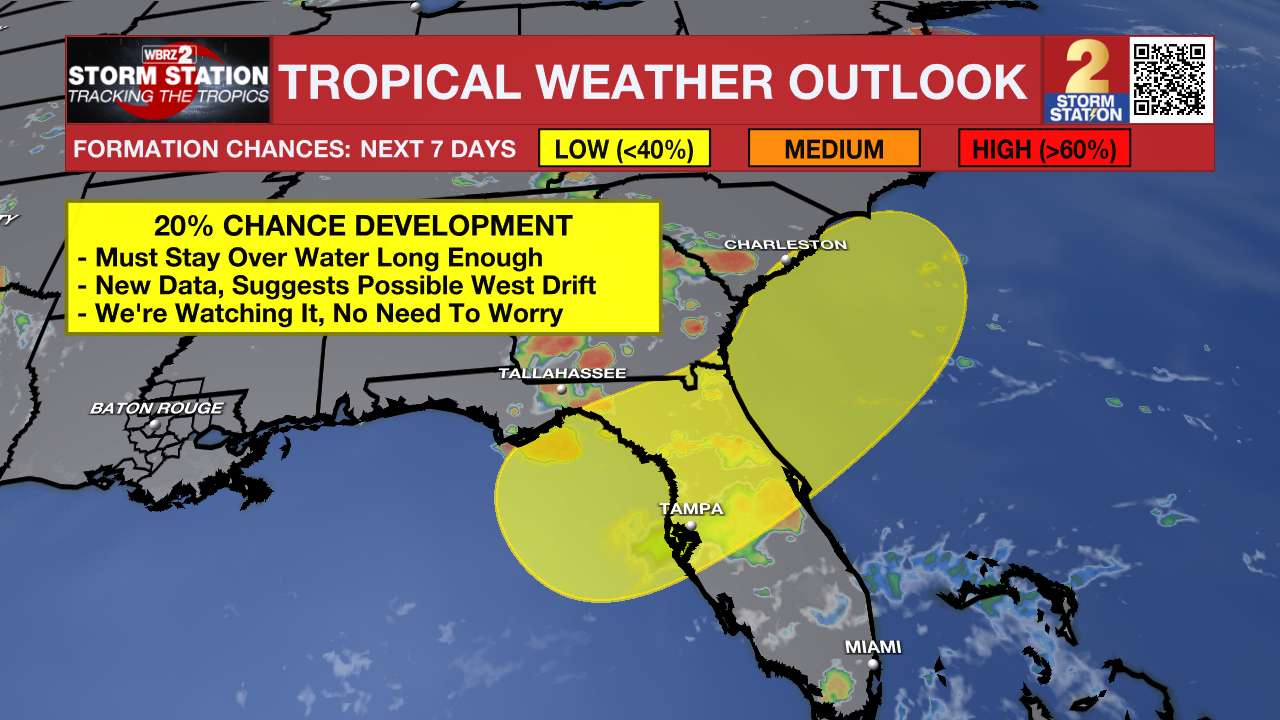
Eastern Tropical Atlantic — Showers and thunderstorms, associated with a tropical wave, southeast of the Cabo Verde Islands, remain disorganized. Some slow development is possible over the next day or so as the system generally migrates west. Toward the weekend, the system will enter a hostile environment. Once that happens, further development is not expected. Tropical development odds remain at 10%.
Get the latest 7-day forecast and real-time weather updates HERE.
Watch live news HERE.
— Meteorologist Malcolm Byron
The Storm Station is here for you, on every platform. Your weather updates can be found on News 2, wbrz.com, and the WBRZ WX App on your Apple or Android device. Follow WBRZ Weather on Facebook and X for even more weather updates while you are on the go.
More News

