

Latest Weather Blog
Thursday AM Forecast: Greatest heavy rain threat over, isolated storms remain possible
Thankfully, the Capital Area was spared from the worst of the heavy rain and severe potential this morning. Further to the east, closer to places like New Orleans and Slidell, it has been a very different story. For the rest of the day, rain coverage goes down, but isolated storms will remain.
Several area rivers have gotten into flood stage, with the highest crest expected on the Tangipahoa River at Robert. This river is now forecasted to get into major food stage. Here are the expected impacts:
Water will be in homes along Highway 445 and Highway 443. Highway 445 will be under water and closed from Highway 190 to Interstate 12. Louisiana Highway 22 will be under water in many places. Access to Magnolia Island and Lee's Landing will be cut off.

Today & Tonight: The potential for flash flooding continues to trend lower, but it cannot be ruled out, especially for areas north of Baton Rouge. This is also where rain chances will be the highest for the rest of the day. Overall, rain coverage will be isolated through the afternoon, meaning a good chunk of us will stay dry. Highs will reach into the upper 80s under mostly cloudy skies. Overnight, rain chances go way down, with lows in the upper 70s.

Use the slider to advance through the next 24 hours of Futurecast
Trending News
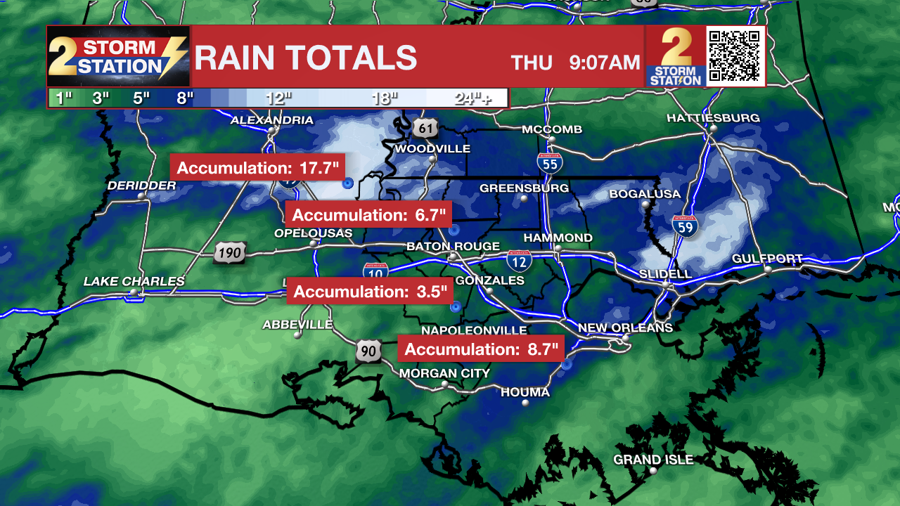
Rainfall totals over the past 3 days have been very high over some portions of southeast Louisiana. Notably, areas north and northwest of Baton Rouge have been hit especially hard, with much lower totals closer to the Capital City. There is also enhanced rainfall totals further to the south and east, closer to New Orleans and Slidell.
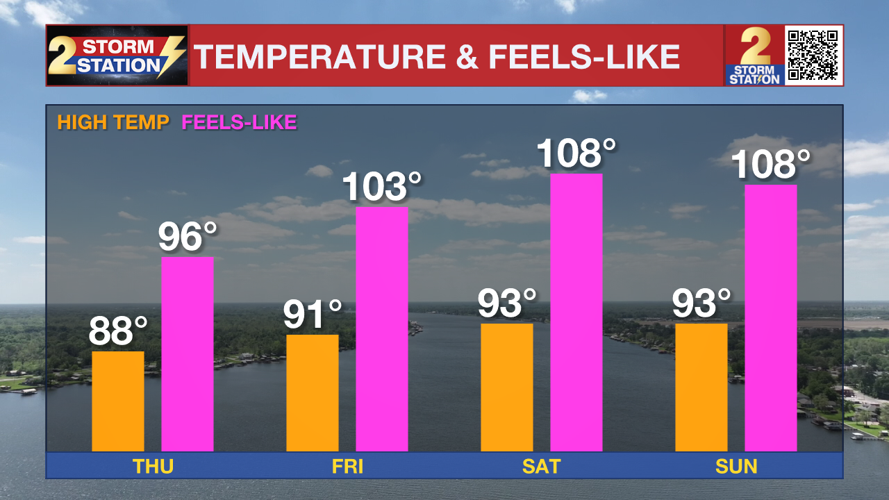
Up Next: The widespread flooding threat diminishes Friday, but scattered storms remain possible, with isolated action into Saturday. Sunshine returning to the region will allow temperatures to climb into the lower and middle 90s. Heat index values could approach 108 to 110 degrees Friday through Sunday, and Heat Advisories may be needed. Early next week looks hotter with lower rain chances, especially Monday.
The Tropics: Arthur is now just a remnant area of low pressure, driving a lot of heavy rain and severe weather across the south. There are low chances that this low could re-develop into a tropical storm Friday or Saturday after it exits the east coast and moves into the Atlantic.
Local Rivers: With recent heavy rain and more storms on the way, several local river gauges are forecast to rise. To track conditions, find the latest river levels and forecasts below, updated twice every hour.


Get the latest 7-day forecast and real-time weather updates HERE.
Watch live news HERE.
– Balin
The Storm Station is here for you, on every platform. Your weather updates can be found on News 2, wbrz.com, and the WBRZ WX App on your Apple or Android device. Follow WBRZ Weather on Facebook and X for even more weather updates while you are on the go.
More News
