

Latest Weather Blog
Saturday AM Forecast: high heat and daily thunderstorm chances over the weekend
Moisture will stay high over the weekend, but a ridge of high pressure will begin to break down, opening the door for a greater coverage of thunderstorms. Before the storms, high heat will continue to be a factor.
Today & Tonight: Early sunshine will allow highs to get into the mid 90's for most locations today. Humidity will make feels like temperatures between 105-110 degrees. Showers and thunderstorms will provide some relief from the heat in the afternoon and evening. This activity will stay scattered in nature, and about 60% of the viewing area will pick up some rain. Any remaining storms will begin to taper off after the sun sets. Skies will be partly to mostly cloudy in the overnight hours with a low near 80 degrees.
Up Next: Sunday will feature similar weather to Saturday. The differences will be slightly higher heat, and storms staying isolated. Early next week, the same general pattern will continue with the only potential caveat being some increased moisture in the atmosphere from the tropics. Should this occur, daily rain coverage may need to trend up from the current forecast. As for temperatures, highs will remain in the low to mid 90s with lows in the upper 70s. Thermometers will be highly dependent on the onset of showers and thunderstorms each day.
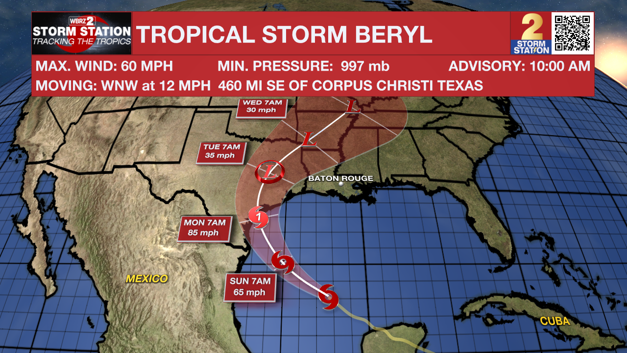
The Tropics: Tropical Storm Beryl has emerged into the Gulf of Mexico after moving through the Yucatan Peninsula. A hurricane watch is in effect for the western Gulf Coast. As of 10am Saturday, Beryl had 60mph winds and was moving west-northwest at 12mph. The storm will turn northwest on Saturday with re-intensification to hurricane strength likely before a landfall in Texas Sunday night into Monday. Areas in the hurricane watch may expect storm surge along the coast, strong winds and heavy rain.
Trending News
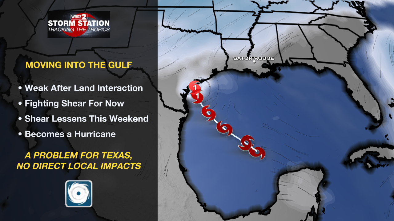
Local Impacts: Beryl will bring some indirect impacts to the local area next week. Here is a summary:
- Rip Currents—dangerous rip currents will be possible along the Louisiana Coast and for beaches as far east as the Florida Panhandle. Extreme caution should be used in areas that are permitting swimming.
- Coastal Flooding—persistent onshore winds could lead to water inundation for immediate coastal areas around the Gulf of Mexico and the tidal lakes. Tides may run a few feet above average for several days.
- Heavy Rain—remnant moisture from the storm could end up over Louisiana and Mississippi by the middle of next week. The tropical moisture could lead to heavy thunderstorms and possible some street and poor drainage flooding.
Get the latest 7-day forecast and real time weather updates HERE.
Watch live news HERE.
– Balin
The Storm Station is here for you, on every platform. Your weather updates can be found on News 2, wbrz.com, and the WBRZ WX App on your Apple or Android device. Follow WBRZ Weather on Facebook and Twitter for even more weather updates while you are on the go.
More News
