

Latest Weather Blog
Thursday AM Forecast: Excessive heat returns, little relief from rain or clouds
The end of summer sizzle ramps up as we head towards a big weekend in the Capital City. Heat safety should be a top priority over the next several days as we welcome back heat index values in the triple digits!
Today & Tonight: Mainly clear skies early Thursday morning may allow for a few patchy areas of fog around sunrise. Temperatures will quickly warm back into the low and middle 90's this afternoon with heat index values nearing 100 degrees at times. Expect plenty of sunshine and almost no rain Thursday afternoon. Into the overnight, temperature will slowly fall back near 73° by early Friday morning with light fog formation again possible.
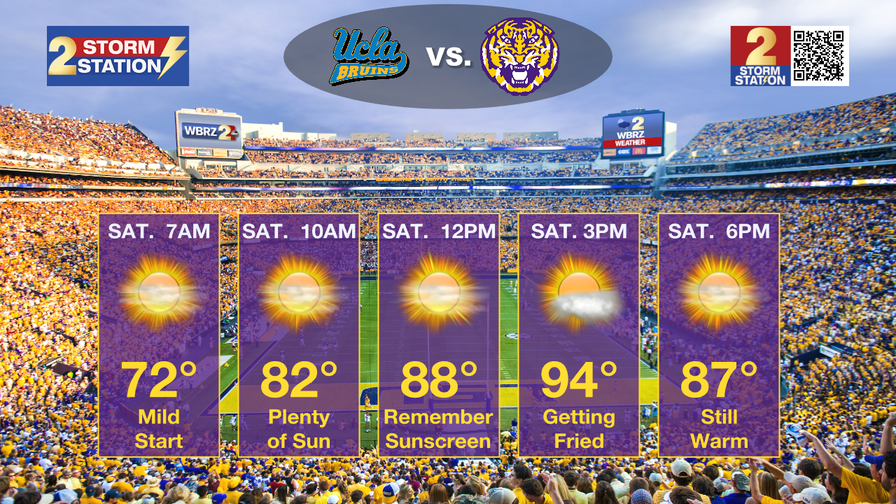
Up Next: With rain chances eliminated over the weekend and skies remaining mostly sunny Friday through Sunday, relief from the excessive heat will be extremely hard to come by when outdoors. This weekend will see mild mornings in the lower-70's and very hot and humid afternoons with forecast high's in the middle-90's resulting in feels-like conditions exceeding 100° at times. For those heading out to Tiger Stadium for the 2:30pm kickoff against UCLA on Saturday; prepare for one of the hottest games in LSU history, according to the LSU Kickoff Weather Index. Make sure to prioritize staying hydrated (with water) while participating in typical game day activities!
Into next week, there are a number of factors that will play into the forecast including a weak front approaching from the northwest and the possibility of a tropical system in the southeastern Gulf of Mexico. Any added impacts such as rain will likely not be in play until Tuesday or Wednesday.
Trending News
Get the latest 7-day forecast and real time weather updates HERE.
Watch live news HERE.
The Tropics:
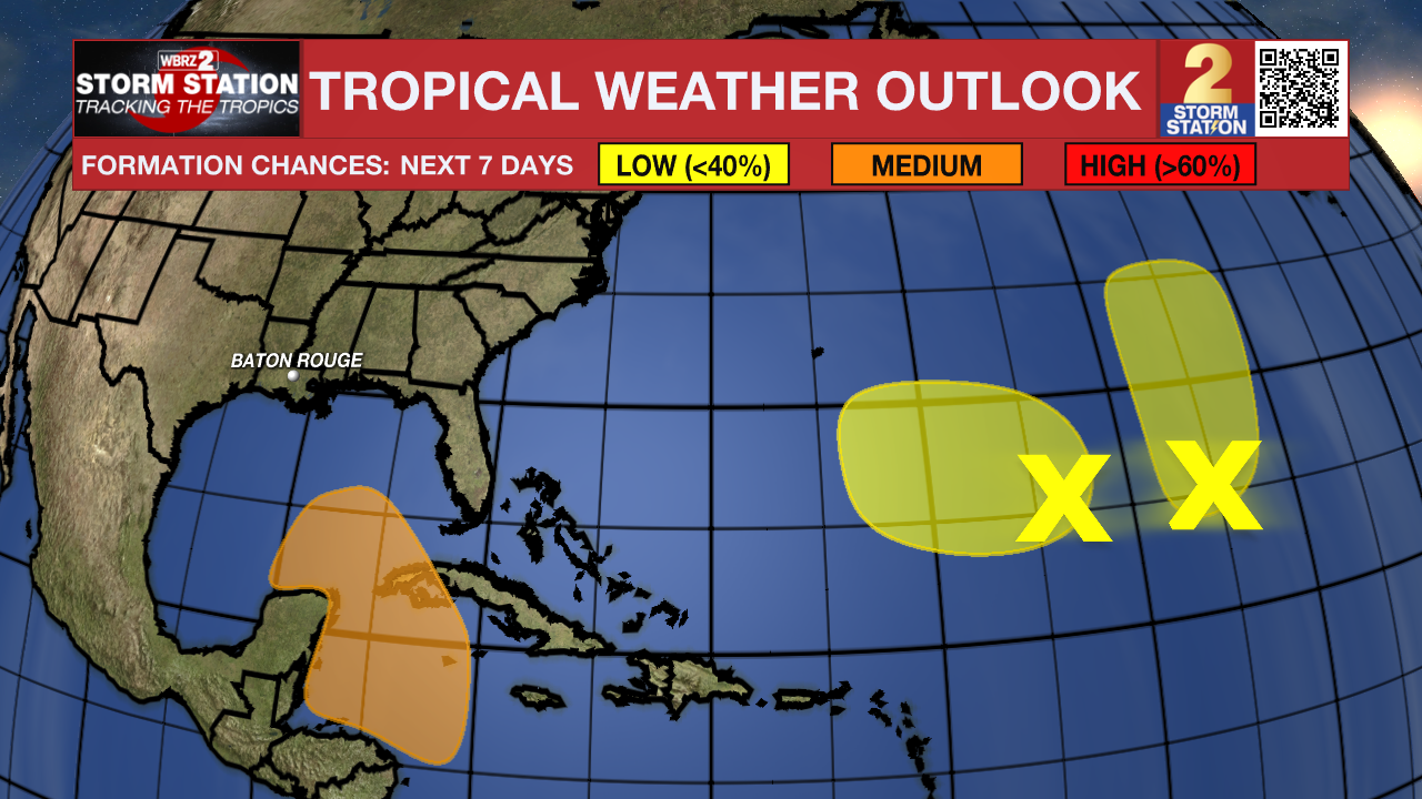
Northwestern Caribbean Sea and Southeastern Gulf of Mexico: A broad area of low pressure could form late this weekend or early next week over the northwestern Caribbean Sea. Thereafter, some slow development of this system is possible through the middle of next week while it moves slowly to the north or northwest over the northwestern Caribbean Sea or the southeastern Gulf of Mexico.
Central Subtropical Atlantic (Remnants of Gordon): An area of disorganized showers and thunderstorms located over the central subtropical Atlantic is associated with the remnants of Gordon. Some development of this system is possible while it moves generally northward over the next several days.
Central and Western Subtropical Atlantic: Shower and thunderstorm activity in the left yellow highlighted area is associated with a well-defined area of low pressure. Slow development of this system is possible over the next week. This system poses no threat to Louisiana.
– Emma Kate C.
The Storm Station is here for you, on every platform. Your weather updates can be found on News 2, wbrz.com, and the WBRZ WX App on your Apple or Android device. Follow WBRZ Weather on Facebook and Twitter for even more weather updates while you are on the go.
More News
