

Latest Weather Blog
Wednesday Morning Video Forecast
Related Story
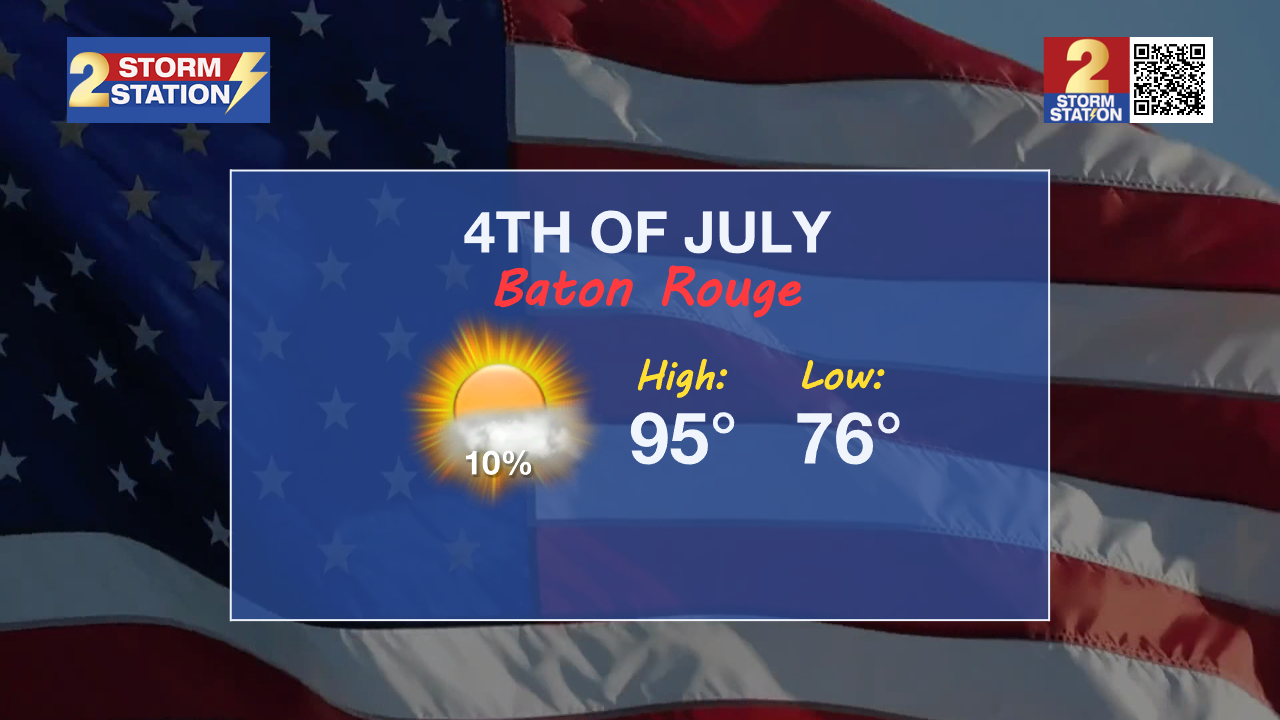
Wednesday brings one more round of afternoon storms before a stretch of drier—but hotter—weather takes over! Expect sizzling afternoons through the 4th of July weekend with only spotty rain chances and heat indices in the triple digits.
Today & Tonight: Watch for isolated to scattered showers and thunderstorm development Wednesday afternoon as a front presses towards the region. Aside from the afternoon t-storms, Wednesday will be another hot and sticky day with plenty of sun and temperatures nearing 93 degrees for a high in the Capital City. Tonight, radar activity will gradually shut down after dusk, setting the area up for another warm summer night with temperatures in the 70s.
Thursday through Sunday: The same front that helps spark thunderstorms Wednesday will be offshore on Thursday; behind it, a shift to northerly winds will usher in drier air to the mid-levels of the atmosphere which will help limit rain chances the rest of the week. Thursday through Sunday, daily rain coverage will slip into the spotty 10-20% coverage range. Expect hot afternoons with highs in the mid-90s through the Independence Day Weekend. Humidity levels will slightly drop, but feel-like temperatures will climb into the low-100s each day! Stay hydrated and take breaks in the shade or air conditioning while celebrating Independence Day.
Looking Beyond: By late Sunday and into next week, deep tropical moisture is expected to return, bringing an end to the brief break from daily thunderstorms. Still, there’s some uncertainty in how the pattern will evolve; the exact evolution of the pattern will be highly dependent on a weak disturbance we will be monitoring in the Gulf.
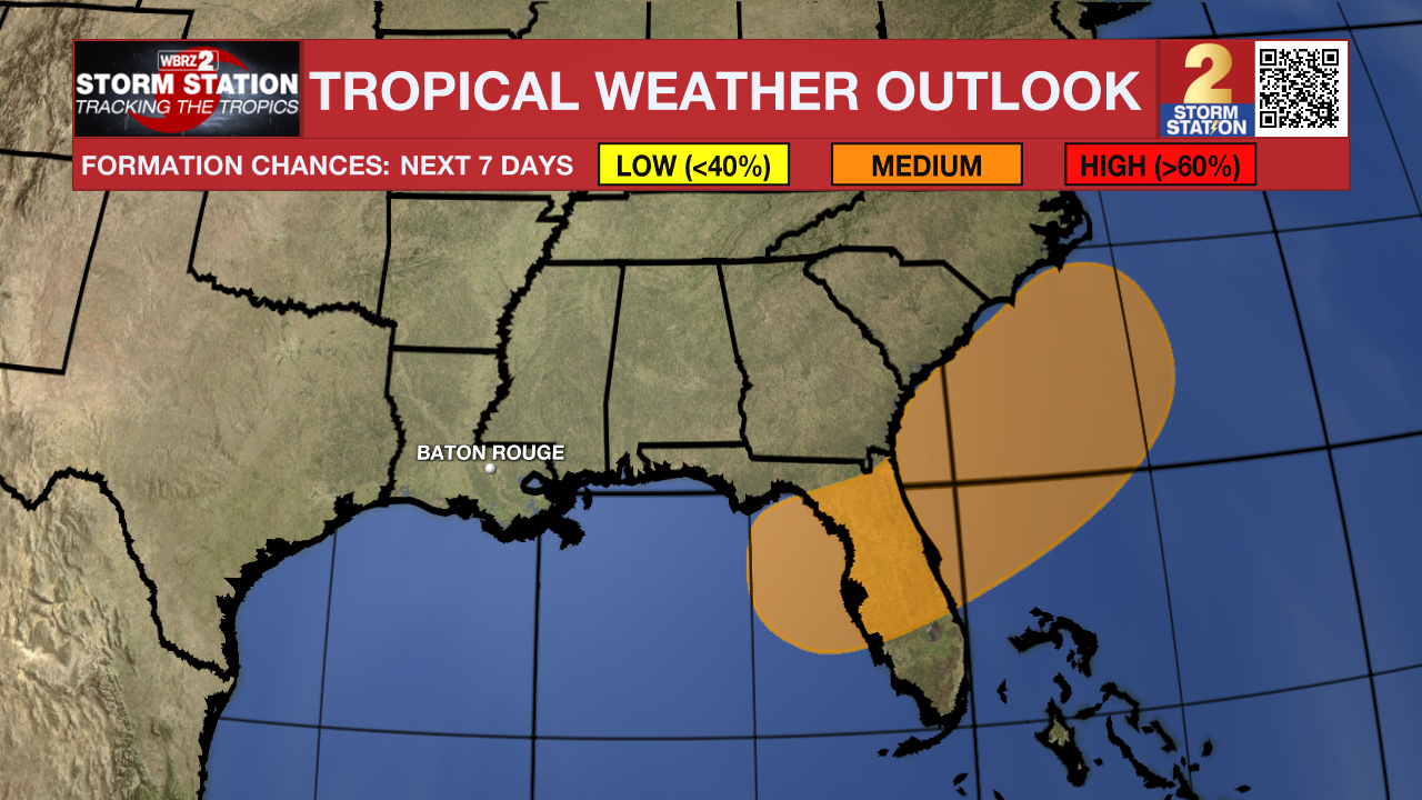
The Tropics: An area of low pressure could develop near the southeast U.S. Atlantic or Gulf coasts by this weekend along a weakening frontal boundary. Environmental conditions appear only marginally conducive for some slow development, but a tropical or subtropical depression could form in this region over the weekend or early next week while the system moves little. There is a 40% chance of development over the next 7 days as of Wednesday morning.
Get the latest 7-day forecast and real-time weather updates HERE.
Watch live news HERE.
– Emma Kate C.
The Storm Station is here for you, on every platform. Your weather updates can be found on News 2, wbrz.com, and the WBRZ WX App on your Apple or Android device. Follow WBRZ Weather on Facebook and X for even more weather updates while you are on the go.
News
