

Latest Weather Blog
Sunday morning video forecast
Related Story
Showers and thunderstorms are winding down across South Louisiana this morning as a cold front pushes through the region. Conditions will gradually improve through the day, but clouds and cooler temperatures will stick around.

Today and tonight: Rain is already winding down this morning, sprinkles will continue through midday, gradually shifting toward the coast by the afternoon. Skies will remain mostly cloudy, with cooler temperatures holding highs in the upper 60s to near 70 degrees. Tonight, conditions turn drier, but clouds may linger. Temperatures will drop into the lower 50s, with some upper 40s north.

Use the slider to advance through the next 24 hours of Futurecast
Up Next: Clouds may hang tough into Monday as moisture lingers behind the front, keeping conditions cooler than normal with highs again near 70. By Monday night into Tuesday, skies begin to clear as drier air moves in. The rest of the week trends warmer, with temperatures climbing back into the 80s by late week.
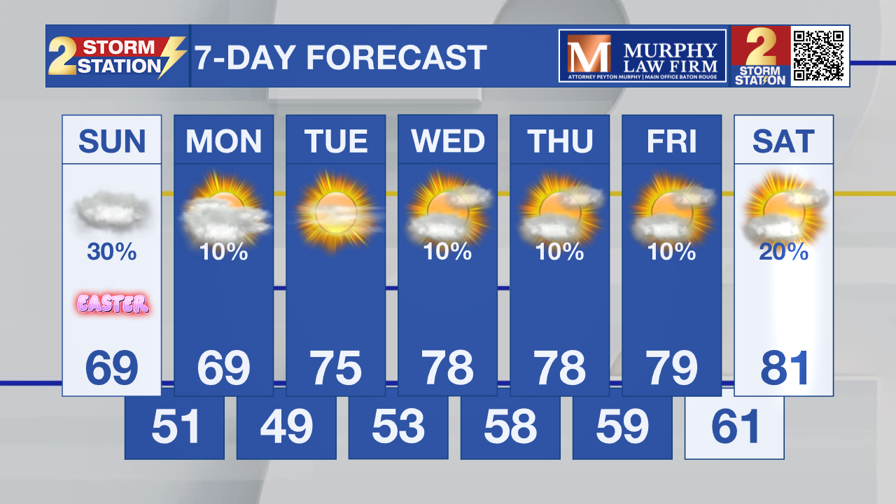
What to look out for: The main impact today will be lingering showers into early afternoon, especially south of I-10.
Early Easter activities like sunrise services and egg hunts may deal with wet conditions, lingering showers, and cloudy skies. The weather improves later in the day, but expect soggy grounds in spots.
Get the latest 7-day forecast and real-time weather updates HERE.
Watch live news HERE.
– Dave
The Storm Station is here for you, on every platform. Your weather updates can be found on News 2, wbrz.com, and the WBRZ WX App on your Apple or Android device. Follow WBRZ Weather on Facebook and X for even more weather updates while you are on the go.
News
