

Latest Weather Blog
UPDATE: Flood Watch extended through Friday, keeping an eye on the tropics
A FLOOD WATCH remains in effect for the entire Capital Region through Friday morning. A FLASH FLOOD WATCH means conditions may develop that lead to flash flooding. Flash flooding is a very dangerous situation. Be on the lookout for threatening weather conditions and listen for later statements and possible warnings. For more on flooding safety, CLICK HERE.
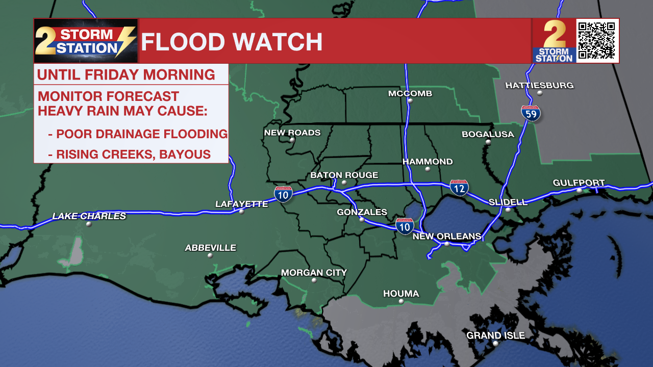
Multiple periods of heavy rain are likely through the end of the week, racking up rain totals on the order of 3-7” across the area. However, it’s worth noting that localized areas could see considerably more on the order of 8”+. While rain is in the forecast daily, Tuesday and Thursday look to be the wettest days, carrying the highest risk for flash flooding.
Tonight & Tomorrow: Isolated showers and thunderstorms will persist into the evening hours, particularly along and north of I-10. Overnight, storm coverage will ramp up again as another surge of tropical moisture arrives. The Tuesday morning commute could be another soggy one, so watch for slick roads and allow for extra travel time. Overnight lows will stay mild in the mid-70s.

Use the slider to advance through the next 24 hours of Futurecast
Finding dry periods will be difficult on Tuesday. Following a round of morning rain, widespread showers and thunderstorms will persist into the afternoon. Continuous rounds of heavy rainfall may lead to isolated flash flooding. As the day progresses, please exercise extra caution while driving, as water is likely to accumulate on roads and in low-lying areas. Just about everyone will experience rain on Tuesday. Persistent clouds and rain will keep a tight lid on temperatures, keeping highs safely in the upper 70s and low 80s.
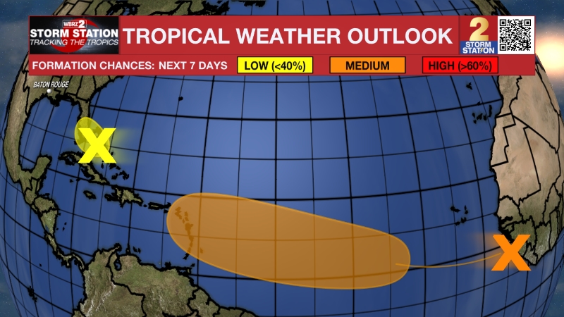
Up Next: Though Wednesday might bring a lull in terms of storm coverage, scattered downpours will still be out there from time to time. Thursday looks notably messy, as a tropical disturbance moves through the region. The National Hurricane Center does note a medium chance of tropical development with this system. Regardless of the outcome, the local impact remains the same: tropical downpours with very high rain rates will move through the region. Especially following the early-week activity, these storms appear to pose more significant problems from a flash flooding standpoint. Local river levels will need to be monitored as well, though there are no immediate concerns as of now.
Trending News
Heavy rain will remain a nuisance on Friday as well, as the departing tropical disturbance drags a front back toward the Capital Area. Over Father’s Day Weekend, rain coverages will steadily step down.


Get the latest 7-day forecast and real-time weather updates HERE.
Watch live news HERE.
The Tropics: A disturbance over northeastern Mexico will re-emerge over the northwest Gulf late Tuesday or Wednesday. Once over open water, it now appears to have a 50% chance of tropical development before moving inland by Thursday. The National Hurricane Center specifically notes that “Tropical Storm Watches or Warnings could be required on Tuesday.” Regardless of formation, heavy rainfall and flash flooding are likely across the central Gulf Coast, including the Capital Area.
— The Storm Station Meteorologists
The Storm Station is here for you, on every platform. Your weather updates can be found on News 2, wbrz.com, and the WBRZ WX App on your Apple or Android device. Follow WBRZ Weather on Facebook and X for even more weather updates while you are on the go.
More News
