

Latest Weather Blog
Tuesday PM Forecast: Summer heat builds, with some minor midweek rain relief
The summer pattern is locking in across our area, with hot and mostly dry conditions dominating much of the upcoming week. High pressure parked over the eastern U.S. is flexing its muscles, and that ridge will help to keep our afternoons toasty, with highs climbing into the low to mid 90s through the weekend. Expect plenty of sunshine, especially Tuesday and Friday, when rain chances are lowest.
Tonight & Tomorrow: Like last night, mostly clear skies are expected to persist. Unlike last night, slightly higher humidity will cause lows to stay in the 70s rather than the 60s. An increase in humidity and moisture from the Gulf will bring a noticeable bump in rain coverage on Wednesday. A disturbance, tied to the tail end of an old front, will take its time getting here but should spark isolated to scattered showers and thunderstorms. While not a washout, this will be our best shot at rain for several days.
Up Next: From Thursday into Saturday, we're back to more typical summer fare—warm, partly sunny, and just spotty to isolated showers or thunderstorms each afternoon. Any given day, rain coverage should stay between 10–30%. If you're heading outdoors, make sure to stay hydrated and take breaks in the shade.
Looking toward early next week, there are signs that a weak cold front will try to slide into the area. While there's still some uncertainty about whether it will stall north or push through our region, it could lead to more organized rain and storm chances by Monday. Stay tuned for updates.
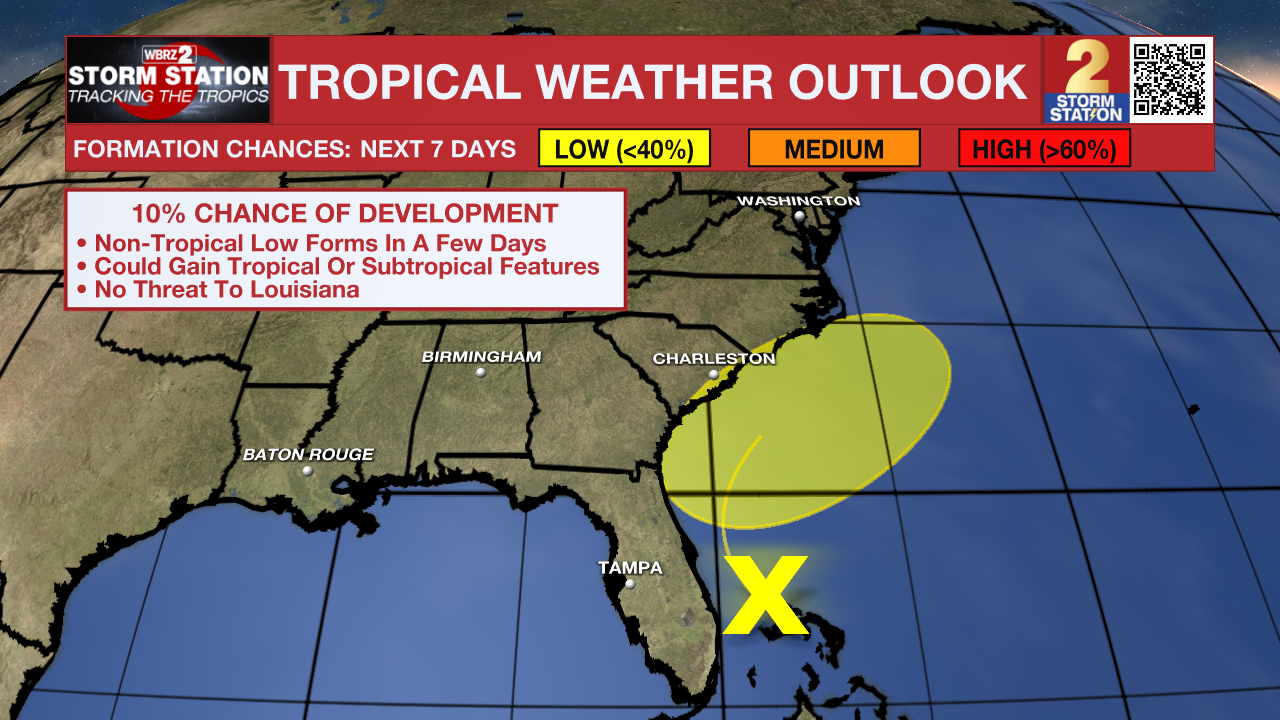
The Tropics: The 2025 Atlantic hurricane season is underway. Until it ends on November 30, any important tropical weather information will be provided in this section of the Storm Station Weather Blog. Forecasters from various entities have called for an above-average hurricane season.
Trending News
Meanwhile, over the western Atlantic, we're watching a broad area of unsettled weather. There’s only a small chance of tropical development over the next seven days, but if this feature edges closer to the East Coast, it could have an impact there. While no concern locally, it is something to monitor as hurricane season ramps up.
Get the latest 7-day forecast and real-time weather updates HERE.
Watch live news HERE.
– Josh
The Storm Station is here for you, on every platform. Your weather updates can be found on News 2, wbrz.com, and the WBRZ WX App on your Apple or Android device. Follow WBRZ Weather on Facebook and X for even more weather updates while you are on the go.
More News
