

Latest Weather Blog
Tuesday PM Forecast: small dip in temperatures on Wednesday; keeping a close eye on Beryl
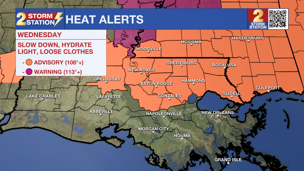
Extreme heat remains as the primary local impact as the Fourth of July gets closer. More heat alerts have been posted for Wednesday, even with a slight dip in temperatures.
Tonight & Tomorrow: After hitting the century mark for a second time this year, it remains uncomfortably warm on Tuesday night. Low temperatures will bottom out near 80° in Baton Rouge, with feels-like temperatures staying in the 90s for much of the night. Aside from a stray early evening shower, Tuesday night will be mainly dry with a few clouds.
Mother Nature ever so slightly takes the edge off the heat on Wednesday. But make no mistake about it, it will still be hot. Outside of rain, temperatures will climb into the middle-90s with feels-like temperatures upwards of 108°. That triggers a Heat Advisory on Wednesday. Despite how used to the heat one might be, extreme heat like this doesn’t discriminate. The Storm Station urges everyone to keep hydrating and take breaks if outside for longer periods to avoid heat illnesses.
There will be some heat relief on Wednesday in the form of scattered showers and storms. A greater coverage is anticipated as compared to Tuesday as moisture returns to the region. Roughly 50% of the capital area should see measurable rain (0.01”+) at some point.
Up Next: The July 4th holiday is shaping up to be a standard summer day. Look for a high temperature in the mid to upper-90s with lots of humidity and isolated thunderstorms. None have been issued yet, but another round of heat alerts is on the table. If you’re planning to watch the Fireworks on the Mississippi on the night of the 4th, the weather should cooperate. Storms will be coming to an end and temperatures will sit in the mid-80s. More of the same is expected into the weekend.
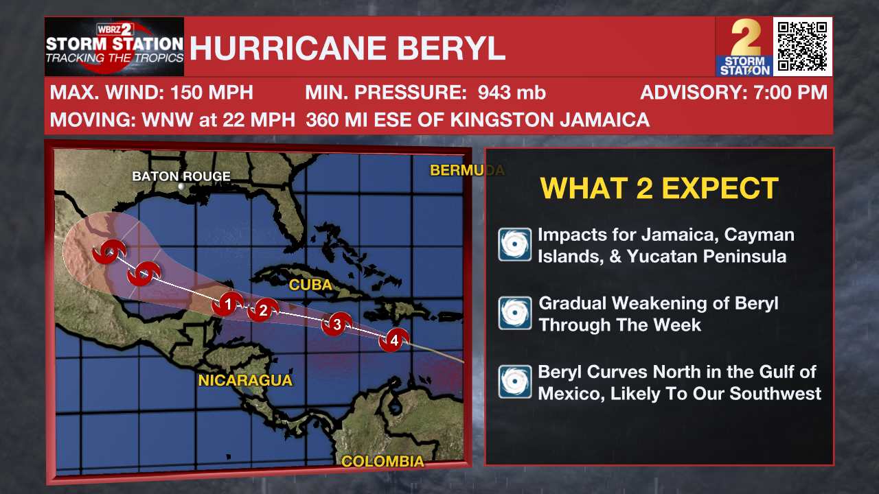
The Tropics: After making history on Monday night as the earliest recorded Category 5 hurricane, a weakening trend began on Tuesday. The latest update has Beryl at Category 4 strength with maximum sustained winds at 150 mph. While there is a fair amount of uncertainty with how strong Beryl will be in the coming days, the system will continue to exhibit this weakening trend as it moves west through the Caribbean at 20-25 mph.
Trending News
A landfall is is possible in Jamaica on Wednesday as a major hurricane. The storm will then brush the Cayman Islands before making yet another landfall in the Yucatan Peninsula on Thursday night. Further weakening is anticipated while the storm is over land. However, Beryl will emerge over the southwest Gulf of Mexico over the weekend before taking a northward turn. How extreme this turn will be depends on a few factors: the strength and placement of an upper-level ridge and the strength of Beryl after hitting the Yucatan Peninsula. These details should come into better agreement by the weekend. Parts of northern Mexico and south Texas should monitor the progress of this storm closely. Given the question marks surrounding the long-term prospects of Beryl, Storm Station is continuing to keep a watchful eye on this storm.
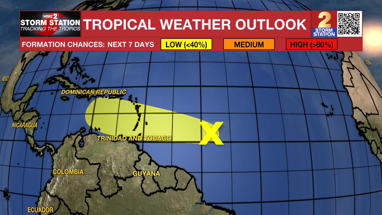
Another tropical wave trailing behind Hurricane Beryl is located east of the Lesser Antilles. The thunderstorms associated with this wave continue to become less organized. Tropical development now appears unlikely with this disturbance. Regardless, heavy rain and gusty winds are possible in the Lesser Antilles by midweek, even in some areas already affected by Beryl.
Get the latest 7-day forecast and real time weather updates HERE.
Watch live news HERE.
-- Meteorologist Malcolm Byron
The Storm Station is here for you, on every platform. Your weather updates can be found on News 2, wbrz.com, and the WBRZ WX App on your Apple or Android device. Follow WBRZ Weather on Facebook and Twitter for even more weather updates while you are on the go.
More News
