

Latest Weather Blog
Tuesday AM Forecast: Near record warmth to kickoff month of April
The first several days of April will see an increase in temperatures, winds, and humidity levels. Many afternoon highs may meet or beat records.
Here’s a breakdown of what to expect:
- Tuesday: warm with passing clouds
- Wednesday through Friday: breezy with near-record warmth
- Saturday: more clouds and isolated showers
- Sunday: cold front with rain and thunderstorms
- Next Week: cooler
Today & Tonight: After a mild start in the 60s Tuesday morning, temperatures will return to the low 80s during afternoon hours under a mix of sun and clouds. Winds today will bring a light breeze, between 5-15 mph out of the southeast. Into the overnight hours, clouds and winds will increase, holding Wednesday morning lows to a warm 72 degrees in the Capital City.
One thing to watch: as we enter a spring tide cycle, water levels will rise over the next few days. While no coastal flooding is expected just yet, a coastal flood advisory might be needed by Wednesday or Thursday.
Trending News
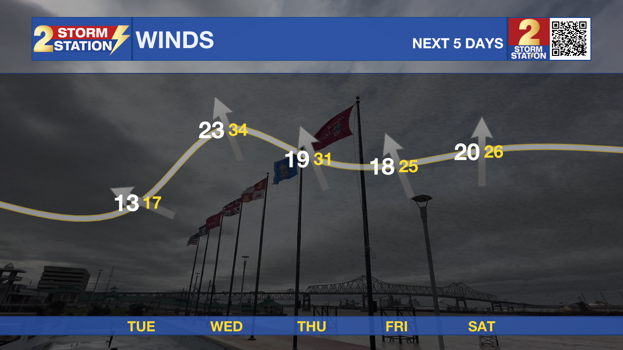
Up Next: Daily high and low records will be challenged Wednesday through Friday as mornings begin unseasonably warm, in the 70s, and afternoons will be around 10-15 degrees warmer than average, in the upper-80s. These conditions will make the days feel like we are in early Summer, not the start of April. Like summertime in south Louisiana, you will likely notice an increase in humidity in the air, and a passing shower or two cannot be ruled out each afternoon. On top of the warm conditions, winds ramp up through the end of the workweek, with southerly breezes of 10-25mph with occasional higher gusts.
Weekend: A large weather system moving across the western U.S. will help weaken the pattern causing unseasonable warmth and moisture to increase. This change means rain chances will ramp up, with isolated showers possible on Saturday and more widespread activity by Sunday as a cold front moves into the region. Keep tabs on the forecast if you have outdoor plans.
Get the latest 7-day forecast and real-time weather updates HERE.
Watch live news HERE.
– Emma Kate C.
The Storm Station is here for you, on every platform. Your weather updates can be found on News 2, wbrz.com, and the WBRZ WX App on your Apple or Android device. Follow WBRZ Weather on Facebook and X for even more weather updates while you are on the go.
More News
