

Latest Weather Blog
Thursday AM Forecast: Weekend front to bring greater rain chances
Rain coverage will stay very low, with humidity rising through the end of the week. A front will approach over the weekend, causing more storms across the area.
Rest of the Week: Thursday and Friday will bring some extra days of comfortable late-summer weather. Afternoon temperatures will climb into the low to mid-90s, but humidity levels stay low enough to keep it from feeling oppressive. Clear skies and drier air at night will allow lows to dip into the upper 60s and lower 70s — a welcome break from the sticky nights we typically see. Any plans after school or work will be good to go! Rain coverage will be very minimal, with almost everyone staying dry.
Up Next: By Saturday, a shift in the weather pattern begins. With plenty of sunshine at first, temperatures will climb quickly out of the 70s and into the 90s. An onshore breeze will gradually bring back Gulf moisture, which means humidity levels will creep higher. A disturbance from the west, and an approaching front will be enough to spark isolated showers and storms.
Football fans should plan for hot tailgates as both LSU and Southern play at home this weekend. While humidity won’t be as oppressive as it was in August, it will still be noticeable. The chance for a storm is not overly high, but not zero — so it’s smart to have a safe spot in mind if lightning pops up. As the evening wears on, temperatures will slip back into the 80s, offering a bit of relief by kickoff.
On Sunday, a weak cold front will edge closer, keeping storms in play. Even then, the day won’t be a washout, but outdoor plans may require a radar check, especially during the afternoon.
One wildcard is whether the front actually passes the area. If it stalls near the coast or just inland, humidity and storm chances could stick around into next week. The opposite will happen if this front ends up in the Gulf. We are leaning towards this front passing, but it's not guaranteed.
Trending News
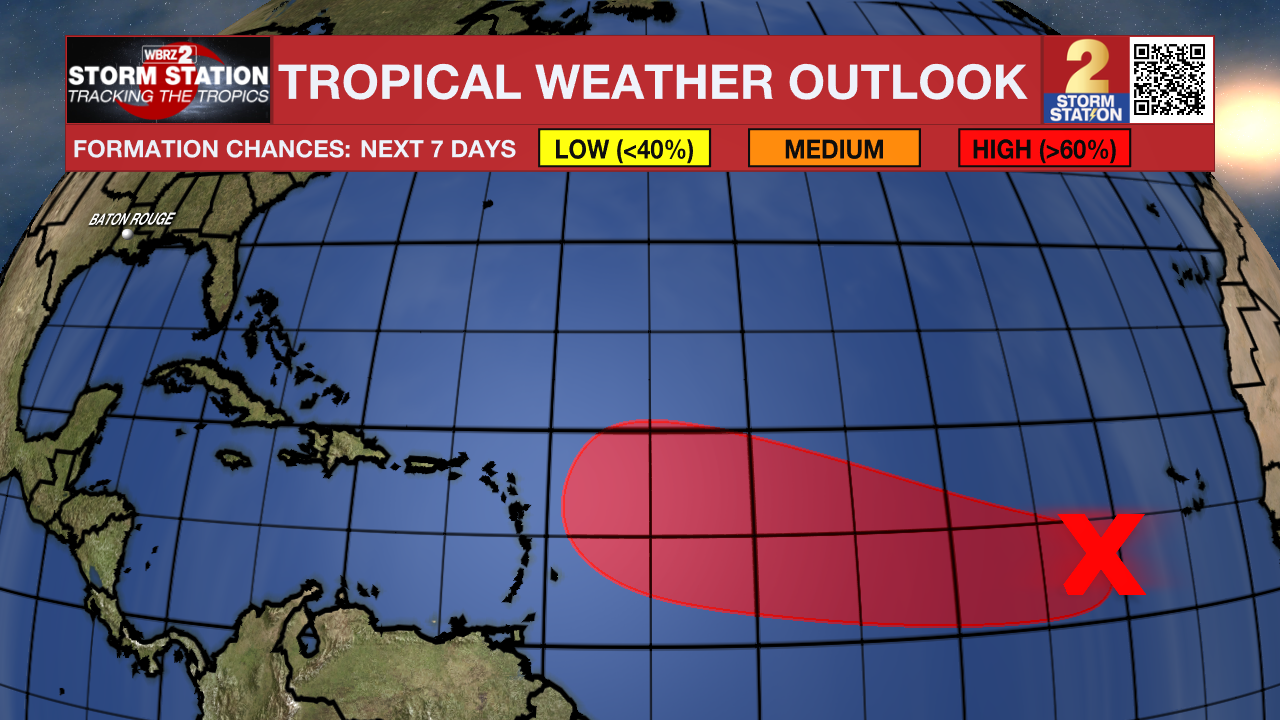
The Tropics: Showers and thunderstorms associated with a tropical wave located over the eastern tropical Atlantic several hundred miles west-southwest of the Cabo Verde Islands have become a little more concentrated during the past several hours. Environmental conditions are conducive for development of this system during the next several days, and a tropical depression is likely to form late this week or this weekend over the eastern or central tropical Atlantic while moving slowly toward the west-northwest at 5 to 10 mph. The system is likely to move faster toward the west or west-northwest thereafter and reach the waters east of the Lesser Antilles by the middle of next week.
Get the latest 7-day forecast and real-time weather updates HERE.
Watch live news HERE.
– Balin
The Storm Station is here for you, on every platform. Your weather updates can be found on News 2, wbrz.com, and the WBRZ WX App on your Apple or Android device. Follow WBRZ Weather on Facebook and X for even more weather updates while you are on the go.
More News
