

Latest Weather Blog
Wednesday PM Forecast: Chilly air hangs on as Halloween approaches
The cooler weather has arrived and is here to stay through Halloween. Don’t expect above-average warmth to return anytime soon.
Tonight & Tomorrow: A lingering breeze and incoming low clouds will slow the overnight cooldown, but not enough to stop a morning chill from settling in. Overnight lows will still dip into the upper 40s for most. Even in the milder spots, a northwest wind of 5–15 mph will still make it feel a few degrees cooler. Clouds will be quick to clear out on Thursday, giving way to a sunny and cool afternoon with a high in the mid to upper 60s. Winds will stay out of the northwest at 5-15 mph.
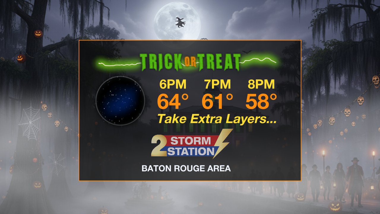
Halloween & Trick-or-Treating: Exiting clouds and relaxing winds will set up a chilly Halloween morning with lows in the low to mid-40s. But with full sunshine, afternoon highs will warm to the upper 60s, if not 70°. Trick-or-treaters won’t be facing any frightening weather, just a spooky chill to set the mood. Temperatures will drop into the lower 60s by nightfall, eventually hitting the upper 50s by 8 p.m.. Consider adding an extra layer beneath costumes.
The Weekend & Beyond: High clouds will begin arriving on Saturday and could linger into Sunday. It now appears that a storm system will spin up along the coast. While there are no tropical concerns, if it positions itself favorably, there might be a few showers to dodge late Saturday into Sunday. Currently, the Storm Station forecast favors a largely dry weekend with the chance of a passing shower, especially south of I-10 late Saturday. Stay in touch with the forecast in case of any future updates. Highs and lows will generally hold steady through the weekend, with a more notable warm-up taking shape next week.
Don't forget, Daylight Saving Time ends on Sunday morning — so be sure to set the clocks back one hour the night before.
The Tropics: After making landfall in eastern Cuba before dawn, Hurricane Melissa emerged offshore before Noon as a Category 2 hurricane. The Bahamas are next up in line for this system and will face impacts through Wednesday night. Such impacts include hurricane-force winds, storm surge of 4-7 feet, and 5-10” of rain. Now with Melissa over water again, there is a brief window where the storm may reorganize and intensify. However, weakening will likely begin late Thursday once the storm encounters a more hostile environment. The latest forecast shows Melissa continuing northeast, passing by Bermuda to its west before becoming post-tropical by Friday.
Trending News

Get the latest 7-day forecast and real-time weather updates HERE.
Watch live news HERE.
— Meteorologist Malcolm Byron
The Storm Station is here for you, on every platform. Your weather updates can be found on News 2, wbrz.com, and the WBRZ WX App on your Apple or Android device. Follow WBRZ Weather on Facebook and X for even more weather updates while you are on the go.
More News
