

Latest Weather Blog
Sunday PM Forecast: One final push of rain and storms before ditching the umbrella
After a pleasant Mother’s Day, one final round of thunderstorms will sweep through on Monday. Once those clear out, a much quieter weather pattern will take hold.
Tonight & Tomorrow: Overnight, the focus shifts northwest to ongoing thunderstorms in East Texas. Most forecast guidance suggests that these storms will bypass the Capital Area to the west; however, these patterns are often challenging and can easily throw a curveball. The Storm Station will monitor their progression throughout the night to see if they can make a run toward Baton Rouge. In any event, prepare for the possibility of isolated showers for the morning commute. Meteorologist Dave Baker will be tracking any developments, or lack thereof, on 2une-In starting at 5 a.m. on WBRZ. Otherwise, expect partly cloudy skies with mild lows in the mid-to-upper 60s.
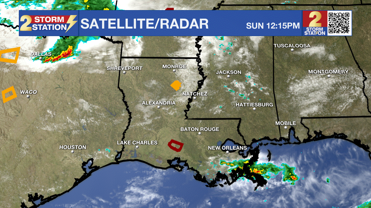
The rest of Monday will bring mostly cloudy skies as rain refuses to take a breather. An arriving upper-level disturbance will trigger numerous showers and thunderstorms as the day progresses, potentially impacting the lunch rush and/or evening commute. These storms could drop an additional inch of rain, with isolated totals exceeding 2”. Fortunately, these storms appear to be faster-moving than those from late last week. That said, with the recent soaking rains, brief nuisance flooding remains a concern, particularly in population centers. Expect highs to reach the upper 70s and lower 80s before rain-cooled air settles in.

Use the slider to advance through the next 24 hours of Futurecast
Up Next: Starting Tuesday, rain will generally avoid the Capital Area as sunshine returns and a quieter weather pattern takes hold. It won’t take long for temperatures to rebound either, with highs climbing from the low-to-mid 80s on Tuesday toward the upper 80s by late week. Next weekend looks much more cooperative for outdoor plans.

Trending News
Get the latest 7-day forecast and real-time weather updates HERE.
Watch live news HERE.
– Meteorologist Malcolm Byron
The Storm Station is here for you, on every platform. Your weather updates can be found on News 2, wbrz.com, and the WBRZ WX App on your Apple or Android device. Follow WBRZ Weather on Facebook and X for even more weather updates while you are on the go.
More News
