Sunday AM Forecast: next several days to bring warm temperatures and even rain chances
Warm temperatures will continue to be the norm through all of next week. Rain will also be a possibility, especially on Tuesday.
Today & Tonight: Get ready for more highs in the 80's today. The record high is 89 degrees set back in 1935. There is a chance of tying, or even breaking that record. Humidity will make those warm temperatures feel over 90 degrees at times. A stray shower cannot be ruled out, but the vast majority will remain dry. The overnight hours will feature partly cloudy skies, and lows in the lower 70's.
Up Next: Monday will be rinse and repeat in the world of weather. Conditions get a bit more interesting on Tuesday as a front approaches from the west. Unfortunately, the front will not pass, but it will get close enough for spotty to isolated storms on Tuesday and Wednesday. The rest of the week will remain unseasonably warm. Significant uncertainty exist at the end of the week and into the weekend. It all has to do with what effects a tropical disturbance currently located in the Caribbean has on the local area. (Go to tropics section for more details)
Get the latest 7-day forecast and real time weather updates HERE.
Watch live news HERE.
Trending News
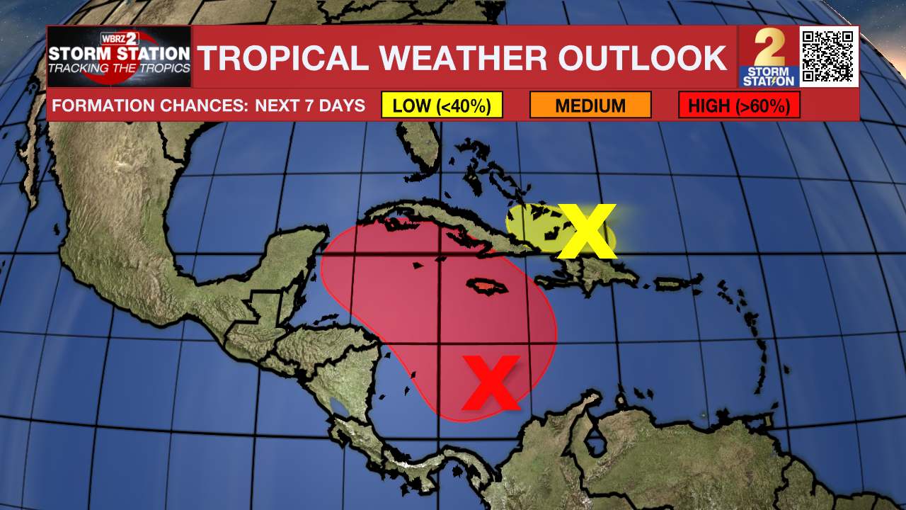
The Tropics: Odds are high for development with a tropical disturbance located in the Caribbean. A tropical depression is likely to form in the coming days. Steering currents will likely drive this system north a first, before a ridge of high pressure steers it to the northwest. There seems to be a decent probability that some sort of disturbance gets in the southeastern Gulf of Mexico. Where it goes from there is highly uncertain. Please note that forecast uncertainty will remain high until we get an organized system.

A trough of low pressure a couple hundred miles east of the southeastern Bahamas continues to produce disorganized showers and thunderstorms along with gusty winds over the adjacent waters of the southwestern Atlantic. Slow development of this system is possible during the day or so while it moves westward toward the southeastern Bahamas and eastern Cuba. This system is expected to be absorbed into the low pressure area over the Caribbean Sea (AL97) by late Monday, ending its chances of development. Regardless of formation, locally heavy rains are possible during the next couple of days across the northern Leeward Islands, Puerto Rico, Hispaniola, eastern Cuba, and the southeastern Bahamas.
Subtropical Storm Patty is near Sao Miguel island in the northern Atlantic. It has max sustained winds of 50 mph, and is moving east at 18 mph. Patty is no threat to the United States, and is expected to become post-tropical later today or tonight.
– Balin
The Storm Station is here for you, on every platform. Your weather updates can be found on News 2, wbrz.com, and the WBRZ WX App on your Apple or Android device. Follow WBRZ Weather on Facebook and Twitter for even more weather updates while you are on the go.


