

Latest Weather Blog
Saturday AM forecast: Storms could turn strong overnight before cooler air moves in
A stormy night ahead. Big storms are possible before a big cooldown arrives on Sunday
Today & Tonight
Saturday starts warm and muggy, with any morning fog quickly fading as winds pick up from the south. Temperatures climb into the mid to upper 80s this afternoon under partly sunny skies, and humidity will stay high thanks to a steady onshore flow.
By late afternoon, a few isolated showers could pop up, which could affect Southern’s homecoming, but the main event arrives later tonight. A cold front will sweep across south Louisiana overnight, bringing a line of thunderstorms capable of damaging winds and a few isolated tornadoes. The most likely window for severe weather will be overnight, into the very early morning hours of Sunday. While flooding isn’t expected, some brief heavy rain and gusty winds are likely as storms move through.
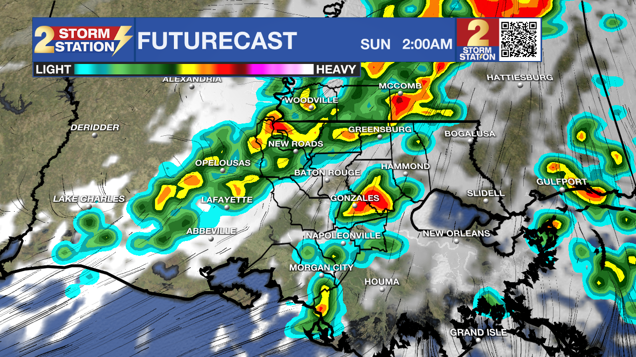
If you have evening plans, keep an eye on radar updates, and make sure your phone is set to receive weather alerts from the Storm Station weather app before heading to bed.
Trending News
Up Next
The front races east by sunrise Sunday, leaving behind drier and much cooler air. Skies will clear quickly, and humidity levels will plummet. Afternoon highs will hold in the upper 70s to near 80, feeling more comfortable with a crisp breeze out of the north.
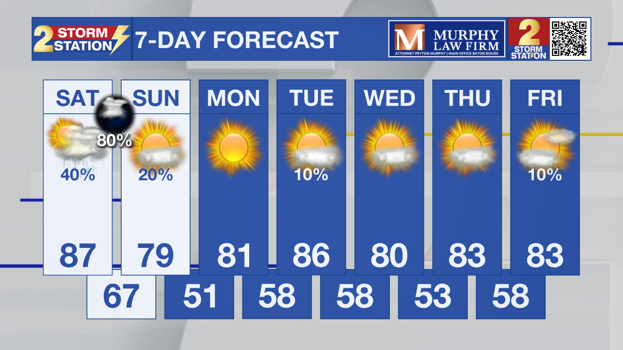
By Monday morning, lows will dip into the 50s for most areas, with a few 40s possible. Another reinforcing front on Tuesday will keep the pattern dry and pleasant through next week, with highs in the upper 70s to low 80s.
Tropics
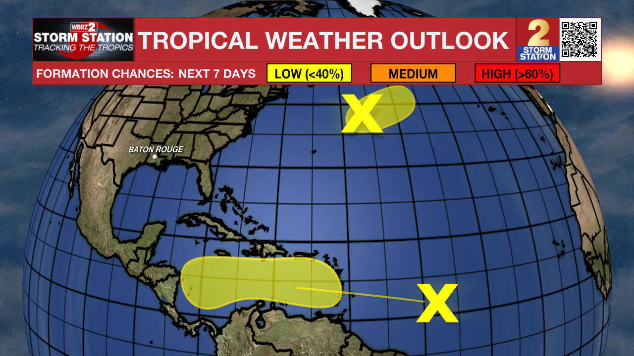
A tropical wave located about 800 miles east of the Windward Islands continues to produce a large area of showers and thunderstorms. Gradual development of this system is possible over the next several days as it moves westward at around 20 mph. This system is expected to bring heavy rainfall and gusty winds to the Windward Islands on Sunday and Sunday night, then move across the Caribbean Sea, where tropical development is more likely.
Get the latest 7-day forecast and real-time weather updates HERE.
Watch live news HERE.
– Dave
The Storm Station is here for you, on every platform. Your weather updates can be found on News 2, wbrz.com, and the WBRZ WX App on your Apple or Android device. Follow WBRZ Weather on Facebook and X for even more weather updates while you are on the go.
More News
