

Latest Weather Blog
Monday PM Forecast: unsettled weather pattern to begin new week
The two-week dry stretch has ended in the Capital Area. As we kick off the week, moisture levels are on the rise, setting the stage for multiple rounds of showers and thunderstorms through Wednesday. Sunnier skies will make a comeback by the weekend.
Here is a breakdown of what to expect
- Tuesday & Wednesday: scattered to numerous showers and thunderstorms, some dry time
- Thursday & Friday: showers more isolated in nature, warmer
- Tuesday through Thursday: warm and humid, mainly dry
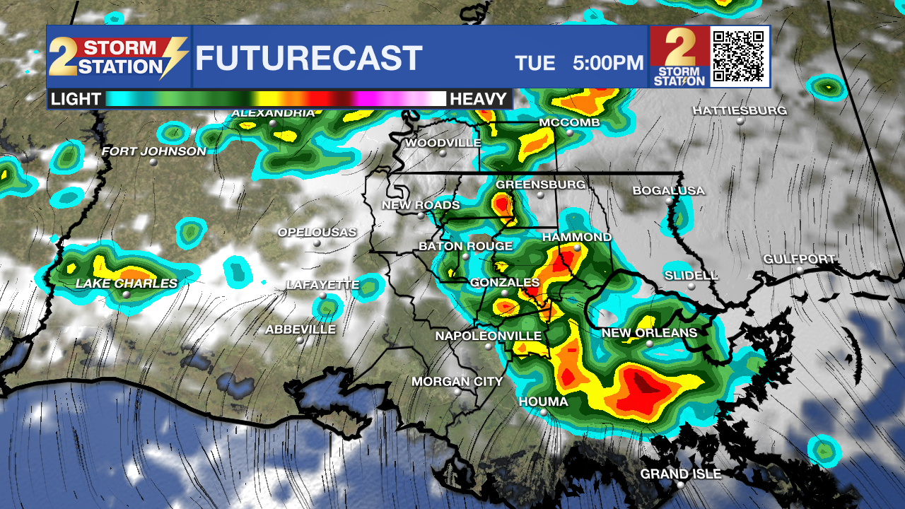
Tonight & Tomorrow: Overnight will be mostly cloudy and muggy with low temperatures in the upper 60s. Tuesday brings the highest rain coverage of the week at 70% area-wide, and while the storms may not be well-organized, the atmosphere will remain juicy enough to bring some downpours. The day won’t be a total washout.
Trending News
Up Next: Wednesday will bring more of the same, with rain coverage dipping slightly to scattered (60%) but still staying fairly active through the afternoon. As we move into Thursday and Friday, the pattern will begin to dry out. A ridge of high pressure will slowly build overhead, causing more of a sinking motion in the atmosphere and dropping rain coverage to just isolated (30%) on Thursday and spotty (20%) by Friday. Sunshine will gradually return, and temperatures will begin creeping up slightly—highs will reach the mid to upper 80s with warm, muggy nights continuing.
By the weekend, we will be in summertime preview mode. Saturday and Sunday look mostly dry, and temperatures will push into the upper 80s by Sunday. While a bit steamy, if you've got outdoor plans, the weekend is looking pretty nice overall.
River Flooding: The National Weather Service has issued a RIVER FLOOD WARNING for the Mississippi River at Red River Landing and Baton Rouge until further notice. In addition, a RIVER FLOOD WARNING will go into effect on Monday, April 21 for the Atchafalaya River at Morgan City.
• At Red River Landing, flood stage is at 48 feet. Moderate flooding is expected with a crest near 58 feet on April 28. Around these levels, Angola farmland on the left bank begins taking on water. Caution is urged when walking near riverbanks. The river will fall below flood stage by May 10.
• At Baton Rouge, flood stage is 35 feet. Major flood stage will be reached with a crest height of 40.7 feet on April 29. Around these levels, the grounds of the older part of Louisiana State University's campus become soggy. This includes the area around the Veterinary Medicine building, the Veterinary Medicine Annex, and Alex Box Stadium. Levees protect the city of Baton Rouge and the main LSU campus at this level. Caution is urged when walking near riverbanks. Levels will fall below flood stage around May 7.

• At Donaldsonville, flood stage is at 27 feet. Minor flooding is already occurring. A crest of 29.5 feet is expected around April 29—just under moderate flood stage. Around these levels, navigation becomes difficult for smaller river craft. Safety precautions for river traffic are urged. The river will crest by April 29, then fall below flood stage around May 7.
• At Morgan City, flood stage of 6 feet may be reached on Monday. Moderate flooding with a crest of 7 feet is forecast from April 26 to May 2. At 7 feet, buildings at the foot of Ann Street on the river side of the flood wall will flood as water overtops the Rio Oil Company dock. Buildings on the river side of the Berwick floodwall will flood. River traffic restrictions will be strictly enforced. In addition, backwater flooding could potentially impact portions of areas around Lake Palourde and Stephensville.
Get the latest 7-day forecast and real-time weather updates HERE.
Watch live news HERE.
– Josh
The Storm Station is here for you, on every platform. Your weather updates can be found on News 2, wbrz.com, and the WBRZ WX App on your Apple or Android device. Follow WBRZ Weather on Facebook and X for even more weather updates while you are on the go.
More News
