

Latest Weather Blog
Friday PM Forecast: Various heat alerts this weekend; new system in the tropics
Heat becomes the primary impact over the weekend, prompting various heat alerts in the Baton Rouge metro. Little relief from the heat is found outside of daily pop-up thunderstorms.
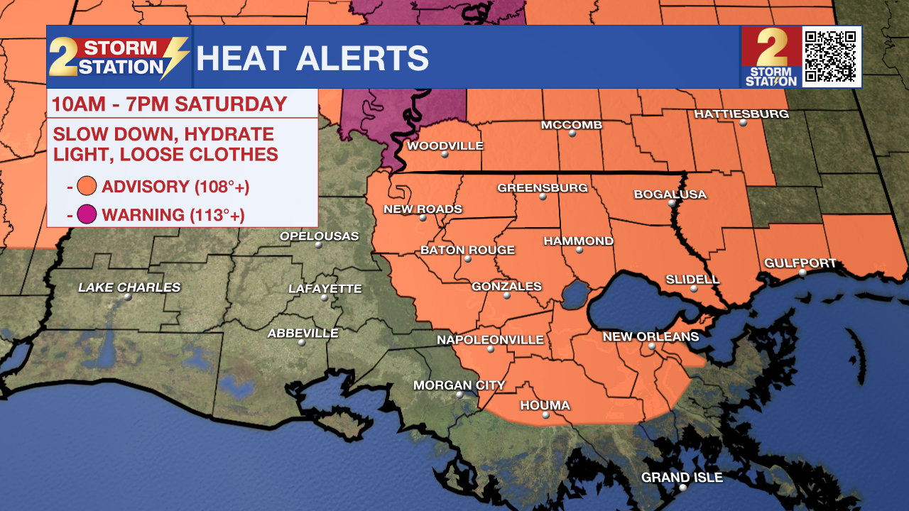
Tonight & Tomorrow: Afternoon storms will taper through the evening. Aside from a stray shower or two in the overnight hours, much of the region stays dry under partly cloudy skies. Overnight lows will be in the upper-70s. Saturday will be another very warm day as highs climb into the middle-90s. The humidity will place feels-like temperatures in the 108-110° range around peak heating. A Heat Advisory has been issued on Saturday to account for the high heat. Drink lots of water and take frequent breaks if outside for an extended period. Heat illness can become more common with this kind of heat. Scattered storms will fire in the heat of the day, meaning that there are opportunities to find a rain-cooling shower.
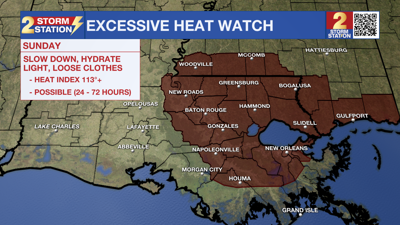
Up Next: The heat builds even more for the second half of the weekend. Look for a high temperature in the upper-90s on Sunday with peak feels-like temperatures pushing 113°. For that reason, an Excessive Heat Watch has been posted for much of the area. If this forecast remains unchanged, then the Watch will likely get upgraded to a Warning on Saturday.
Alerts might be issued later down the line for next week as the heat doesn't appear to relent. That said, isolated to scattered storms will be in the region each day. That would be about the only way to see any relief from the heat. This pattern continues all the way through the Fourth of July.
Trending News
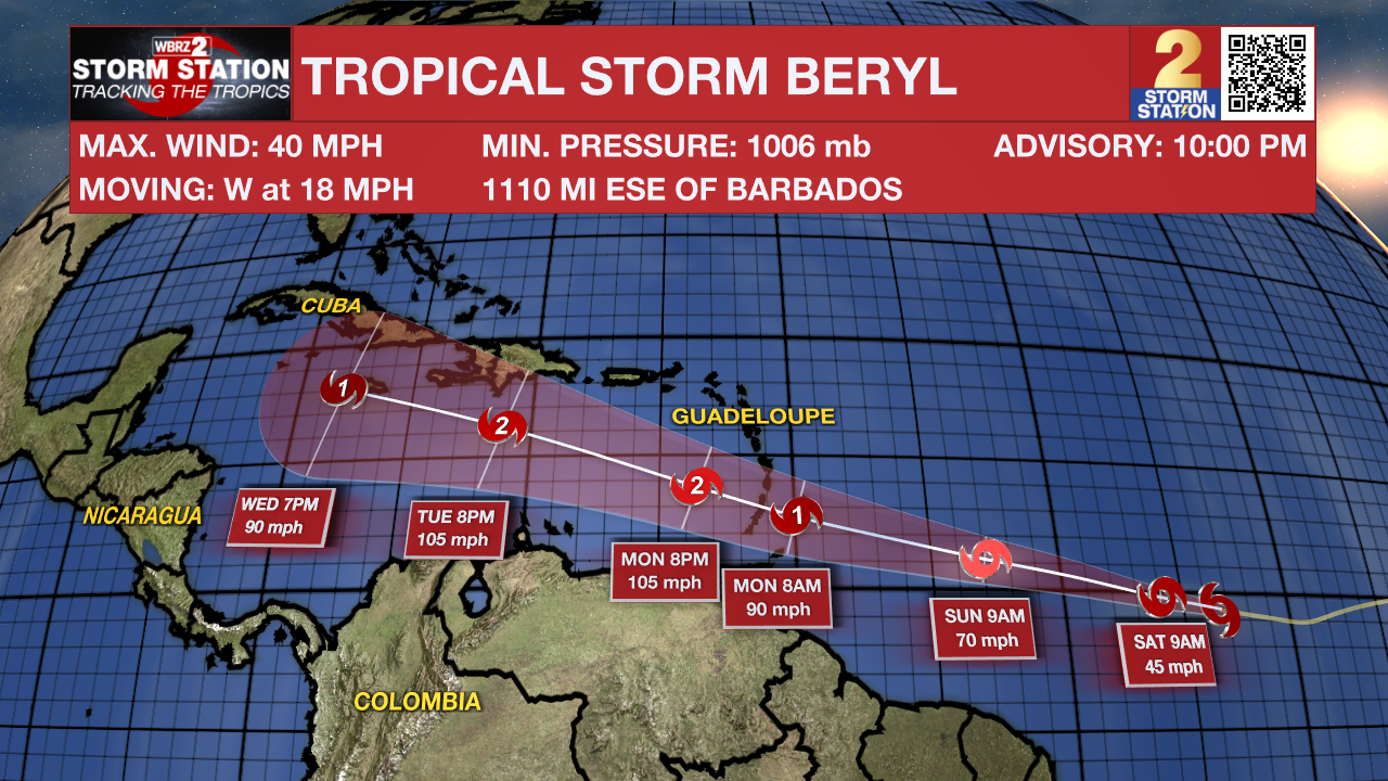
The Tropics: The second named storm of the 2024 Atlantic Hurricane Season has developed as of 10 p.m. Friday. Tropical Storm Beryl is located just over 1000 miles east-southeast of Barbados and is moving west at 18 mph. The storm has maximum sustained winds at 40 mph and is projected to become a hurricane in a couple of days. Impacts in the Windward Islands are likely late Sunday night, into Monday. This system will then push west into the Caribbean Sea. Uncertainty grows as to where the storm will go thereafter. At this stage, there is no reason for worry in the capital area as there's still lots of time to monitor the storm's progression. The Storm Station is keeping a close eye on the situation and will bring further updates as they come in.
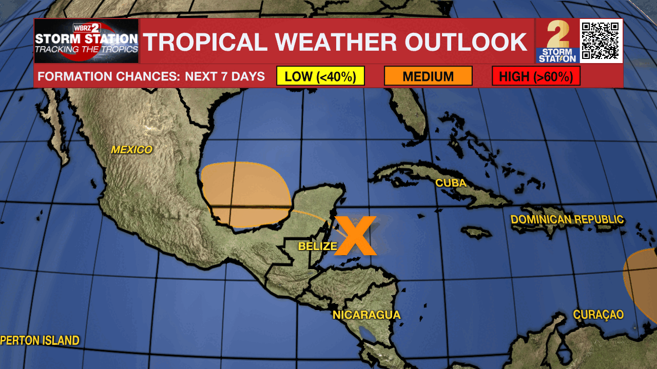
Another area of low pressure over the western Caribbean Sea continues to produce widespread storm activity. This disturbance will move over the Yucatan Peninsula and emerge over the Bay of Campeche this weekend. As of now, there is a medium chance of this system becoming a tropical depression before moving inland into Mexico. Regardless, heavy rainfall is likely over portions of Central America and Mexico.
Another tropical wave located several hundred miles southwest of the Cabo Verde Islands remains disorganized. Slow development of this system is possible as it moves westward across the tropical Atlantic in the footsteps of Tropical Depression Two. A tropical depression could form closer to the middle of next week.
Get the latest 7-day forecast and real time weather updates HERE.
Watch live news HERE.
-- Meteorologist Malcolm Byron
The Storm Station is here for you, on every platform. Your weather updates can be found on News 2, wbrz.com, and the WBRZ WX App on your Apple or Android device. Follow WBRZ Weather on Facebook and Twitter for even more weather updates while you are on the go.
More News
