

Latest Weather Blog
Friday PM Forecast: Finally feeling like fall, perfect football weather ahead
The long-awaited cooler and drier air is here, and it’s not going away any time soon. Make sure to take advantage of the beautiful weather over the weekend.
Tonight & The Weekend: Clear skies and dry air will help temps fall fast, slipping through the 70s this evening and into the upper 60s by midnight. Baton Rouge, and especially points north, will make another run for the upper 50s by sunrise. Farther south, lows will settle in the lower 60s. If that sounds chilly, consider wearing a light jacket early Saturday. Though cool to start, sunny skies will send temperatures rising into the mid-80s by afternoon. Sunday will bring more of the same, but a calm morning wind could mean a few more neighborhoods waking up in the 50s.
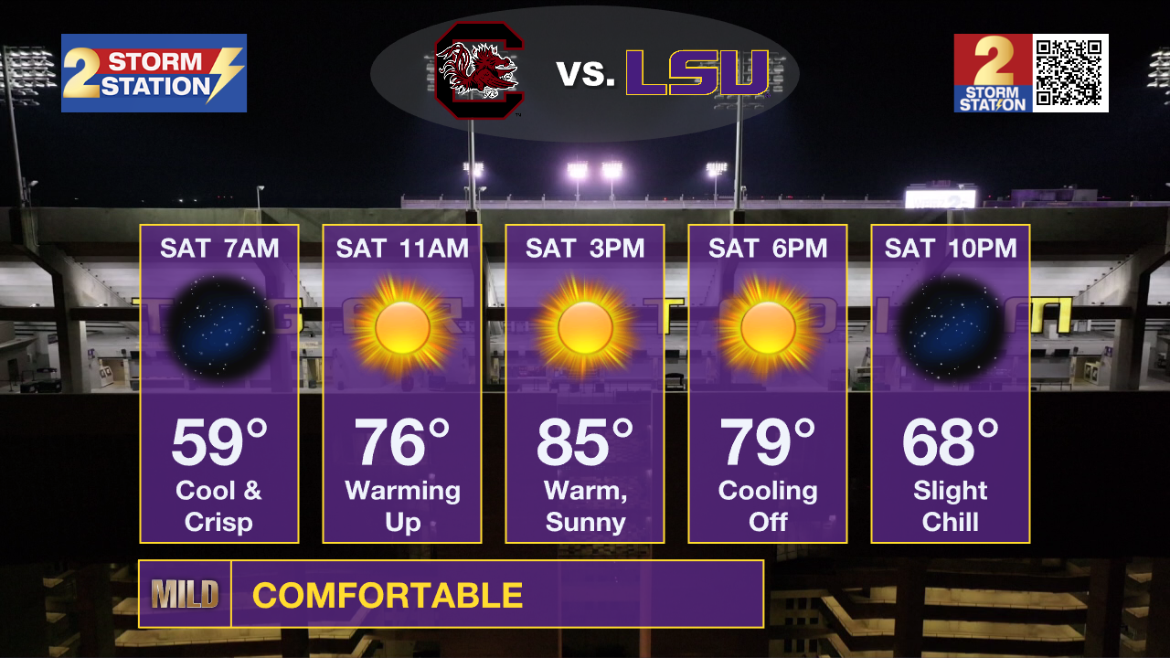
LSU Homecoming: Early morning tailgaters will face crisp and cool conditions with temperatures in the upper 50s to low 60s. Warming through the 70s after mid-morning, temperatures will find the mid-80s by afternoon. Very little humidity will accompany the comfortably warm feel. Kickoff temperatures will be in the upper-70s, and steadily cool into the upper 60s as the game is wrapping up.
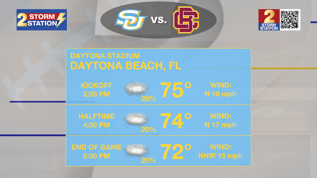
Southern on the Road: The weather will be a bit more “turbulent” as the Jags take on Bethune-Cookman at 2 p.m. Saturday on Daytona Beach, Florida. The main consideration will be winds, which will be sustained at 15-25 mph with gusts in the 30+ mph range. An isolated shower or storm cannot be ruled out either. Cloud cover will keep temperatures in the mid-70s through most of the game.
Up Next: Temperatures start a steady climb next week as a ridge of high pressure builds in. By midweek, highs will reach the upper 80s and possibly flirt with 90°. Morning lows will also warm, returning to the lower and middle-60s. While it won’t feel as cool as the weekend, dry conditions will remain in place, with sunshine dominating through the end of the week. Rain doesn’t appear to return at least until late next week.
Trending News
The Tropics: Tropical Storm Jerry remains somewhat disorganized, with wind shear displacing the majority of its storm activity to the southeast of its center. The disruption to the storm’s structure is preventing it from intensifying. Jerry will likely remain a tropical storm for the next couple of days as it moves north into the open Atlantic. The storm will soon move away from the northern Leeward Islands and is not expected to impact any land areas moving forward.

Meanwhile, Subtropical Storm Karen became post-tropical on Friday afternoon. It was a brief system, but noteworthy as the farthest north a storm has formed in the modern era.
Get the latest 7-day forecast and real-time weather updates HERE.
Watch live news HERE.
— Meteorologist Malcolm Byron
The Storm Station is here for you, on every platform. Your weather updates can be found on News 2, wbrz.com, and the WBRZ WX App on your Apple or Android device. Follow WBRZ Weather on Facebook and X for even more weather updates while you are on the go.
More News
