

Latest Weather Blog
Thursday AM forecast: Flood threat moves east after today.
Tropical moisture associated with the remnants of Arthur will keep the threat of flooding and isolated tornadoes in place today. Once the rain moves out, attention quickly turns to dangerous heat and humidity for the weekend.

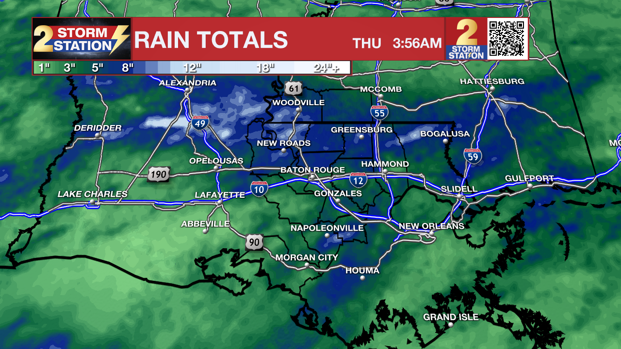
Today and tonight: The remnants of Arthur will continue moving across Louisiana today, bringing multiple rounds of heavy rain, embedded thunderstorms, and the potential for isolated tornadoes. Some locations could see several more inches of rain, leading to flash flooding and dangerous travel conditions. Rain coverage will gradually decrease late this afternoon and tonight, but scattered showers and storms will remain possible. Flooding concerns may linger even after the heaviest rain ends.

Use the slider to advance through the next 24 hours of Futurecast
Rainfall totals over the past 3 days have been extreme over parts of Louisiana, while other areas have only seen a few showers. An additional 3-4 inches of rain is possible over isolated locations, but 1-2 inches looks more reasonable for much of the area before rain tapers off this afternoon.
Trending News
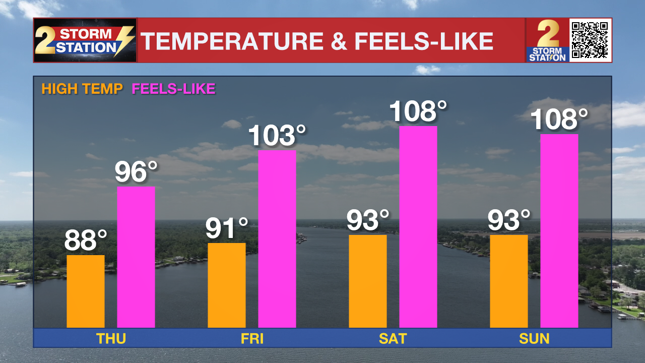
Up Next: The widespread flooding threat diminishes Friday, but scattered storms remain possible through the weekend. Sunshine returning to the region will allow temperatures to climb into the lower and middle 90s. Heat index values could approach 108 to 110 degrees Friday through Sunday, and Heat Advisories may be needed. Early next week looks hotter with lower rain chances, especially Monday.
Tropics: Post-Tropical Cyclone Arthur continues to weaken as it moves inland across Louisiana and toward the Southeast U.S. While Arthur is no longer a tropical cyclone, its tropical moisture remains responsible for the dangerous flooding threat across the Gulf Coast. The National Hurricane Center is not monitoring any areas for tropical development over the next seven days.
Local Rivers: With recent heavy rain and more storms on the way, several local river gauges are forecast to rise. To track conditions, find the latest river levels and forecasts below, updated twice every hour.


Get the latest 7-day forecast and real-time weather updates HERE.
Watch live news HERE.
– Dave
The Storm Station is here for you, on every platform. Your weather updates can be found on News 2, wbrz.com, and the WBRZ WX App on your Apple or Android device. Follow WBRZ Weather on Facebook and X for even more weather updates while you are on the go.
More News
