Rain chances stay low while heat becomes the biggest concern across the Baton Rouge area through the weekend.

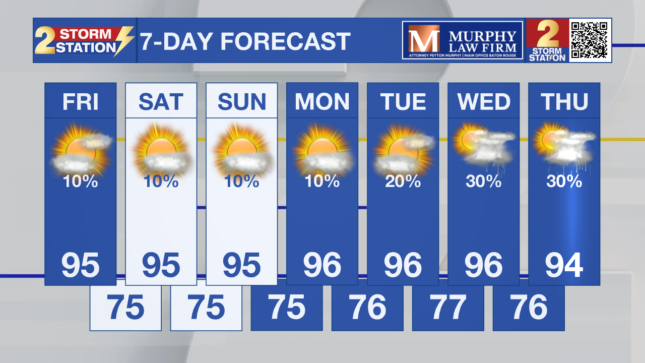
Today and Tonight: A much drier weather pattern has settled across south Louisiana, bringing plenty of sunshine and a noticeable increase in temperatures. Afternoon highs will climb into the middle 90s today, with heat index values approaching Heat Advisory levels in many locations. Only a very isolated afternoon shower or thunderstorm is expected, mainly east of Baton Rouge toward the Mississippi coast. Most communities will stay dry from start to finish.
Up Next: The hot, mostly dry pattern continues through the weekend and into early next week. High temperatures will remain in the middle to upper 90s. Heat index values will routinely reach the upper 100s, making outdoor activities more dangerous during the afternoon hours. Rain chances remain very limited through at least Monday, with only isolated sea breeze thunderstorms possible. Anyone spending time outside should stay hydrated, take frequent breaks, and avoid prolonged activity during the hottest part of the day.
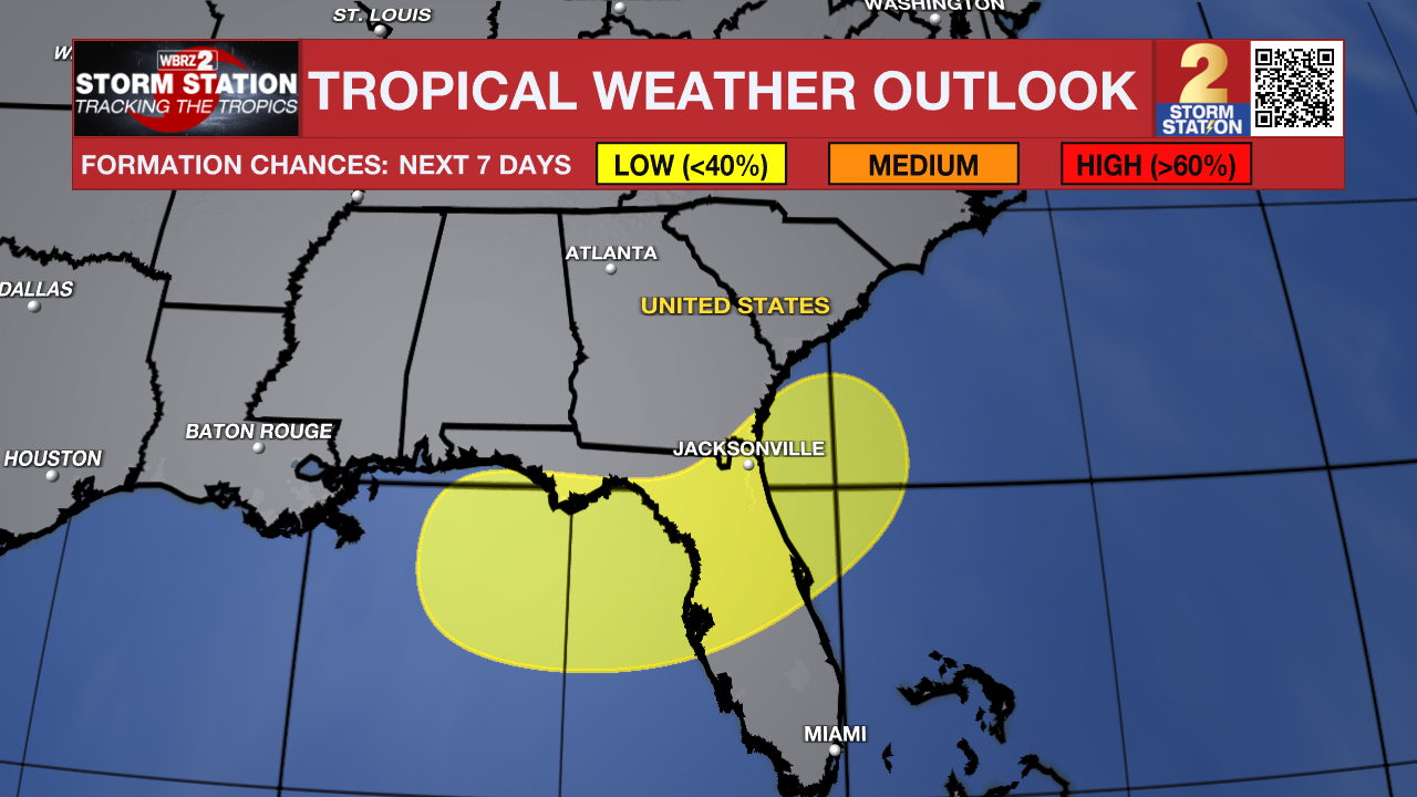
Tropics: The National Hurricane Center continues to monitor two areas for potential tropical development. A tropical wave southeast of the Cabo Verde Islands has only a 10% chance of development before moving into less favorable conditions this weekend. Closer to home, a weak area of low pressure could form over the northeastern Gulf this weekend and has a 20% chance of gradual development early next week as it meanders over the northeastern Gulf or drifts toward the southeastern U.S. coast. No impacts are expected across south Louisiana at this time.
Get the latest 7-day forecast and real-time weather updates HERE.
Watch live news HERE.
– Dave
The Storm Station is here for you, on every platform. Your weather updates can be found on News 2, wbrz.com, and the WBRZ WX App on your Apple or Android device. Follow WBRZ Weather on Facebook and X for even more weather updates while you are on the go.