

Latest Weather Blog
Wednesday Evening Video Forecast
Related Story
Freezing temps are nowhere to be found in the Storm Station 7-Day forecast. The warming trend is set to continue, with highs approaching 80° by the weekend and no weather concerns for outdoor plans.
Tonight & Tomorrow: The temperature rebound will continue through the night. Lows will not be nearly as chilly on Thursday morning, bottoming out in the mid-50s. A subtle increase in moisture could bring some patchy fog to a few spots, especially over traditionally colder inland locations or river basins. Aside from that, it’ll be a calm, mostly clear night. While a light jacket may be necessary at first, it won’t be by afternoon. Mostly sunny skies will give temperatures a gentle boost Thursday, with highs a degree or two warmer into the upper 70s.
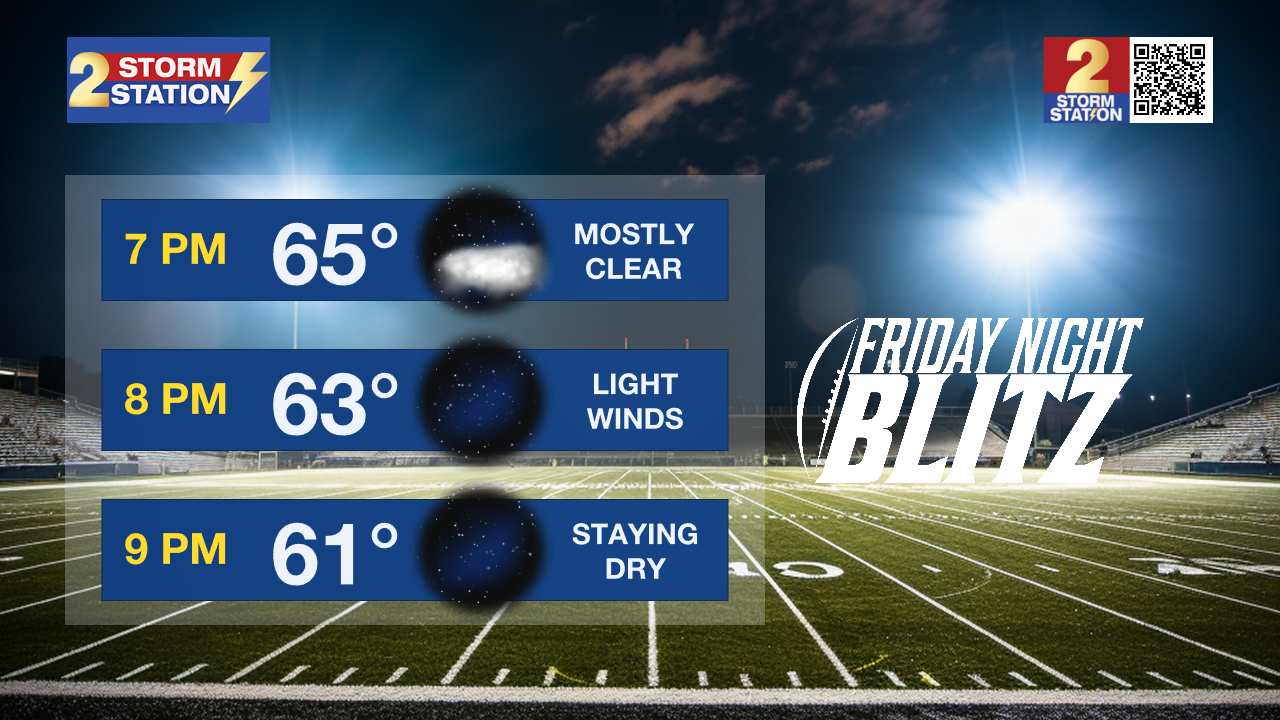
Friday Night Blitz: After peaking in the upper-70s during the day, temperatures will fall into the mid-60s around kickoff and hover near 60° by the fourth quarter. Rain won’t be an issue — just a few passing clouds and pleasant conditions for the game.
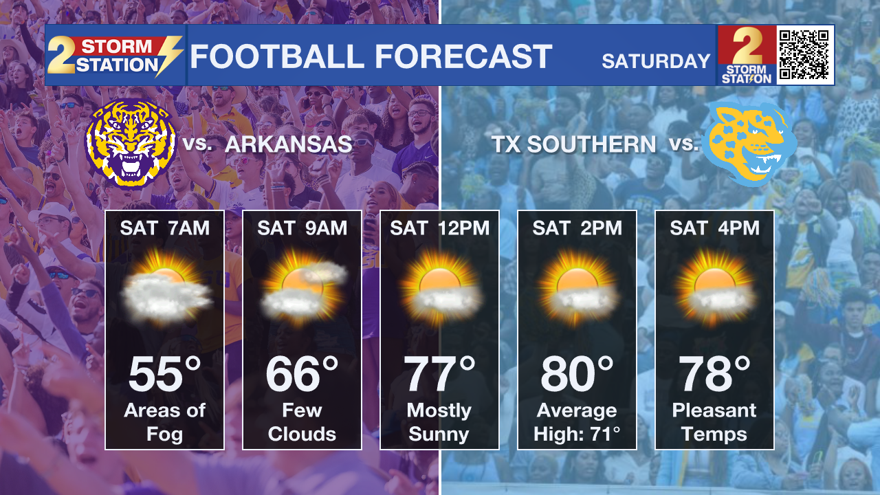
LSU/Southern Game Day: The weather looks ideal for both LSU and Southern’s home games on Saturday. Morning tailgates might have to contend with patchy fog and a slight chill as temperatures start off in the mid to upper 50s. But sunshine will dominate by kickoff — at 11:45 a.m. for LSU and 2 p.m. for Southern. Kickoff temps will be in the mid to upper 70s for LSU and near 80° for Southern.
Up Next: No major changes will take place through the weekend, aside from a steady warming trend. Highs will reach the 80s by the weekend, with lows settling closer to 60°. Each morning will also bring the possibility of low clouds and/or patchy fog development, which would quickly disperse after sunrise. Any hint of a storm signal has all but disappeared, meaning that most, if not all, outdoor plans will stay comfortably dry this weekend. Increasing moisture next week might instigate a few thunderstorms, but even those will be difficult to find. Rain will be spotty to isolated at best without a frontal system to trigger widespread activity. The absence of any major frontal passage will also keep temperatures running well above average.
The Tropics: For the Gulf, Caribbean, and Atlantic, all is quiet. No new tropical development is expected over the next seven days.
Get the latest 7-day forecast and real-time weather updates HERE.
Watch live news HERE.
— Meteorologist Malcolm Byron
The Storm Station is here for you, on every platform. Your weather updates can be found on News 2, wbrz.com, and the WBRZ WX App on your Apple or Android device. Follow WBRZ Weather on Facebook and X for even more weather updates while you are on the go.
News
