

Latest Weather Blog
Tuesday morning video forecast
Related Story
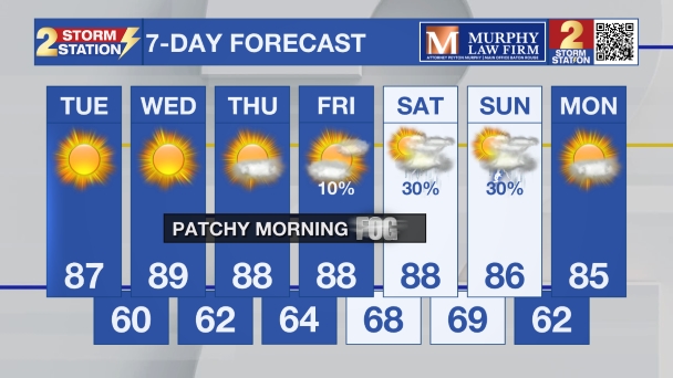
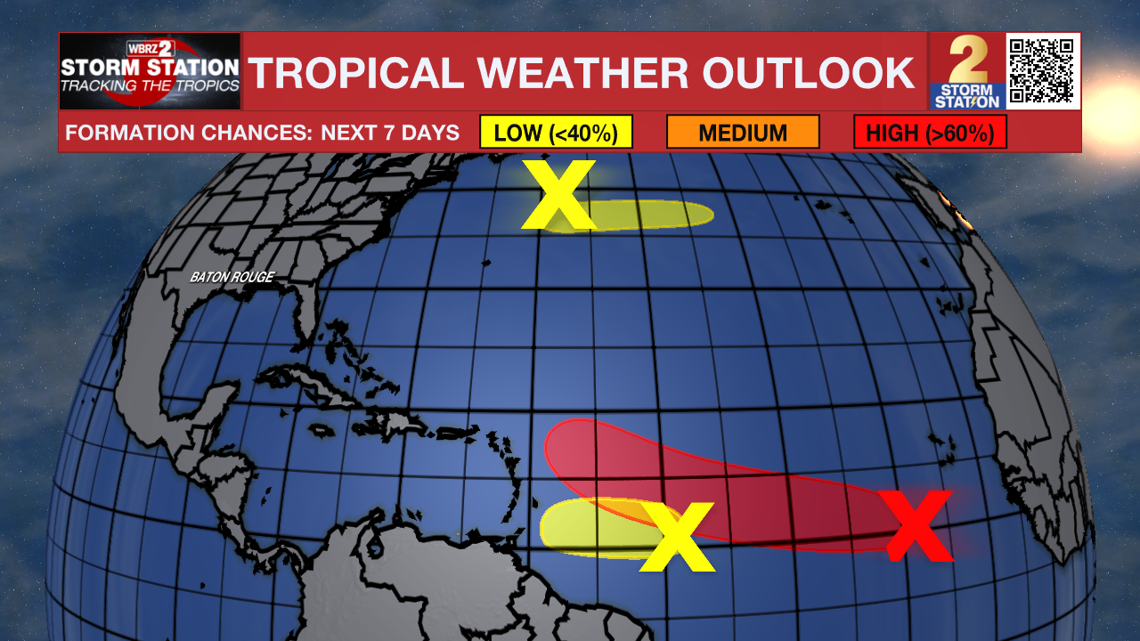
The chances of pop-up storms will steadily decrease in the coming days, eventually leading to some of the hottest conditions of the year over the weekend. In the tropics, there are now three separate areas with chances of development.
Today & Tonight: High temperatures are projected to reach the mid-90s on Tuesday, with high humidity pushing heat index values roughly 10 degrees higher. Isolated afternoon thunderstorms will affect roughly 30% of the area. While the majority of the region remains dry, localized storms may bring brief heavy rainfall, frequent lightning, and gusty conditions. Precipitation will dissipate rapidly after sunset, leading to mainly clear overnight skies and lows settling near 76°.

Up Next: Storm coverage will diminish daily through the remainder of the week as high pressure builds across the region. Sinking air under this high-pressure system will suppress most rain activity. As the pattern strengthens over the weekend, temperatures will rise significantly, with upper 90s becoming likely. The combination of elevated heat and humidity may necessitate heat alerts over the weekend and into early next week.
The Tropics:
Central Tropical Atlantic:
Shower and thunderstorm activity is currently limited in association with an area of low pressure located about 500 miles southwest of the Cabo Verde Islands. Environmental conditions are forecast to gradually become more conducive for development during the next day or two, and a tropical depression will likely form during the latter half of this week while the system moves westward to west-northwestward across the central tropical Atlantic.
East of the Windward Islands:
Disorganized showers and thunderstorms associated with a tropical wave are located about 850 miles east of the Windward Islands. Some gradual development of this system is possible through the next day or two while it moves quickly westward across the central tropical Atlantic. The system is expected to encounter a large area of environmental dry air by the time it reaches the Windward Islands Wednesday night, which should end its chances for development.
Central Subtropical Atlantic:
A trough of low pressure located several hundred miles northeast of Bermuda is producing disorganized showers and thunderstorms. Some development of this system is possible during the next couple of days while it moves eastward at around 20 mph across the central subtropical Atlantic. The system is forecast to reach cooler waters later this week, ending its chances of formation by Thursday.
Get the latest 7-day forecast and real-time weather updates HERE.
Watch live news HERE.
— Balin
The Storm Station is here for you, on every platform. Your weather updates can be found on News 2, wbrz.com, and the WBRZ WX App on your Apple or Android device. Follow WBRZ Weather on Facebook and X for even more weather updates while you are on the go.
News

