

Latest Weather Blog
Thursday morning video forecast
Related Story
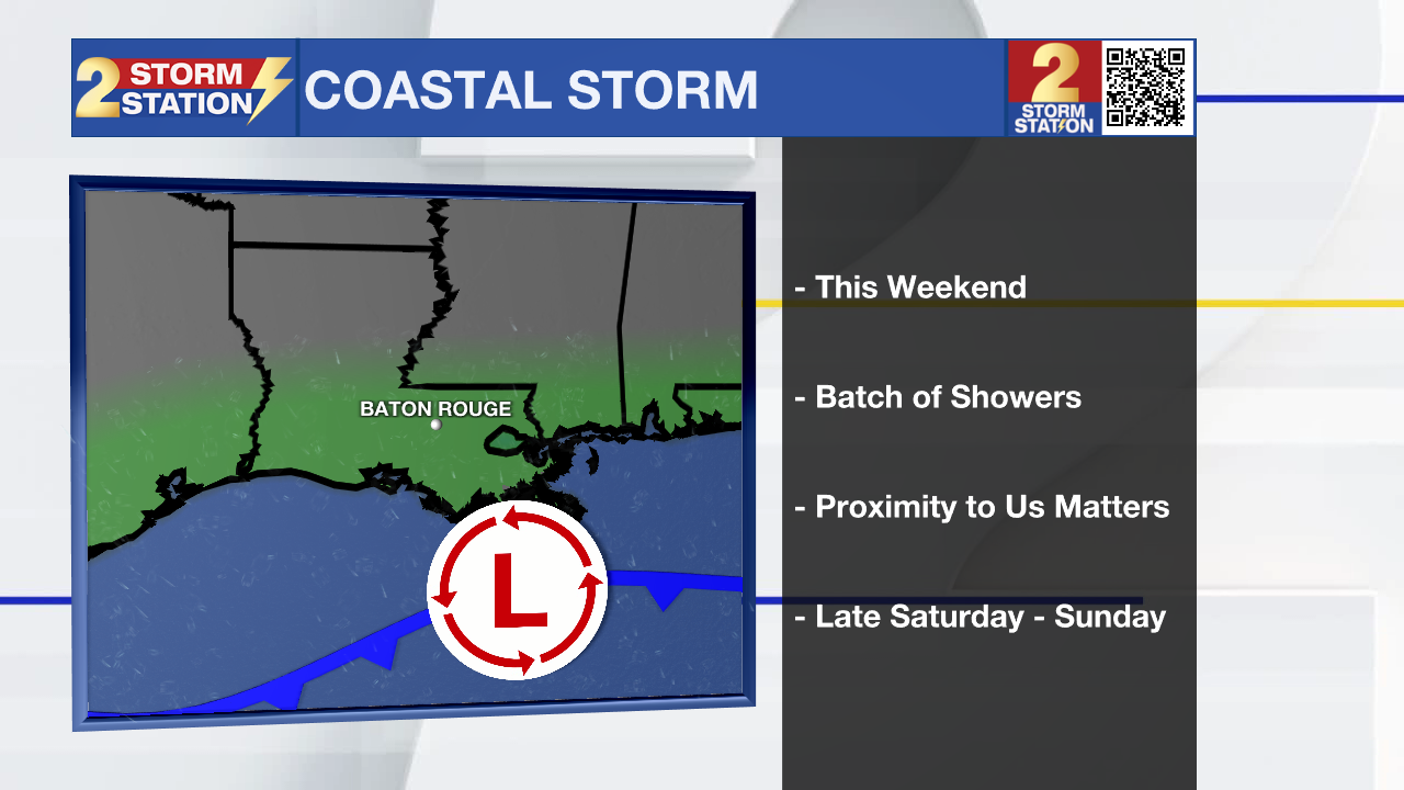
Fall weather lovers will have no complaints about the next several days! Looking ahead to the weekend, a coastal storm system has the potential to produce some showers.
Today & Tonight: After some morning clouds, these will quickly clear out by the mid-morning, leading to a mainly sunny day. Highs will top out near 67 degrees, with a northwest breeze at 10-15 mph. Clear skies and light winds will allow temperatures to rapidly drop overnight. Lows will settle near 43 degrees — the chilliest since early April!
Halloween & Trick-or-Treating: A nice and cool Halloween is in store, with afternoon highs in the upper 60s. Trick-or-treaters won’t be facing any frightening weather, just a spooky chill to set the mood. Temperatures will drop into the lower 60s by nightfall, eventually hitting the upper 50s by 8 p.m.. Consider adding an extra layer beneath costumes.
The Weekend & Beyond: Higher level clouds will move in Saturday and may hang around into Sunday. A coastal storm system is expected to develop, but it’s not tropical in nature. Depending on its exact track, a few showers could sneak in late Saturday into Sunday. For now, the Storm Station forecast keeps most of the weekend dry, with just a small chance of a passing shower—mainly south of I-10 Saturday night. Keep an eye on future forecasts in case things change. Temperatures will hold steady through the weekend before a more noticeable warm-up arrives next week.
And don’t forget—Daylight Saving Time ends early Sunday morning! Set your clocks back one hour before heading to bed Saturday night.
The Tropics: Melissa looks a bit better organized this morning. Satellite data shows a developing eye and strong storms wrapping around the center, so winds have been increased to around 105 mph. The storm is tilted slightly to the northeast because of upper-level winds pushing against it, and a Hurricane Hunter plane will be checking it out later today. Melissa is racing northeast, moving away from the Bahamas and expected to pass northwest of Bermuda tonight, where a Hurricane Warning is still in effect. After that, it should move near southeastern Newfoundland Friday night before heading across the North Atlantic as a strong non-tropical storm this weekend. Melissa could strengthen a little more today while over warm water, but stronger wind shear and cooler ocean temperatures will soon weaken it. By late Friday or early Saturday, Melissa is expected to lose its tropical characteristics and transition into a powerful post-tropical system.

Get the latest 7-day forecast and real-time weather updates HERE.
Watch live news HERE.
— Balin
The Storm Station is here for you, on every platform. Your weather updates can be found on News 2, wbrz.com, and the WBRZ WX App on your Apple or Android device. Follow WBRZ Weather on Facebook and X for even more weather updates while you are on the go.
News
