

Latest Weather Blog
Thursday Evening Video Forecast
Related Story
The return of storms to the forecast will coincide with a busy slate of outdoor events as a cold front nears the region. But as rain exits, cooler weather may follow close behind.
Tonight & Tomorrow: Skies will quickly clear out with the loss of daytime warming. Morning lows will trend upward, bottoming out in the low to mid-70s early Friday. Friday will be on the stickier side in terms of humidity. With highs warming into the mid-90s, peak heat index readings could flirt with 100°. The vast majority will stay rain-free, with only a slim chance of a shower passing late. The weather will generally cooperate during high school football. Although clouds will be on the increase, rain won't be too widespread. Temperatures will fall through the 80s during the evening. Overnight clouds will keep lows in the mid-70s.
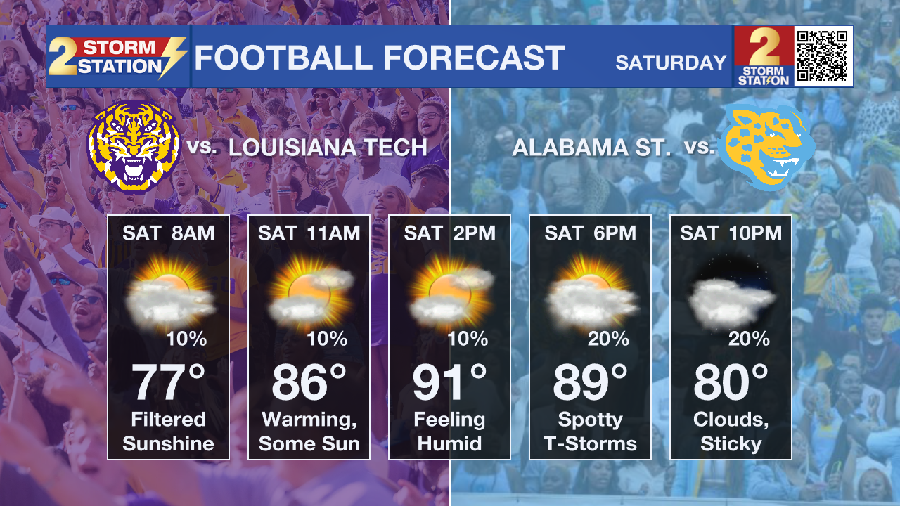
The Weekend: Saturday will start with some cloud cover, but pockets of sun will push temperatures into the low 90s by afternoon. An onshore breeze will pump additional humidity into the area. That, coupled with an upper-level disturbance and approaching cold front from the north, will work to squeeze out isolated showers and thunderstorms. Overall odds of a pop-up storm are low, but not impossible, so have a lightning-safe spot in the back of your mind. Especially with LSU and Southern playing at home this weekend, that will be an important consideration. Temperatures will slip back into the 80s during the evening, offering a bit of relief by kickoff.
The cold front will continue pressing south on Sunday, possibly ringing out another round of isolated storms. A washout is not the expectation, but keep an eye on the sky.
Dry Air Intrusion: For a few days now, forecast guidance has teeter-tottered with the idea of another push of dry air early next week. The latest round of data more aggressively latches onto this scenario, and the Storm Station forecast has started reflecting that. Highs may not even reach 90° on Monday — and that's with sunshine. Low humidity would make for a very comfortable afternoon also. And by Tuesday morning, the drop in humidity could nudge temperatures into the mid-60s. Some degree of mugginess appears to return by late next week.
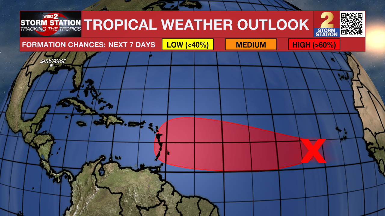
The Tropics: An elongated area of low pressure has formed in association with a tropical wave over the eastern tropical Atlantic. Recent satellite imagery suggests the system continues to become better organized with shower and storm activity emerging on its eastern edge. Conditions are favorable for additional development, and a tropical depression is likely to form by this weekend. Those in the Lesser Antilles and Leeward Islands should monitor the progress of this system.
Get the latest 7-day forecast and real-time weather updates HERE.
Watch live news HERE.
— Meteorologist Malcolm Byron
The Storm Station is here for you, on every platform. Your weather updates can be found on News 2, wbrz.com, and the WBRZ WX App on your Apple or Android device. Follow WBRZ Weather on Facebook and X for even more weather updates while you are on the go.
News
