Saturday morning video forecast
Related Story
After the much needed rainfall, showers will be extremely hard to come by this weekend. Along with the drier conditions, will be very warm temperatures.
Today & Tonight: After some locations picking up over six inches of rain over the last couple of days, conditions will be much drier for your Saturday. A stray afternoon shower is possible, but the vast majority will remain dry. Temperatures will be well above average for this time of year. A normal high in early November is in the mid 70's. We will instead be the mid 80's. Tack on a bit of humidity and you have the recipe for an unpleasant feeling early November day. Skies will be partly sunny during the daytime hours, with some clouds hanging around tonight as well. Lows will be near 68 degrees, with patchy fog a possibility.
Up Next: Sunday will continue the drier and unseasonably warm conditions. Not much change is expected for the new workweek and first full week of November. A number of record highs, and especially record warm lows will be in danger with highs near 90 and lows near 70. On Tuesday, a weakening front over Texas could help to generate another round of showers and thunderstorms across the central Gulf Coast. Unfortunately, this front will not make it through the Capital Area and temperatures will remain above average all week long.
Get the latest 7-day forecast and real time weather updates HERE.
Watch live news HERE.
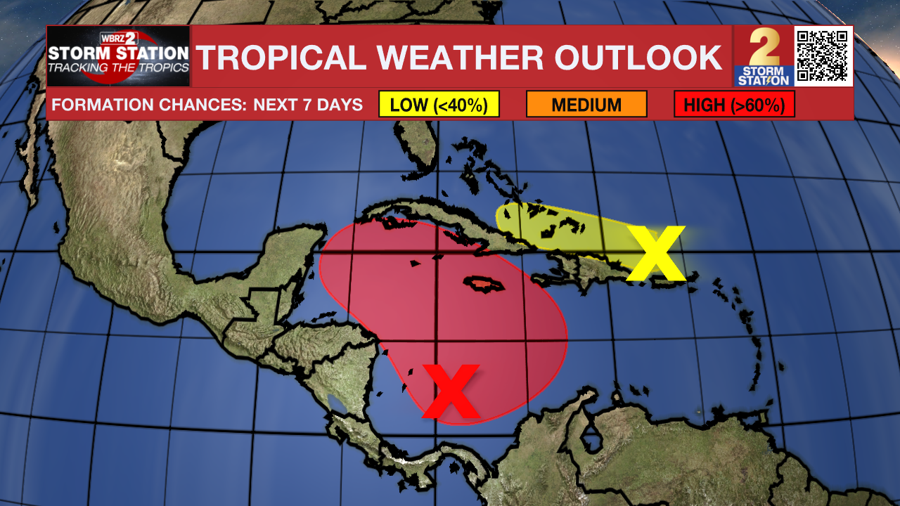
The Tropics: Disorganized showers and thunderstorms over the southwestern Caribbean Sea are associated with a broad area of low pressure. Gradual development of this system is expected, and a tropical depression is likely to form within the next few days while the system moves generally northward to northwestward over the central and western Caribbean Sea. Regardless of development, locally heavy rains are possible over portions of the adjacent land areas of the western Caribbean, including Jamaica, Hispaniola, and Cuba. Interests in the western Caribbean Sea should monitor the progress of this system.

A large area of disorganized showers and thunderstorms, and gusty winds extending from near Puerto Rico and Hispaniola northeastward for a few hundred miles are associated with a trough of low pressure. Slow development of this system is possible during the next couple of days while it moves west-northwestward near the Greater Antilles. By early next week, this system is expected to be absorbed into the low pressure area over the Caribbean Sea. Regardless of development, locally heavy rains are possible during the next few days across the northern Leeward Islands, Puerto Rico, Hispaniola, eastern Cuba and the southeastern Bahamas.

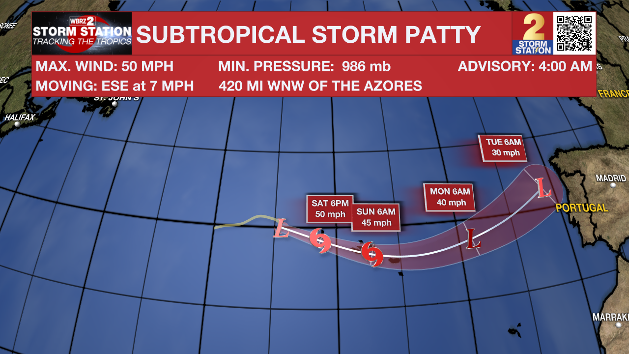
Subtropical Storm Patty has formed over the northern Atlantic. It has max sustained winds of 50 mph, and is moving ESE at 7 mph. This system is expected to pass near or over the Azores this weekend. Patty is no threat to the United States.
– Balin
The Storm Station is here for you, on every platform. Your weather updates can be found on News 2, wbrz.com, and the WBRZ WX App on your Apple or Android device. Follow WBRZ Weather on Facebook and Twitter for even more weather updates while you are on the go.


