

Latest Weather Blog
Saturday evening video forecast
Related Story
An area of low pressure in the northern Gulf will slowly mover closer over the next 24 hours. This system will bring high atmospheric moisture, creating scattered showers and some thunderstorms Sunday.
Tonight & Tomorrow: Moisture values will slowly work up overnight as an area of low pressure creeps closer. Lows will bottom out near 70 degrees under increasing clouds. Rain chances will be on the rise as we approach daybreak, with the best shot south of the 10/12 corridor. These showers, and even a few thunderstorms will spread further inland as the day progresses. Expect hit-and-miss action, with a decent chunk of the area receiving measurable rainfall. One benefit of the added clouds and rain will be highs in the low to mid-80s. Rain totals for the most part will remain below an inch, with the highest totals near the coast.
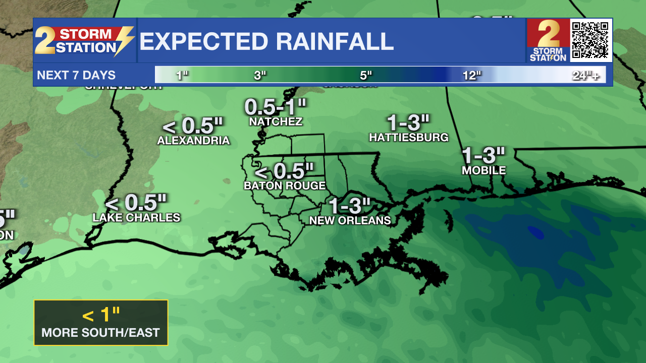
Up Next: Leftover moisture will lead to isolated showers and storms Monday, with most action in the PM hours. Rain coverage will slowly tick down as the week progresses, until we are mainly dry by Thursday. Temperatures will stay above average all week long with highs near 90 degrees, and lows near 70 degrees.
The Tropics: Recent satellite-derived wind data indicate that a broad area of low pressure, associated with a tropical wave, has formed several hundred miles south of the Cabo Verde Islands. Environmental conditions appear conducive for gradual development of this system, and it could become a tropical depression by the middle to latter part of next week while moving across the central tropical Atlantic and approaching portions of the Leeward Islands.
Get the latest 7-day forecast and real-time weather updates HERE.
Watch live news HERE.
– Balin
The Storm Station is here for you, on every platform. Your weather updates can be found on News 2, wbrz.com, and the WBRZ WX App on your Apple or Android device. Follow WBRZ Weather on Facebook and X for even more weather updates while you are on the go.
News
