

Latest Weather Blog
Friday morning video forecast
Related Story
A mostly dry Friday kicks off a quiet weekend across the Capital Region, with only a stray coastal shower possible today. Lower humidity will make the next couple of days feel more comfortable, although temperatures will climb back into the lower 90s this weekend.

Today and Tonight: Most of South Louisiana stays dry Friday, with plenty of sunshine. Highs will reach the lower 90s, with lower humidity making a noticeable difference compared with earlier this week.

Use the slider to advance through the next 24 hours of Futurecast
Friday night will be quiet and mostly clear, with temperatures falling into the upper 60s and lower 70s. That sets up a comfortable evening for anyone heading out to a high school football game.
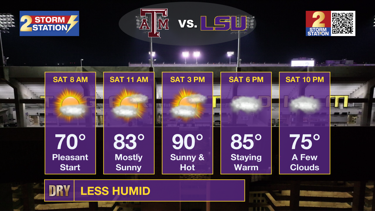
College Football: LSU hosts its game at Tiger Stadium on Saturday at 6:30 p.m. Tailgating will be hot, with temperatures climbing through the upper 80s and into the lower 90s during the afternoon. Conditions should become more comfortable by kickoff as temperatures begin to ease back through the 80s.
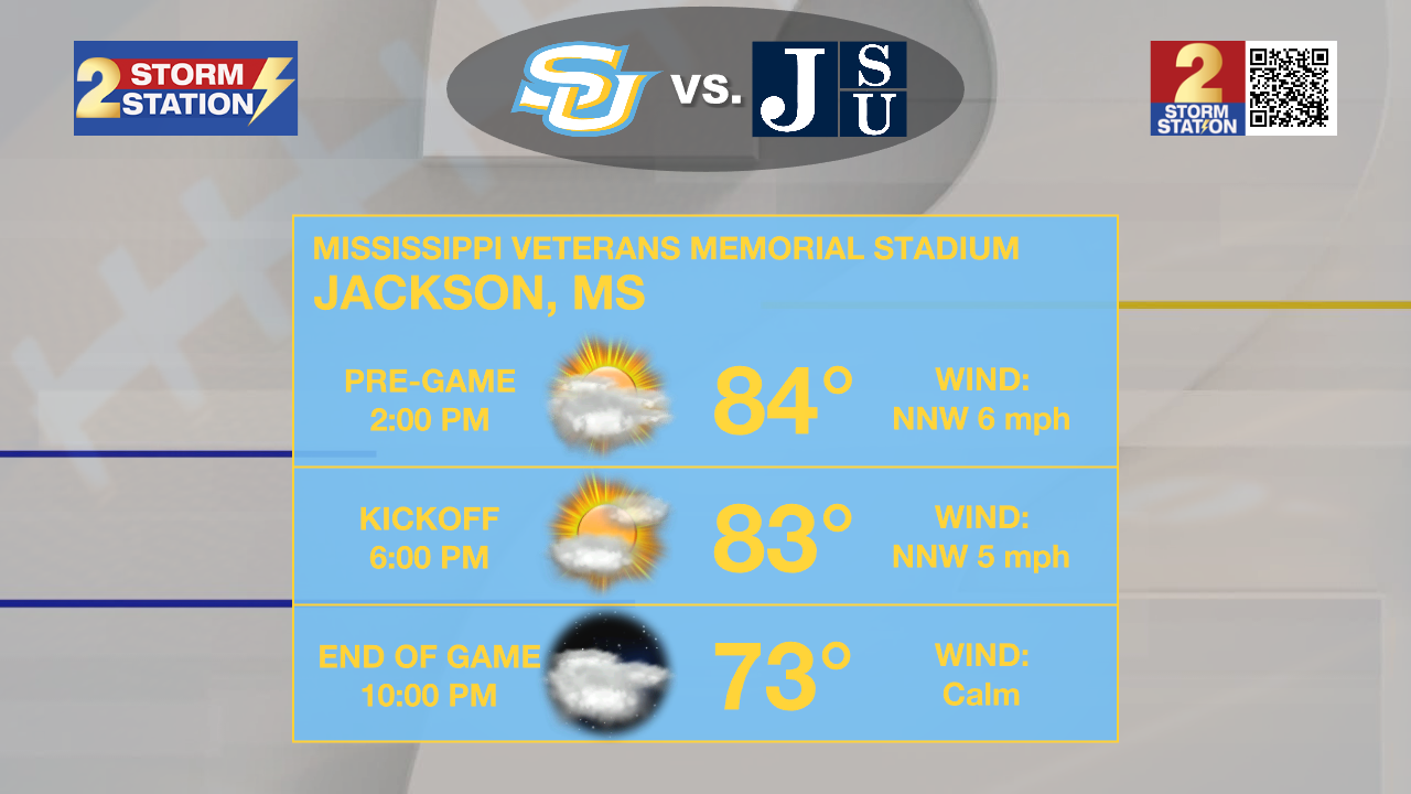
Southern is on the road in Jackson, Mississippi, with a 6 p.m. kickoff. The weather there will be similar to Baton Rouge, with a hot afternoon followed by temperatures settling into the 80s during the game.
Up Next: The dry pattern sticks around through the weekend, although temperatures will continue to warm. Highs will be in the lower 90s Saturday and Sunday, with plenty of sunshine and very little rain around the Capital Region.
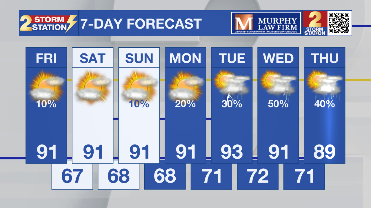
A few showers could develop Monday and Tuesday as moisture begins to pool along a stalled boundary, but rain chances will remain low. The dry air also keeps overnight temperatures relatively comfortable, with lows generally in the upper 60s inland and lower 70s near the coast. By mid-week, moisture increases ahead of a stronger disturbance moving into the southern Plains. That should bring scattered afternoon showers and thunderstorms back to the region, with temperatures easing into the upper 80s.
Tropics: The National Hurricane Center is tracking Tropical Storm Gonzalo near the southernmost Cabo Verde Islands and Tropical Storm Fay well west-southwest of the Azores. No additional tropical development is expected during the next seven days, and neither system poses a threat to the Gulf of Mexico.
– Dave
Get the latest 7-day forecast and real-time weather updates HERE.
Watch live news HERE.
The Storm Station is here for you, on every platform. Your weather updates can be found on News 2, wbrz.com, and the WBRZ WX App on your Apple or Android device. Follow WBRZ Weather on Facebook and X for even more weather updates while you are on the go.
News

