

Latest Weather Blog
Friday morning video forecast
Related Story
Heat and humidity are about to take center stage as the first heat advisory of the year has been issued. Storms will still be possible, but should stay scattered in nature.
Today & Tonight: Friday will bring a mix of sun and clouds, with highs climbing into the lower 90s. High tropical moisture will make conditions feel very oppressive. As a result, the National Weather Service has issued a Heat Advisory, as peak heat index values—the apparent temperature on the human body—are projected to reach 108°F to 110°F. If you are participating in outdoor activities, please mitigate the risk of heat-related illness by maintaining proper hydration and scheduling frequent rest periods in shaded or air-conditioned environments.
Late in the afternoon and into the evening, expect scattered showers and thunderstorms to develop, with the highest probability of activity concentrated north of the interstate corridors. While widespread flooding is not anticipated, these summer storms are capable of producing localized downpours of 1 to 2 inches, which could cause minor drainage issues given the already saturated soil conditions.

Use the slider to advance through the next 24 hours of Futurecast
Up Next: Saturday will retain sufficient atmospheric moisture to trigger another round of scattered showers and thunderstorms. However, the first half of the weekend will still offer ample dry intervals for outdoor activities. Given these storms will be capable of lighting, ensure you have immediate access to a shelter should a storm develop nearby. By Sunday, a ridge of high pressure is projected to expand across the Gulf South, dominating our weather patterns for Father's Day and into early next week. This dome of warm air will suppress storm development and trap heat across the region. Daily storm coverage will drop to just 10% to 20% from Sunday through Tuesday. Consequently, ambient high temperatures will respond by climbing into the mid-90s, and with humidity levels remaining exceptionally high, additional heat alerts will likely be required.
.png)
Get the latest 7-day forecast and real-time weather updates HERE.
Watch live news HERE.
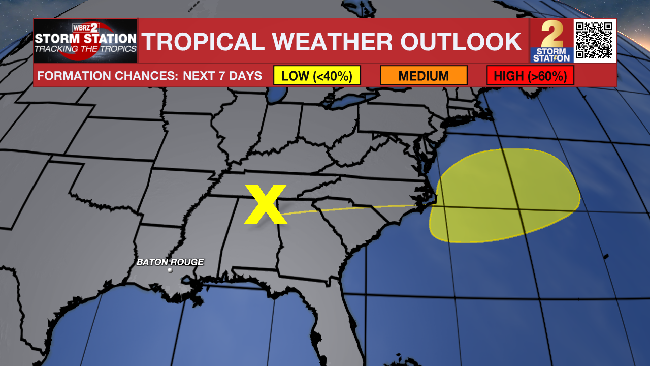
The Tropics: The remnants of Arthur will move across the Eastern United States and offshore Friday or Saturday. This system will move northeastward across the Western Atlantic Ocean at 15 to 20 mph where conditions may be supportive of some reorganization. There is a low chance of development into early next week as the system moves away from the country. The rest of the Gulf and Caribbean are quiet.
– Balin
The Storm Station is here for you, on every platform. Your weather updates can be found on News 2, wbrz.com, and the WBRZ WX App on your Apple or Android device. Follow WBRZ Weather on Facebook and X for even more weather updates while you are on the go.
News
