

Latest Weather Blog
Wednesday AM Forecast: Increasing severe weather threat for Saturday, Warm ahead of storm system
The warm and dry weather continues ahead of a storm system that will move across the country this weekend. Rain, as well as the risk for severe weather, return on Saturday with that system. No major cooldown will follow.
Today & Tonight: More sunshine is on the way today. After a cool morning in the 50s temperatures will warm well into the 70s this afternoon, some may even hit the 80-degree mark. Clouds will increase overnight as a weak shortwave passes in the atmosphere, this could result in a few spotty showers developing early Thursday, especially near the LA/MS state line. Temperatures will be held to the low-60s overnight in response to more cloud cover.
Up Next: Thursday and Friday will see highs in the mid-80s, around 10 degrees above average for the middle of March. Clouds will clear Thursday afternoon before they build back in overnight and stick around on Friday. A few spotty showers and thunderstorms may develop on Friday ahead of a much stronger storm system that will approach the region to start the weekend.
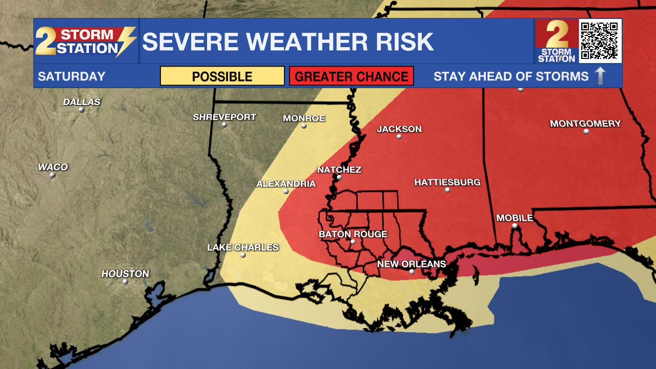
Saturday: A strong storm system will move in, bringing in more widespread rain and thunderstorms and, perhaps more notably, the possibility of severe weather. Both energy and winds in the atmosphere will increase, meaning we could see strong thunderstorms with all hazards such as wind, hail, and tornadoes possible. As of Wednesday morning, much of the WBRZ coverage area, including Baton Rouge, is now included in a greater chance for severe weather. The timing will be important to outdoor events such as the Wearin’ of the Green Parade, however, those details will not become clear until around Thursday.
Trending News
Beyond: By Sunday morning, skies will clear and give way to plenty of sunshine for the second half of the weekend. Despite a cold front passage with the storms on Saturday, temperatures will hold in the 70s each afternoon through at least the first part of next week. Mornings will dip into the 40s and low 50s.
Get the latest 7-day forecast and real-time weather updates HERE.
Watch live news HERE.
– Emma Kate C.
The Storm Station is here for you, on every platform. Your weather updates can be found on News 2, wbrz.com, and the WBRZ WX App on your Apple or Android device. Follow WBRZ Weather on Facebook and X for even more weather updates while you are on the go.
More News
