

Latest Weather Blog
Wednesday AM Forecast: Front drives multiple rounds of rain through Saturday
A cold front entering later on Wednesday will bring big changes to the weather pattern. Multiple rounds of showers and thunderstorms and much cooler temperatures can be expected into the weekend.
Today & Tonight: A transition day is on tap for Wednesday. We'll begin with very warm conditions as ambient temperatures approach 88°, yielding heat indices in the mid-90s. Hydration is strongly encouraged.
By the afternoon, atmospheric instability increases ahead of an approaching cold front. The Storm Prediction Center has placed the region under a Level 1 Marginal Risk, meaning while severe coverage will be spotty, any organized cells could produce damaging winds or hail. Expect initial activity during the evening hours, becoming more scattered overnight. Precipitation will be most concentrated along and north of the I-10/I-12 corridor.
.png)
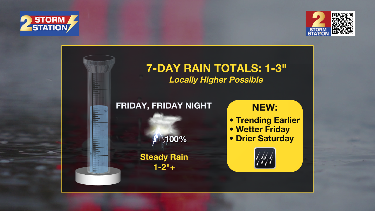
Up Next: The previously mentioned front will stall, and remain draped across the region through Friday, establishing a sharp thermal gradient characterized by cooler conditions in southwest Mississippi and persistent warmth along the Louisiana coast. This boundary will maintain predominantly overcast skies and intermittent shower and storm activity until Friday. A more widespread round of rain will arrive Friday and Friday night as an upper-level disturbance interacts with the front. Rainfall is expected to be steady and heavy at times, with localized accumulations of 1–2 inches possible, bringing projected rainfall totals from Wednesday through Saturday morning into the 1–3+ inch range.
Trending News
Once this system clears early Saturday, the front will propagate well offshore, ushering in a much cooler and drier air mass. Consequently, Saturday will see highs retreat into the low 70s, followed by a chilly Sunday morning in the upper 40s and a sunny afternoon in the mid 70s. This pattern of below-average temperatures and tranquil conditions is forecast to persist into the early part of next week.
Get the latest 7-day forecast and real-time weather updates HERE.
Watch live news HERE.
– Balin
The Storm Station is here for you, on every platform. Your weather updates can be found on News 2, wbrz.com, and the WBRZ WX App on your Apple or Android device. Follow WBRZ Weather on Facebook and X for even more weather updates while you are on the go.
More News
