

Latest Weather Blog
Tuesday PM Forecast: weak front brings overnight showers, cooler air comes by the weekend
A weak cold front will bring a quick round of passing showers and thunderstorms tonight, followed by drier autumn air for Wednesday and Thursday. A couple of reinforcing shots of cool air are expected late this week into the weekend.
Cold Front: showers and a few thunderstorms overnight
Drier Air: big drop in humidity
Cooler Air: expected behind a reinforcing front around Friday

Trending News
Tonight and Tomorrow: A decaying front will slide across the Capital Area tonight. The weakening showers and thunderstorms should not pose a big threat for severe weather or heavy rain, though briefly gusty wind and a quick downpour will be possible, especially north and west of Baton Rouge. Low temperatures will be stubborn in the mid-60s. Winds will calm near the front and, thanks to lingering moisture trapped near the surface, areas of patchy fog will form. Additionally, after a long dry spell, accumulated oils and dirt on the roads could make conditions extra slick where it rained. Given the possibility of reduced visibility and slippery spots, use some extra caution on the morning drive. Clouds will clear from west to east by Wednesday afternoon. High temperatures will top out in the upper 70s.
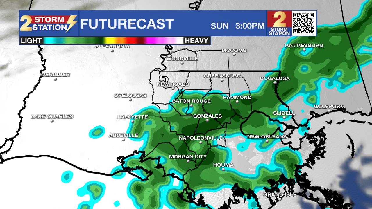
Use the slider to advance through the next 24 hours of Futurecast
Up Next: Much drier, less humid air will take hold Thursday, and morning lows in the 50s will respond to sunshine and turn into afternoon highs in the low 80s. High clouds will increase late ahead of another fast-moving weather disturbance.
A weak front will pass through on Friday, triggering isolated showers (a 30% rain coverage). Skies will be mostly cloudy otherwise. Slightly cooler air will follow behind for the weekend.
Expect high temperatures in the lower to mid-70s for Saturday and Sunday. Meanwhile, nighttime temperatures will feel cool, tumbling into the lower 50s and upper 40s. By this time, there won’t be much moisture left in the atmosphere to support rain, but token 10% rain coverages are carried both days, as yet another fast-moving, weak disturbance could realistically stir up a passing shower.
A lull in the parade of weather systems is expected early next week. Look for seasonable temperatures with highs in the mid-70s and lows in the mid-40s.
Get the latest 7-day forecast and real-time weather updates HERE.
Watch live news HERE.
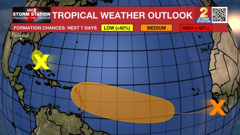
The Tropics: An area of low pressure is likely to form along a weakening front a few hundred miles northeast of the Bahamas in a couple of days. There is a medium chance this system could acquire some subtropical characteristics late this week while it drifts over the western Atlantic. The chances of subtropical development should end by the weekend when the system is expected to move eastward or northeastward into unfavorable environmental conditions.
– Josh
The Storm Station is here for you, on every platform. Your weather updates can be found on News 2, wbrz.com, and the WBRZ WX App on your Apple or Android device. Follow WBRZ Weather on Facebook and X for even more weather updates while you are on the go.
More News

