

Latest Weather Blog
Tuesday AM forecast: Sticky Today, Drier Air Late This Week
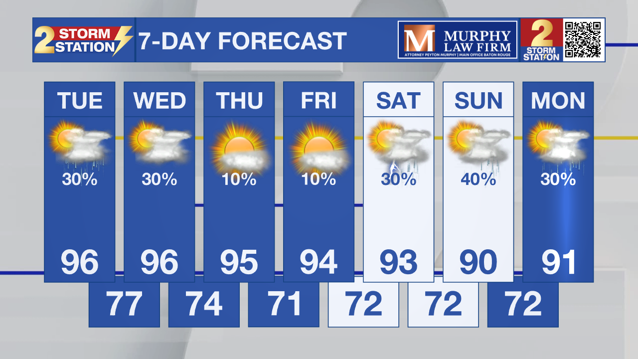
Tuesday will be another hot and humid day across the Capital Region, but a backdoor front arrives Wednesday, lowering humidity for the rest of the week. Another round of storms is possible this weekend.

Today and Tonight: Tuesday will be hot and mostly dry, with only a few isolated showers or thunderstorms developing during the afternoon. Highs will reach the mid-90s, with heat index values around 103° to 108°. Storm coverage will be very sparse, so most of the Capital Region will stay dry.

Use the slider to advance through the next 24 hours of Futurecast
Up Next: A backdoor cool front moves through Wednesday, bringing a slight chance for scattered showers and thunderstorms, especially near the coast. A bigger change arrives Thursday and Friday as much drier air moves in behind the front. Highs will hold in the low 90s, with much lower humidity making it feel noticeably more comfortable.
Trending News
Tropics: The National Hurricane Center is watching a disturbance in the central subtropical Atlantic east-southeast of Bermuda. Development is unlikely through today, but conditions could become more favorable later this week, with a medium chance of formation over the next seven days.

– Dave
Get the latest 7-day forecast and real-time weather updates HERE.
Watch live news HERE.
The Storm Station is here for you, on every platform. Your weather updates can be found on News 2, wbrz.com, and the WBRZ WX App on your Apple or Android device. Follow WBRZ Weather on Facebook and X for even more weather updates while you are on the go.
More News

