

Latest Weather Blog
Tuesday AM forecast: Gradual warmup into midweek
A chilly start across the Baton Rouge area this morning, but lingering clouds kept things warmer than forecast. Gradual warming begins today and continues through midweek as an onshore flow returns. A weak, dry front arrives Wednesday night with only a slight dip in temperatures before attention turns to another pattern shift late week.
.png)
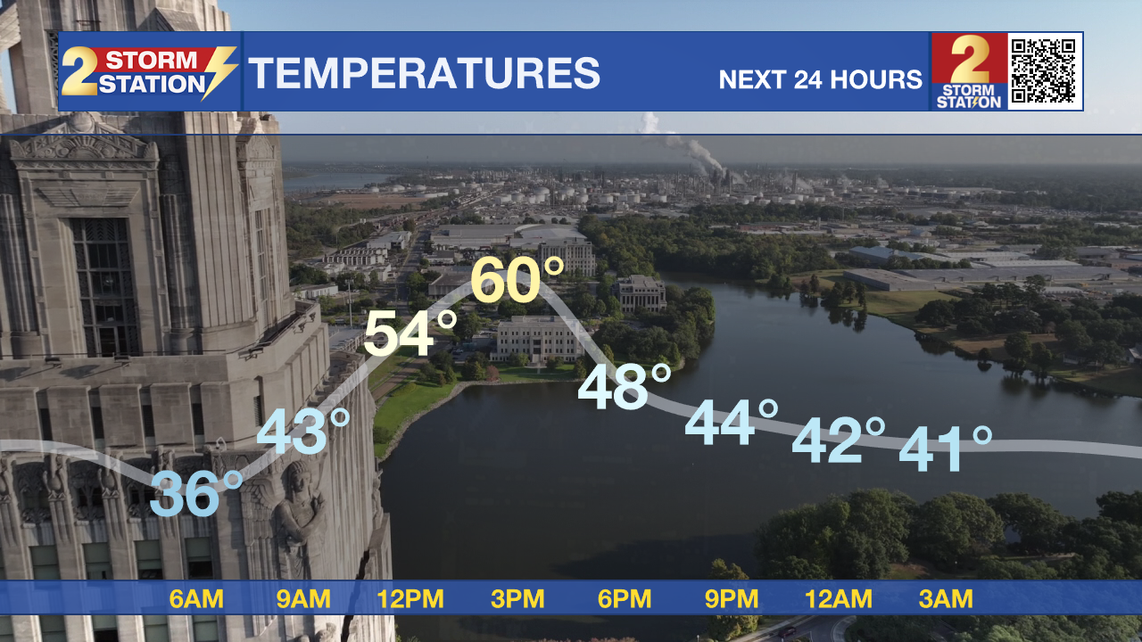
Today and tonight: Cold air has fully filtered into the region behind Monday’s front, but low-level clouds lingering overnight kept most areas above freezing. This morning starts in the 30s to near 40, with isolated colder pockets just north of the metro. Sunshine returns, helping temperatures climb to near 60, just a few degrees warmer than Monday.
Trending News
Tonight, the surface high continues sliding east, bringing a developing onshore flow that keeps temperatures milder than the past few nights. Lows tonight fall into the low to mid-40s, with dry air ensuring quiet and clear conditions.
Up Next: A steady warming trend sets in on Wednesday as the southerly flow strengthens. Highs will rebound into the mid to upper 60s, marking a noticeable turnaround from the early-week chill. By Wednesday evening, a weak front slips through the region, but with very dry air in place, no rain is expected—just a small dip in temperatures and dewpoints.
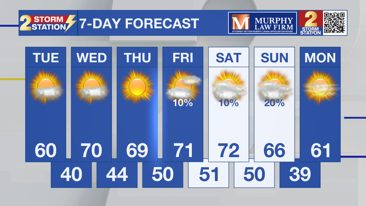
Thursday brings slightly cooler air behind the weak front, with highs slipping back into the 60s. Beyond that, model differences grow heading into Friday and the weekend. For now, near-normal temperatures and continued dry weather look most likely, but another pattern shift is possible depending on how the next large-scale trough evolves.
What to look out for:
Today was still the coldest start of the week for many. A warming trend continues through Wednesday, with highs approaching 70 before a weak, dry front brings slightly cooler air into Thursday. The bigger questions come late week as models diverge on how the next upper-level system evolves.
Get the latest 7-day forecast and real-time weather updates HERE.
Watch live news HERE.
– Dave
The Storm Station is here for you, on every platform. Your weather updates can be found on News 2, wbrz.com, and the WBRZ WX App on your Apple or Android device. Follow WBRZ Weather on Facebook and X for even more weather updates while you are on the go.
More News
