

Latest Weather Blog
Tuesday AM Forecast: Cold front moves through overnight, brings midweek changes
A cold front moving through overnight will first bring passing showers and a few thunderstorms. After it passes, expect lower humidity and more seasonal temperatures.

Today & Tonight: Mostly cloudy conditions are expected to stick around overnight and throughout Election Day Tuesday. Temperatures will remain well above average, with highs climbing into the mid-80s, especially where a few breaks in the clouds allow for some sunshine. It wouldn't hurt to keep an umbrella or rain jacket handy, but most areas should stay dry through the daylight hours. Rain chances increase after sunset as a cold front moves toward the Capital Area from the west. Scattered showers and a few thunderstorms will develop late Tuesday evening and continue into the overnight hours. Those heading to the polls closer to closing time could encounter a passing shower, although the heaviest concentration of rain is expected during the overnight period. A few storms may produce brief gusty winds, but the threat for significant severe weather remains low. Rainfall totals should generally be light, with most locations picking up less than half an inch. Some communities may not see any rain at all, similar to what we experienced over the weekend. Overnight temperatures will settle into the mid-60s.
Trending News
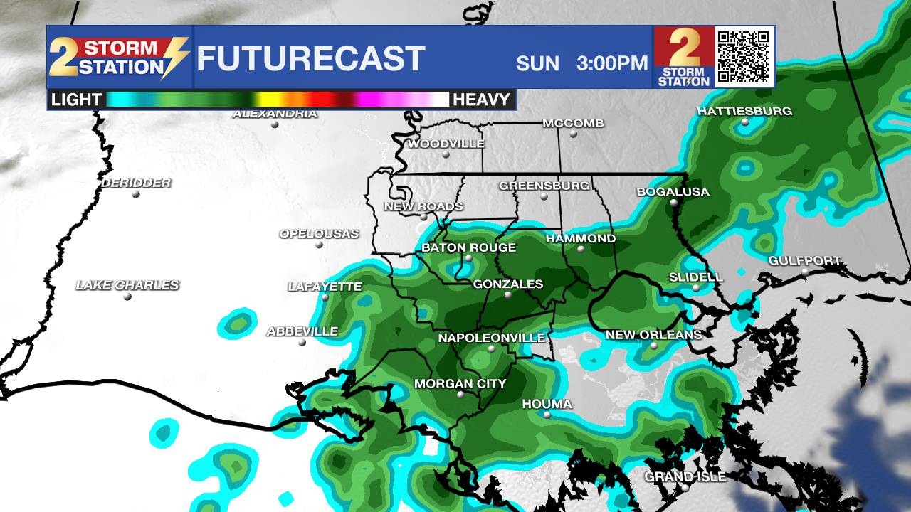
Use the slider to advance through the next 24 hours of Futurecast
Up Next: A few leftover showers and wet roads could make for a damp start to Wednesday morning, but conditions will gradually improve as clouds begin to break apart during the afternoon. High temperatures will reach around 79 degrees before lows overnight reach into the mid-50s.
Temperatures will rebound into the upper 70s Thursday under plenty of sunshine. Clouds will begin building later in the day as another quick-moving disturbance approaches the region.
That disturbance will bring a weak cold front through on Friday, with a few isolated showers possible. Rain coverage will be around 30%, meaning most areas should remain dry despite mostly cloudy skies.
A more noticeable surge of cooler, drier air arrives just in time for the weekend. Afternoon highs will settle into the lower to middle 70s Saturday and Sunday, while overnight lows dip into the upper 40s and lower 50s. With very little moisture remaining in the atmosphere, rain chances will stay minimal. A slight 10% chance is included both days, as a couple of weak disturbances could still squeeze out a passing shower. The timing and impacts of these features should become clearer as we get closer to the weekend.
Get the latest 7-day forecast and real-time weather updates HERE.
Watch live news HERE.
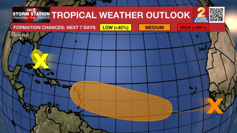
The Tropics: An area of low pressure is expected to form along a weakening frontal boundary a few hundred miles northeast of the Bahamas in a day or so. This system could acquire some subtropical characteristics late this week while it drifts over the western Atlantic. The chances of subtropical development should end by the weekend when the system is expected to move eastward or northeastward into unfavorable environmental conditions.
– Balin
The Storm Station is here for you, on every platform. Your weather updates can be found on News 2, wbrz.com, and the WBRZ WX App on your Apple or Android device. Follow WBRZ Weather on Facebook and X for even more weather updates while you are on the go.
More News

