

Latest Weather Blog
Thursday PM Forecast: warmth peaks Friday before cold returns to Capital Area
Unseasonable warmth will continue through the end of the week, but don't get too comfortable in those short sleeves because a significant shift is expected soon. We are tracking a cold front, which will turn the weekend into a "tale of two days" as spring-like highs transition to winter-like lows.
Friday & Saturday: sun and clouds, isolated showers, unseasonably warm
Sunday: breezy and much cooler
Early Next Week: chilly with light freezes possible north of interstates
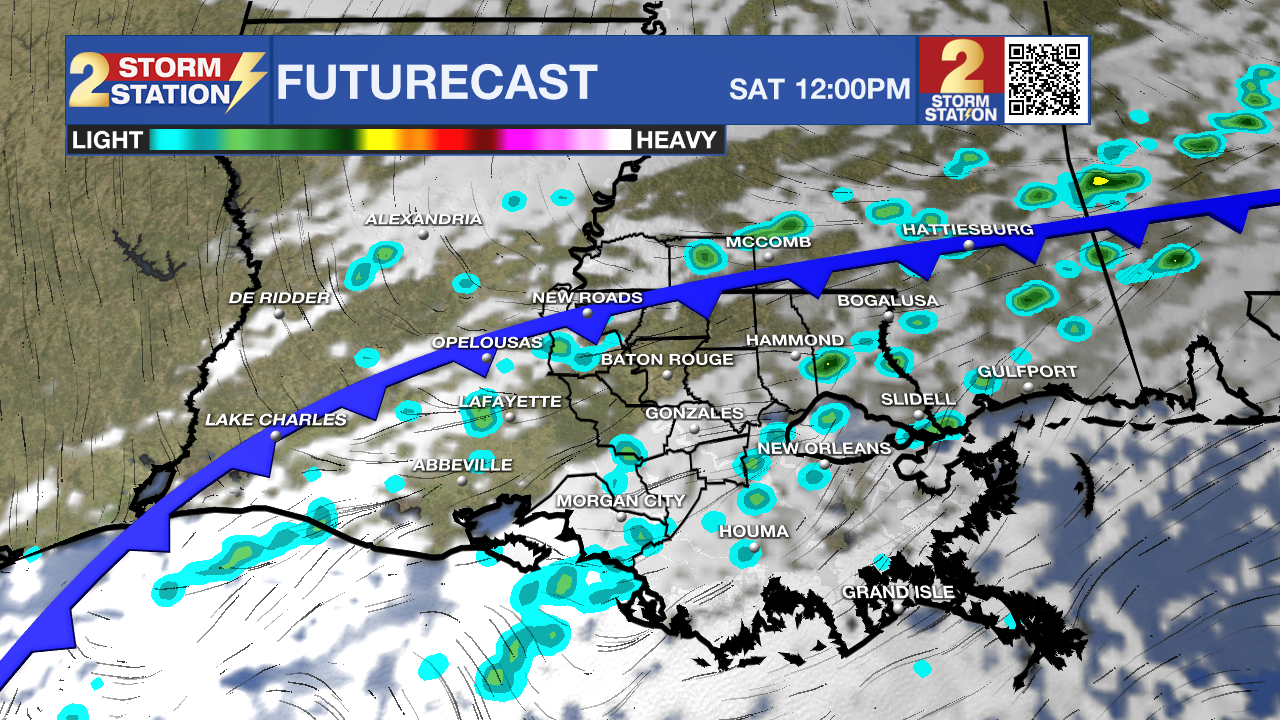
Tonight & Tomorrow: Passing, light showers will be possible tonight, though most locations will be dry most of the time. Otherwise, expect partly cloudy skies overnight with some patchy fog possible near dawn, especially south of I-12 and near the lakes. It will feel muggy with low temperatures keeping to the upper 60s. On Friday, high temperatures will remain well above average with highs climbing into the mid to upper 80s. Look for a sun, cloud mix in skies with isolated showers to dodge—a reason to take the umbrella for short-term use but no reason to cancel plans. Many will miss rain as the week concludes.

Trending News
Up Next: Saturday will feel much like the end of the week with warm and muggy temperatures. The day will start in the upper 60s and peak in the low 80s. A cold front will be moving south through the Capital Area, triggering scattered showers and even a few thunderstorms. It will not rain everywhere and the day will not be a washout, but an indoor break option will be a good idea in case you catch one of those showers or thunderstorms. The main weather impact of the weekend will arrive Saturday night. Behind the cold front, temperatures will tumble by about 20 degrees into Sunday with a cooler, drier and breezy finish to the weekend.
By Monday and Tuesday morning, expect our coldest temperatures in a while. Highs on Monday will struggle to reach 60 degrees, and then a light freeze is possible for many areas overnight, especially along and north of the I-10/I-12 corridor. Because of our recent warm spell, many plants have already started to "green up" and come out of dormancy. These tender buds are very sensitive to freezing temperatures, so you'll want to cover them or bring them inside by Sunday night!
Get the latest 7-day forecast and real-time weather updates HERE.
Watch live news HERE.
While we watch the front here at home, the No. 2 LSU Tigers will travel east for the Jax College Baseball Classic at VyStar Ballpark in Jacksonville, Florida. If you’re making the trip or watching from home, here is what to expect:
Friday and Saturday: Skies will feature a mix of sun and clouds with temperatures in the low 80s
Sunday: The same front hitting Baton Rouge will reach Florida by Sunday, and so the game may have to deal with lingering showers, northwest winds of 10-15mph, and temperatures in the upper 60s
– Josh
The Storm Station is here for you, on every platform. Your weather updates can be found on News 2, wbrz.com, and the WBRZ WX App on your Apple or Android device. Follow WBRZ Weather on Facebook and X for even more weather updates while you are on the go.
More News
