

Latest Weather Blog
Thursday AM Forecast: Rinse and repeat weather continues, great football conditions ahead
The pattern of chilly mornings, warm afternoons, and dry conditions is not going anywhere! This is going to setup some great weather for the Friday night blitz, LSU football, and Southern football.
Today & Tonight: After the chilly morning start, expect a lot of sunshine with highs reaching the mid-80s. Conditions will be amazing for the Baton Rouge State Fair! Bring a jacket, as temperatures will be dropping into the mid-60s by 9-10pm. Overnight, it will be chilly again, with lows in the low 50s.

Up Next: An upper-level high-pressure system is set to take charge across the area, anchoring itself in place right through the weekend. This atmospheric lid will keep the skies full of sunshine, driving daytime temperatures up into the mid-80s. Overnight conditions, however, will stay crisp and cool as temperatures drop into the lower 50s.
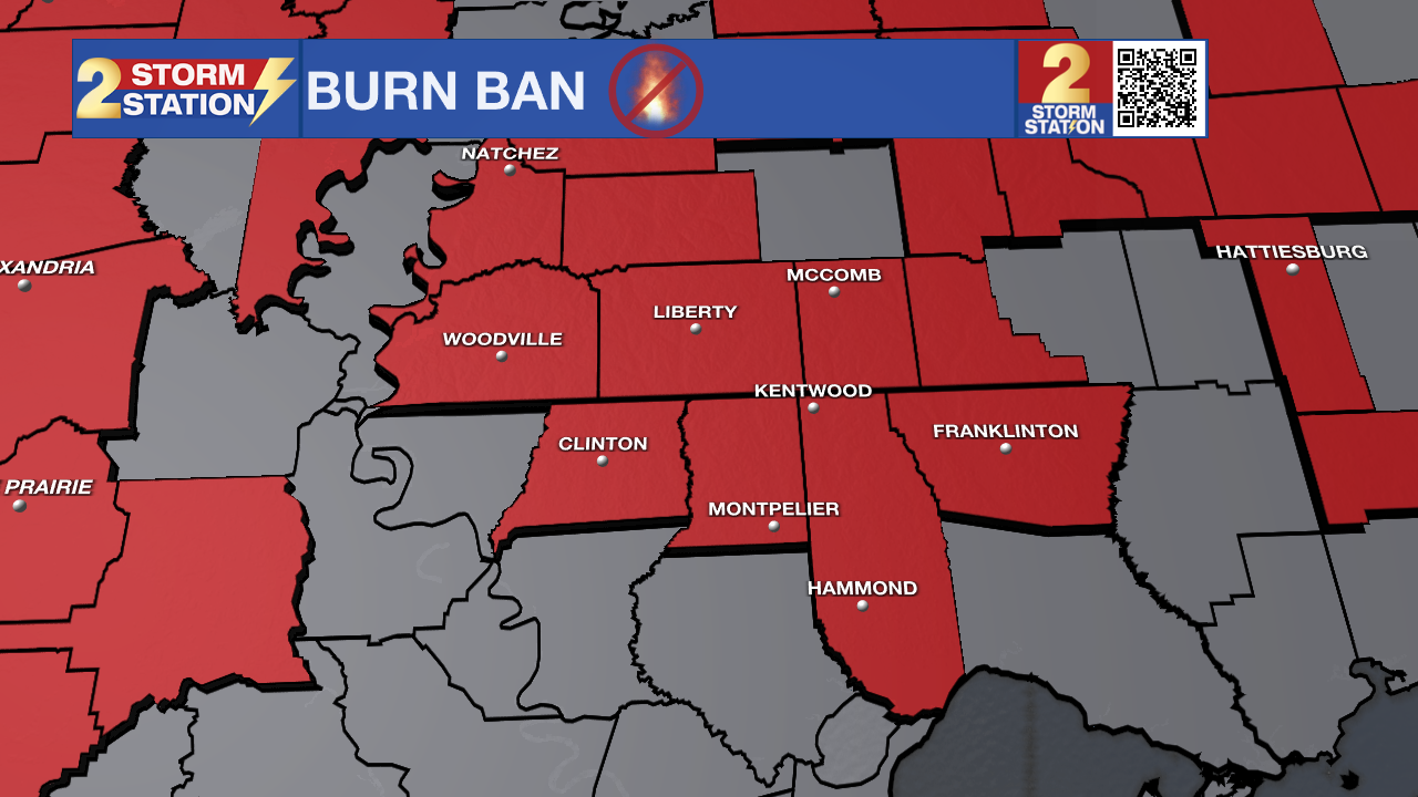
A mild cooling trend arrives this weekend as cooler air arrives from the east. By early next week, a veil of high clouds will drift in, which could shave off another degree or two and keep highs restricted to the lower 80s. With virtually no rainfall in sight, ongoing drought conditions will continue to deepen. This persistent dry stretch has left vegetation parched, significantly elevating the risk of fall grass fires. Please practice extra fire safety outdoors, even if formal burn bans or Red Flag Warnings aren't actively posted.
Trending News
Get the latest 7-day forecast and real-time weather updates HERE.
Watch live news HERE.
The Tropics: Subtropical Storm Josephine formed off the East Coast on Wednesday afternoon. Once attached to fronts, the system has finally shed those off, allowing the storm to officially be designated as subtropical. In essence, a subtropical system is a hybrid storm of sorts, partially tropical and partially non-tropical. They draw power from both warm ocean water (tropical source) and the clash of warm/cool air in the atmosphere (extratropical source). A full explanation of subtropical storms can be found HERE. Josephine will not technically make landfall, but its proximity to the East Coast will bring high winds, coastal flooding, and dangerous surf to parts of the New England and Mid-Atlantic coasts.

Meanwhile, another region of low pressure located several hundred miles east-southeast of Bermuda is producing a disorganized area of thunderstorms. There is a low chance of development with this system as it slowly drifts north through the Atlantic.
— Balin
The Storm Station is here for you, on every platform. Your weather updates can be found on News 2, wbrz.com, and the WBRZ WX App on your Apple or Android device. Follow WBRZ Weather on Facebook and X for even more weather updates while you are on the go.
More News

