

Latest Weather Blog
Thursday AM Forecast: Foggy mornings + sunny afternoons repeat through weekend
Mild and foggy mornings that give way to sunny and warm afternoons will repeat through the weekend. Early morning commuters should be extra cautious as patchy, dense fog becomes more likely to end the workweek. Next week brings increasing rain chances and a dip in temperatures.
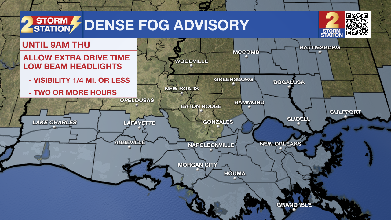
A *DENSE FOG ADVISORY* is in effect until 9 am Thursday for East Ascension, Assumption, Southern Livingston, St. James, St. Mary and Tangipahoa Parishes. Fog may cause visibility of one-quarter mile or less and could make driving conditions hazardous. If driving, slow down, use your low-beam headlights, and leave plenty of distance ahead of you.
Today & Tonight: With the patchy areas of fog this morning, temperatures will again start off mild, in the middle-60s. Similar to Wednesday, skies will begin to clear around mid-morning and become mostly sunny this afternoon. The sunny conditions will help highs stretch into the low 80s again today. The Capital City's forecast high of 83° challenges a record high for February 6th of 82° set back in 2019.
Overnight, foggy conditions will again be possible. Temperatures will sink back into the middle 60s.
Up Next: Foggy mornings and warm afternoons will continue Saturday and Sunday. Rain remains hard to come by over the next several days so outdoor plans this weekend will be good to go. By Sunday night, a weak cold front will move near the Capital Area very slowly and eventually stall north of the I-10/12 corridor early next week. While the arrival of the front could bring a few showers, thunderstorm activity and cooler weather will not be present Monday.
Trending News
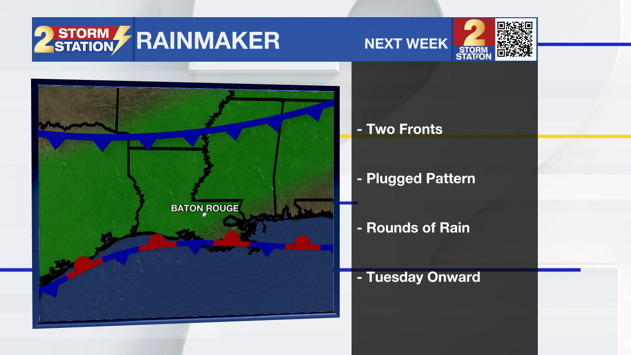
Another push from the atmosphere will help send that front through the Capital Area and into the Gulf, where it may stall out again. At the same time that front is moving through, an active wind flow over the stalled front could send multiple disturbances and accompanying rounds of rain and thunderstorms across the area from Tuesday through Thursday. While temperatures are expected to drop as the rain arrives, conditions through at least the middle of next week will stay above average, with highs in the mid to low 70s.
Get the latest 7-day forecast and real-time weather updates HERE.
Watch live news HERE.
– Emma Kate C.
The Storm Station is here for you, on every platform. Your weather updates can be found on News 2, wbrz.com, and the WBRZ WX App on your Apple or Android device. Follow WBRZ Weather on Facebook and X for even more weather updates while you are on the go.
More News
