

Latest Weather Blog
Sunday PM Forecast: Spring-like pattern staying put as Christmas arrives
Winter may have officially started Sunday, but it certainly doesn’t feel like it. Spring-like warmth is expected to stick around through Christmas and beyond, along with a pattern of foggy starts and brighter afternoons.
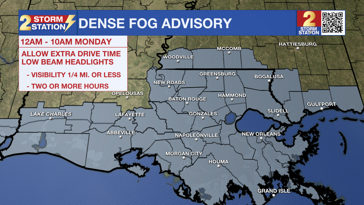
Tonight & Tomorrow: A weak front will meander throughout the Capital Area overnight, keeping clouds and isolated showers around. With time, the front will slowly drift north, setting the stage for dense fog to develop in areas south. A Dense Fog Advisory will be in effect from midnight to 10 a.m. across the entire region. Holiday travelers heading out early Monday should use extra caution, as visibility could drop to one-quarter mile or less. Slow down, use low-beam headlights, and leave plenty of following distance in fog. Otherwise, it will be muggy and incredibly mild with lows running over 20° above average in the mid-60s.
While partial clearing is expected late Monday, clouds will linger for much of the day with a few isolated showers. Even so, highs will still manage to hit the mid-70s.
Christmas Eve & Day: Christmas Day will almost be a carbon copy of Christmas Eve from a weather standpoint. Mornings will start off mild in the mid-50s with areas of dense fog developing. Santa might have to put Rudolph to good use while delivering presents. Expect fog to gradually burn off throughout the morning, revealing sunshine. Afternoons will be warm with temperatures topping out in the upper 70s.
Up Next: A pocket of dry air will move in on Tuesday morning, helping to keep fog at bay. Tuesday looks mostly clear from start to finish with highs climbing just shy of 80° after a morning low in the mid-50s. Fog will become more likely again later in the week, with pockets of dense fog possible each morning starting on Christmas Eve. Afternoons will be sunnier, allowing highs to reach the upper 70s. This pattern will carry into the weekend. By Sunday, another front may approach, possibly bringing a minor cooldown to close out 2025.
Trending News
Get the latest 7-day forecast and real-time weather updates HERE.
Watch live news HERE.
— Meteorologist Malcolm Byron
The Storm Station is here for you, on every platform. Your weather updates can be found on News 2, wbrz.com, and the WBRZ WX App on your Apple or Android device. Follow WBRZ Weather on Facebook and X for even more weather updates while you are on the go.
More News
