

Latest Weather Blog
Sunday PM Forecast: Hotter & drier next week, lower humidity in sight
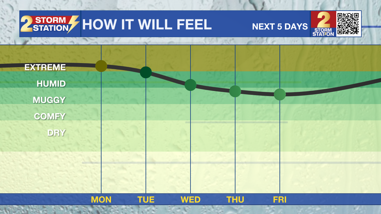
When compared to this past week, next week will have much less showers and storms. It will be hot, but there are indications of a pretty significant humidity drop late week.

Tonight & Tomorrow: Any remaining showers and storms will fade away in the overnight hours. Lows will be in the mid-70s under mainly clear skies. Sunshine will prevail to start off Monday. This will quickly send our temperatures into the 90s, with highs in the mid-90s expected by the afternoon. Peak heat index values look to get close, but fall just short of the 108° needed for a heat advisory. Still, given how close we will be, it is not impossible that we have one issued. Storm coverage will stay isolated meaning many will stay dry. Heavy rain and brief gusty winds will be possible for those who do see a storm.
Trending News
Up Next: The peak heat and lowest rain coverage will occur on Tuesday and Wednesday. Highs will reach into the mid to upper 90s. Storms will only be spotty in nature, so most will stay dry. This is pretty unusual heat for this time of year, so make sure to drink plenty of water. Something pretty interesting happens to end the workweek. As an upper-level low moves into the northeastern Gulf, it will bring in drier air from the north into southeast Louisiana. This will act to lower morning time lows, and also lower humidity during the day. Lows will be near 70° with some in the upper 60s. Peak heat index values will be 10-15° lower than earlier in the week.
Get the latest 7-day forecast and real-time weather updates HERE.
Watch live news HERE.
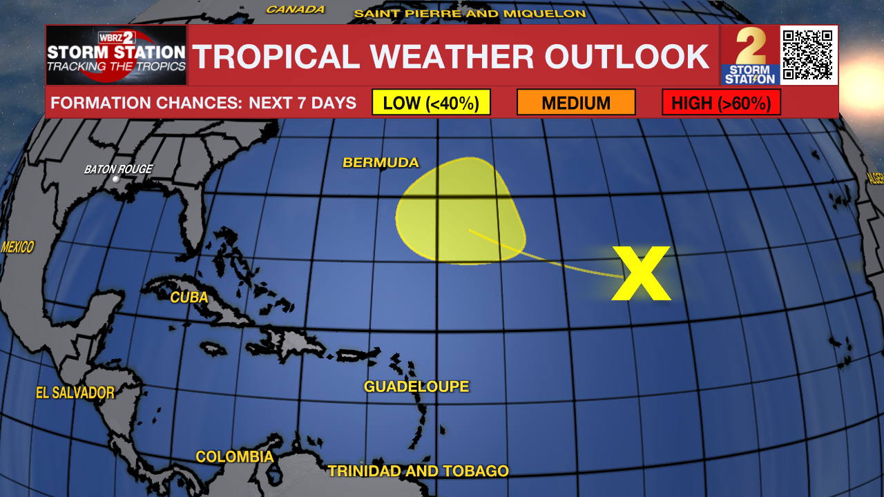
The Tropics: Disorganized showers and thunderstorms persist in association with a trough of low pressure over the central Subtropical Atlantic. Strong upper-level winds are making the current environment unfavorable for development. However, the system is expected to move into a more favorable environment for some gradual development by the middle to later portion of this week. The disturbance is forecast to move west-northwestward across the central part of the Subtropical Atlantic.
– Balin
The Storm Station is here for you, on every platform. Your weather updates can be found on News 2, wbrz.com, and the WBRZ WX App on your Apple or Android device. Follow WBRZ Weather on Facebook and X for even more weather updates while you are on the go.
More News

