

Latest Weather Blog
Sunday AM Forecast: Warm days ahead, Keeping eyes on Tropics
Lows of 65° and highs near 86° are average for late September/early October but the next week will feature temperatures a few degrees warmer each day. Also this week, the Storm Station will be closely monitoring the possibility for another system to form in the Caribbean, more in The Tropics section below.
Today & Tonight: Another comfortable morning with temperatures in the middle 60s early Sunday will turn into a warm afternoon with highs in the low 90s around the Capital Area. Limited moisture in the atmosphere means lots of sunshine, no rain, and a lack of humidity again today. Mainly clear skies will carry into the overnight as temperatures dip into the upper 60s early Monday across southern Louisiana.
Up Next: The workweek will feature very similar conditions. Mornings will start off near 70 degrees and afternoons will be in the low 90s. No extreme humidity levels are expected over the next week so feels-like temperatures will remain in check. For the majority of the week, rain remains unlikely, but there are some signs that rain chances could increase slightly by Friday. At this range, confidence is low on the exact rain coverage, so expect changes in the coming days.
Get the latest 7-day forecast and real time weather updates HERE.
Watch live news HERE
Trending News
The Tropics:
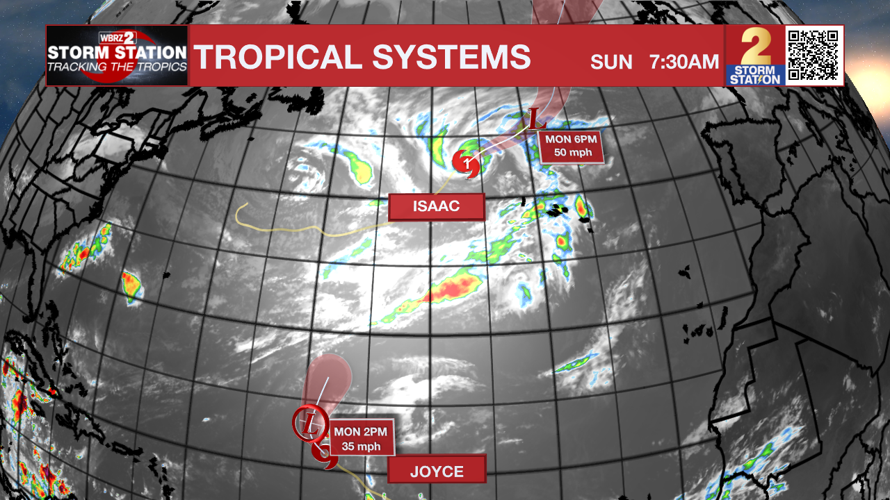
Tropical Storm Joyce has maximum sustained winds of 45mph, and is moving NW at 9 mph. Joyce become post-tropical on Monday.
Hurricane Isaac is slowly winding down. It is now back to a category 1 hurricane with 80 mph winds, and is moving NE at 13 mph. Isaac is moving into cooler waters, which will lead to gradual weakening and likely will become post tropical on Monday. The storm could send high swells toward The Azores.
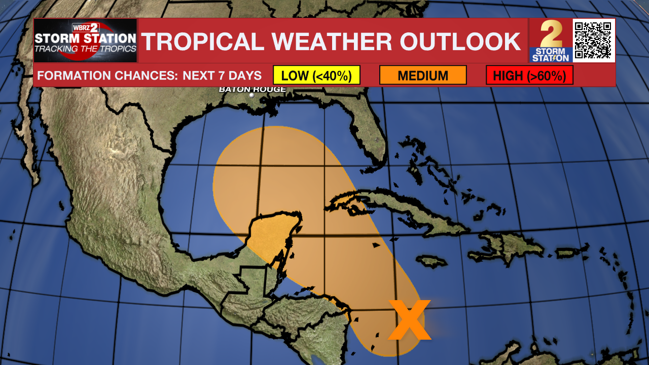
A broad area of low pressure located over the western Caribbean Sea is producing disorganized showers and thunderstorms. Environmental conditions appear to be conducive for gradual development, and a tropical depression could form around the middle part of this week while the disturbance meanders towards the west-northwest. This system is then expected to move northwestward into the Gulf of Mexico during the latter portion of this week, and interests in the northwestern Caribbean Sea and along the U.S. Gulf Coast should monitor its progress.
Showers and thunderstorms associated with an elongated area of low pressure located a few hundred miles west-southwest of the Cabo Verde Islands have become better organized since yesterday. Environmental conditions are conducive for gradual development of this system, and a tropical depression is likely to form during the early or middle part of this week while the system initially moves westward and then northwestward across the eastern and central tropical Atlantic.
A tropical wave located near the coast of western Africa is currently producing limited shower activity. Some gradual
development of this system is possible during the next several days while it moves slowly westward or west-northwestward over the eastern Atlantic Ocean.
– Emma Kate C.
The Storm Station is here for you, on every platform. Your weather updates can be found on News 2, wbrz.com, and the WBRZ WX App on your Apple or Android device. Follow WBRZ Weather on Facebook and Twitter for even more weather updates while you are on the go.
More News
