

Latest Weather Blog
Sunday AM Forecast: Dry pattern coming to an end
While we have been dry the last several days, that pattern looks like it will start to come to an end. Showers and thunderstorms will be possible starting tomorrow, and lasting through the middle of the week.
Today & Tonight: Skies will be mostly cloudy today. Southerly winds will bring moister air into the region. This will make the humidity get to noticeable levels. Even with all the clouds, highs will still reach the lower 80's. A stray sprinkle can not be ruled out but the vast majority will stay dry. Most rain stays well to our northwest through the end of the weekend. Skies will stay mostly cloudy overnight, keeping lows to near 67 degrees.
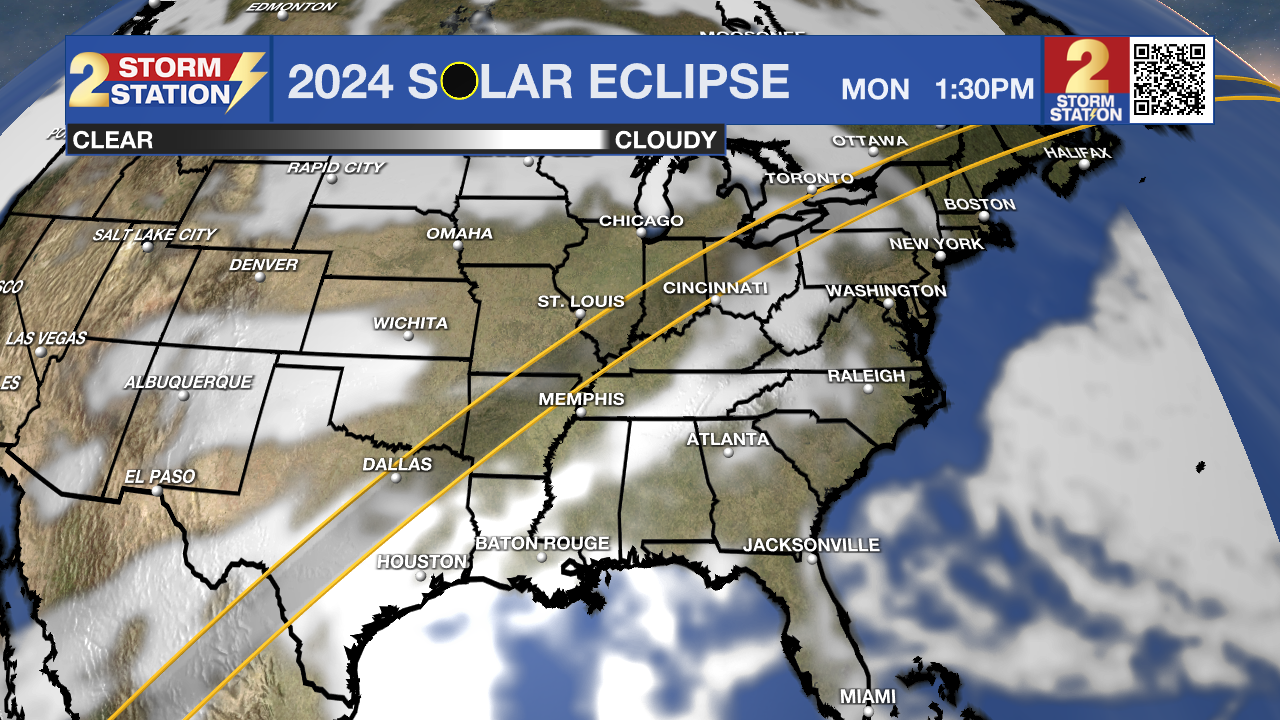
Up Next: The first several days of this coming up week will be on the warm/muggy side. This means there will also be plentiful moisture in the area. With the addition of some lift, showers and thunderstorms will be possible. Rain will stay on an isolated basis Monday and Tuesday. This will especially be the case for our northern parishes and counties. Have the rain gear on standby just in case. No matter how much rain we see, skies will be mostly cloudy both days. This is unfortunate if you're hoping to view the solar eclipse on Monday (see below for more details).
The best shot at rain all week will be on Wednesday. The exact timing still needs to get nailed down, but overall, the day is looking pretty wet. There is the possibility that some of these storms are on the strong to severe side. The Storm Prediction Center continues to highlight all of Louisiana under a severe weather risk by midweek.
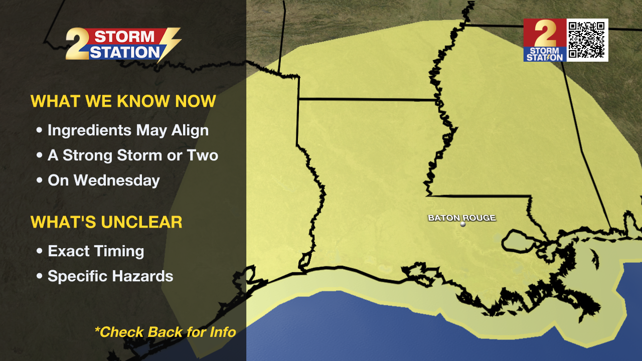
A few inches are possible with this round, which could result in isolated standing water concerns if that falls in too short of a duration. Make sure to check back in with the Storm Station daily for the latest as we get closer.
Eclipse Forecast:
Trending News
Monday still looks mainly cloudy with isolated showers and storms during the solar eclipse (approx. Noon to 3 p.m.). While clouds appear to block the majority of the event, there could be a few cloud breaks from time to time. We suggest having your eclipse glasses ready to go in case clouds briefly cooperate so you can safety take a peek at the eclipse.
For those planning on traveling to the path of totality, much of Texas will be mainly cloudy also. Sky conditions improve dramatically across the Midwest, and portions of New England.
Get the latest 7-day forecast and real time weather updates HERE.
Watch live news HERE.
-- Balin
The Storm Station is here for you, on every platform. Your weather updates can be found on News 2, wbrz.com, and the WBRZ WX App on your Apple or Android device. Follow WBRZ Weather on Facebook and Twitter for even more weather updates while you are on the go.
More News
